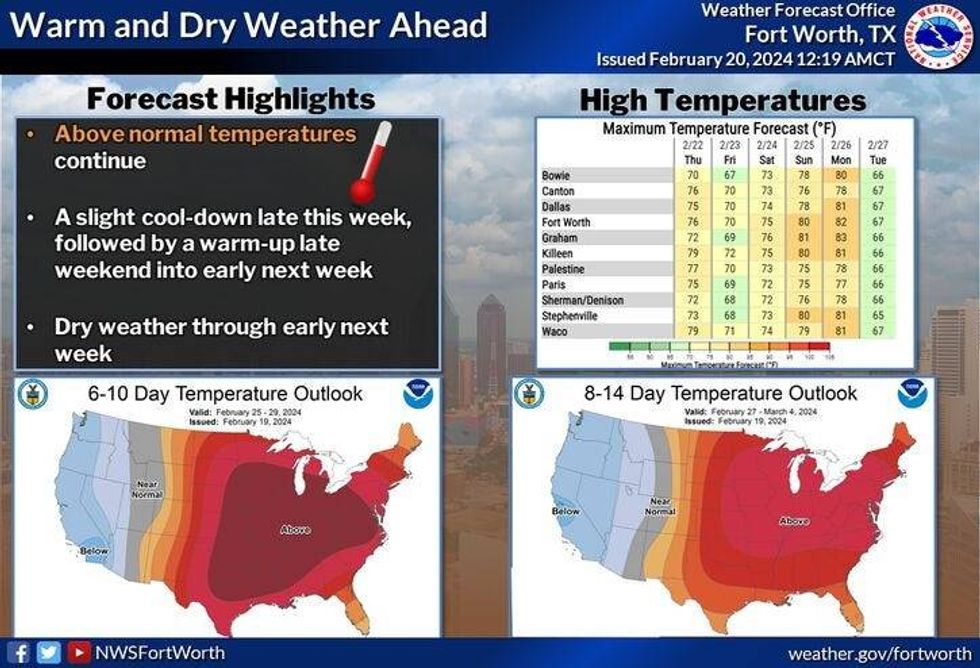
The storm track has shifted to the north of the Lone Star State keeping us warm and dry for the next 7 days. However, a weak cold front comes through Thursday around noon, cooling us down a little bit towards the end of the week.
You may want to grab a jacket this morning as temperatures have fallen into the low to mid-40s. This afternoon temperatures warm into the mid to upper 70s. 62° is our average high on the 20th of February.
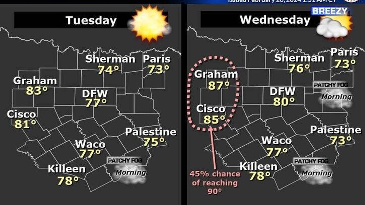
Do you like the 70s? Well, you love the '80s! Those temperatures arrive tomorrow, however, there will be an area of low clouds that'll have trouble eroding, especially areas east of Dallas. This is where temperatures may hold in the 70s all day tomorrow. A south wind will gust to 30 mph, but veer more southwesterly west of Fort Worth. This is where temperatures could approach 90°, especially west of Hwy 281.
 National Weather Service - Fort Worth
A weak cold front arrives around noon tomorrow dropping temperatures into the low 70s for highs. North winds will gust to 30 mph.
Temperatures will fall into the 40s on Friday morning. Relaxing wind, and plenty of sunshine with highs in the upper 60s by afternoon.
Last weekend was cold, but this weekend will be warm. Mid-70s for Saturday, low 80s for Sunday with a ton of wind. Mostly cloudy, windy, and even warmer on Monday with highs in the mid-80s.
*Yest Rain: 0.00"; Yest High: 69 Low: 35
*Today's Averages: High: 62; Low: 41
*Record high: 86 (1980); Record low: 19 (1939)
*February Rain: 1.88"; Surplus: 0.12"
*2024 Rain: 5.08"; Surplus: 0.79"
*Sunrise: 7:08am; Sunset: 6:17pm
LISTEN on the Audacy App
Tell your Smart Speaker to "PLAY 1080 KRLD"
Sign Up to receive our KRLD Insider Newsletter for more news
Follow us on Facebook | Twitter | Instagram | YouTube