Fortunately for us, the severe storms this morning missed north Texas. However, tell that to the residents in NE and east Texas as a big complex of severe storms continues to barrel through that area this morning. We just have a bunch of clouds overhead and air that's thick as a brick! Temperatures are only in the mid to upper 70s right now. Yuck!
We'll see some peaks of sunshine today with afternoon highs and the low 90s. Heat index values will be slightly above 100°.
Another complex of storms will form in Oklahoma late this evening and barrel towards north Texas through the early morning hours. Right now, it looks like residents that live east of 35W have the best chances for storms, especially Mckinney, Dallas and points east. Damaging wind and flooding will be the threats as temperatures fall into the low to mid-70s.
Storms should exit out of the area tomorrow morning giving way to peeks of sunshine with highs and the low 90s.
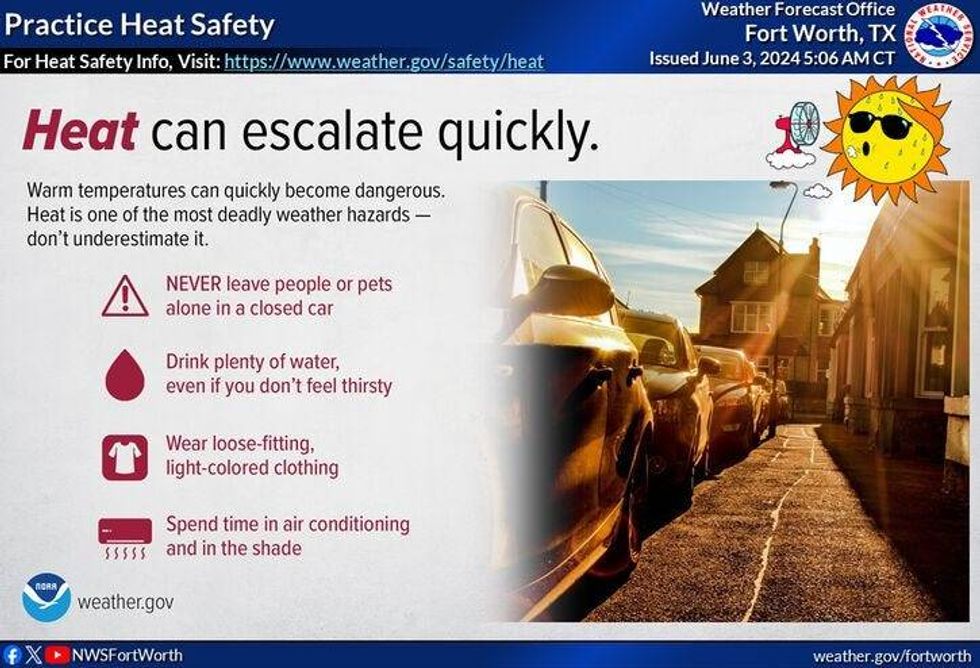
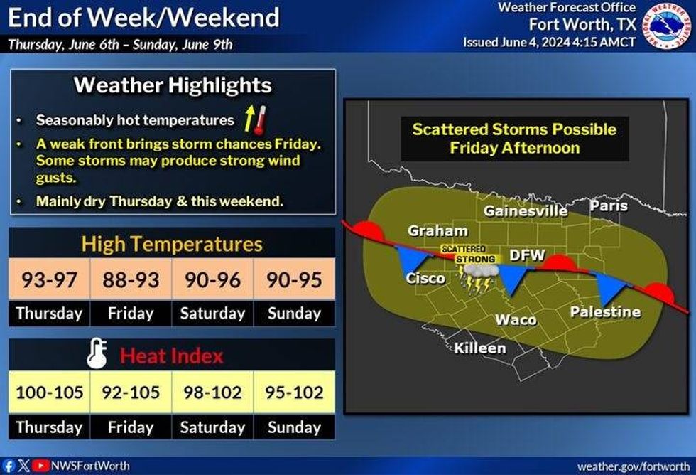
Thursday will be our warmest day this week with highs and mid-90s. Factor in the humidity, heat index values will reach 105° plus. Make sure you stay hydrated and take frequent breaks if you're working outdoors.
 NWS
NWS
Friday through Sunday.... a very tricky forecast. A cold front will stall somewhere across north Texas towards the Red River. This front will act as a railroad track for storms to develop... off and on through the period. Some hail, damaging wind and especially flooding are the concerns. Please keep in mind some of you may not see a drop, while others experience flooding once again. Stay tuned. High temperatures each day will reach near 90°.
 NWS
NWS
By Sunday night, a second front will cruise through the entire north Texas area. An area of storms will most likely form along this front and head south by late Sunday night into early Monday morning. This being said, early next week, very low humidity for this time of the year works its way into the area with afternoon highs struggling to get above 85°. It might even be cooler than that. Something to look forward to.
Have a terrific day today and please enjoy the weather when you can, it's the only weather you've got!
__________________
7-Day Headlines:
* DFW Airport reached 85 yesterday.
* Storms east of DFW this morning.
* A TON of humidity this week.
* Wednesday morning storms. Isolated severe east of I-35W.
* A quiet, hot and humid Thursday.
* Scattered storms Friday - Weekend. Higher coverage north of DFW.
_____________________________________________________
*Yest Rain: 0.25"; Yest High: 85; Low: 70
*Today's Averages: High: 89; Low: 70
*Record high: 99 (1977) Record low: 54 (1919, 1954)
_________________________________________________________
*June Rain: 2.33"; Surplus: 1.95"
*2024 Rain: 27.42"; Surplus: 10.43"
*Sunrise: 6:20am; Sunset: 8:34pm
_________________________________________________________
Today: * Morning severe storms in east Texas * Mostly cloudy early, then partly cloudy, warm and humid. High: Low 90s. Heat index 100+ Wind: South 15-25 mph.
Tonight: Overnight isolated severe storms. Threats: Damaging wind and flooding. Mainly east of I-35W. Low: Low to mid 70s. Wind: South 15-25 mph.
Tomorrow: Morning storms, especially east of DFW, some afternoon sun. Warm and humid. High: low 90s. Wind: South 10-15 mph.
Thursday: Partly cloudy, hot and humid. Highs: Mid 90s...Heat index values: 105+.
Friday - Sunday: Partly cloudy, warm and humid. Scattered showers and storms. Better chances north and east of DFW. Highs: Low 90s. Heat index values near 100 degrees.
Monday: Partly cloudy and slightly cooler. High: Upper 80s.
LISTEN on the Audacy App
Tell your Smart Speaker to "PLAY 1080 KRLD"
Sign Up to receive our KRLD Insider Newsletter for more news
Follow us on Facebook | Twitter | Instagram | YouTube