


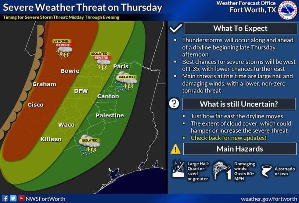
Scattered showers and storms are possible tomorrow through next Tuesday, mainly during the evening hours. Some of these may become severe late Thursday, especially west of Fort Worth.
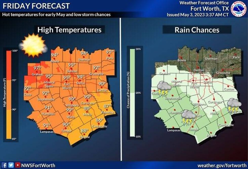
Afternoon highs will continue to warm through the weekend, with increasing humidity. Readings will top out in the mid eighties today and tomorrow, mid nineties (record is 96) on Friday, low nineties Saturday and Sunday, near 90 Monday, and mid eighties on Tuesday.
 National Weather Service - Fort Worth
*Yest Rain: 0.00"; Yest High: 83 Low: 53
*Today's Averages: High: 80; Low: 60
*Record high: 97 (1920): Record low: 39 (2013)
*May Rain: 0.00"; Deficit: 0.29"
*2023 Rain: 11.23"; Deficit: 0.87"
*Sunrise: 6:39am; Sunset: 8:11pm
 National Weather Service - Fort Worth
Today: Mostly to partly cloudy and warm. High: Low to mid 80s. Wind: ESE 5-10 mph.
Tonight: Mostly cloudy and mild. Low: Low to mid 60s. Wind: SE 5-10 mph.
Tomorrow: Mostly to partly cloudy, breezy and warm. Scattered late day showers and isolated severe storms (west of I-35W). High: Mid 80s. Wind: South 10-20 mph.
Friday: Partly cloudy and very warm. A near record high (Record is 95 degrees). High: Low to mid 90s.
 National Weather Service - Fort Worth
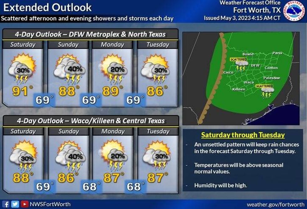
Weekend: Partly cloudy, very warm and humid. Scattered strong evening storms. Highs: Near 90.
Monday. Partly cloudy, warm and humid. Scattered strong evening storms. High: Near 90.
Tuesday: Partly cloudy, warm and humid. Scattered strong evening storms. High: Mid 80s.

LISTEN on the Audacy App
Tell your Smart Speaker to "PLAY 1080 KRLD"
Sign Up and Follow NewsRadio 1080 KRLD


