


Warming temperatures, critical grass fire danger, a lot of wind, and possibly some rain in the early next week. Those are your weather stories over the next 7 days.
We're starting off in the mid 40s to low 50s this morning under a clear sky, sunny and much warmer today with highs in the low to mid 80s. Wind will be light from the NW. Tonight, clear and cool as reading's dip into the upper 40s to mid 50s. Plenty of sunshine will dominate our weather tomorrow through the weekend, with a lot of wind. Sunny and even warmer tomorrow with highs in the upper 80s. There's also a critical grass fire danger along and west of I-35W.
 National Weather Service - Fort Worth
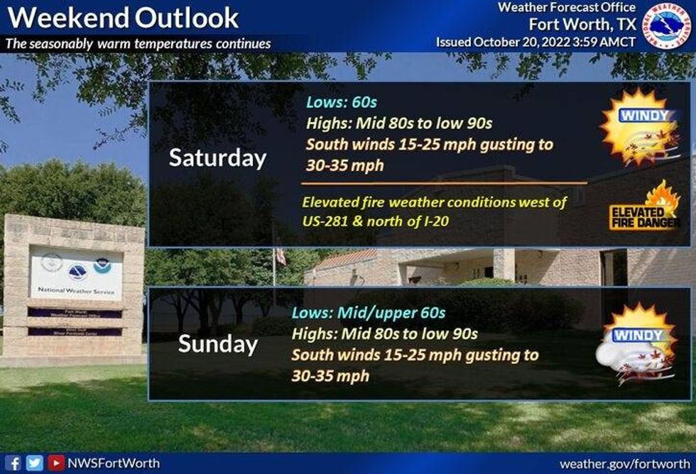
This weekend looks nice with increasing humidity with more wind. Afternoon highs will reach the mid to upper 80s. SSW wind will gust to 35 mph. More grass fire danger, especially west of the Dallas-Fort Worth, as our humidity will start to increase.
 National Weather Service - Fort Worth
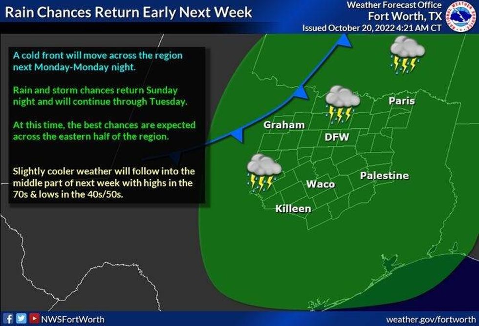
For next week, right now I'm just putting a slight chance of showers and storms in my forecast for Monday. Afternoon highs will be cooler, with readings in the middle 70s. A few leftover showers are possible the first part of Tuesday, otherwise, skies will slowly clear with highs only in the upper 60s. Wednesday looks beautiful, sunny, 66°.
*Yest Rain: 0.00"; High: 67; Low: 42
*Today's Averages: High: 77; Low: 56
*Record high: 95 (1934); Record low: 33 (1989)
*October rain: 0.07"; October deficit: 2.42"
*2022 Rain: 23.49"; 2022 deficit: 6.27"
*Sunrise: 7:36am; Sunset: 6:49pm
Today: Sunny and warmer. High: Low 80s. Wind: NW 10-15 mph.
Tonight: Clear and cool. Low: 48-55. Wind: Lt. Var.
Friday: Sunny, breezy and warm. High: Upper 80s. Wind: SSW 15-25 mph.
Weekend: Mostly sunny, windy and warm. Grass fire danger. Highs: 85-90.
Monday: Partly cloudy to mostly cloudy. Chance of showers and storms. High: Mid to upper 70s.
Tuesday: Slight chance for showers early, then decreasing clouds and cooler. High: Upper 60s.
Wednesday: Sunny and cool. High: Mid 60s.

LISTEN on the Audacy App
Sign Up and Follow NewsRadio 1080 KRLD


