


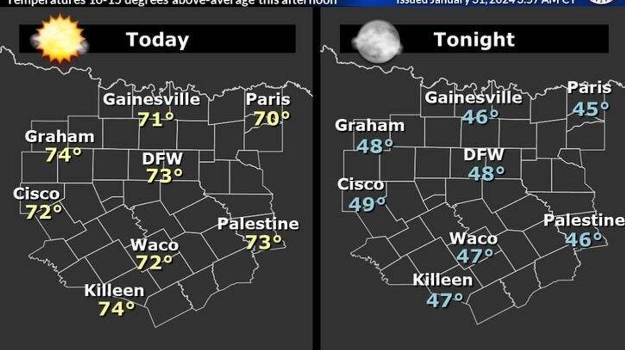
It's another chilly start this morning as temperatures have fallen into the low to mid-40s under a clear sky. You won't need your jacket today as afternoon highs jump up in the mid-70s again. DFW hit 77° yesterday.
Above-average temperatures will continue tomorrow and through the weekend. We're back in the 70s again tomorrow near 70 for Friday as the wind increases from the south at 15 to 25, gusting to 30 mph. High clouds will start to stream overhead tomorrow, but thicken up on Friday.
 National Weather Service - Fort Worth
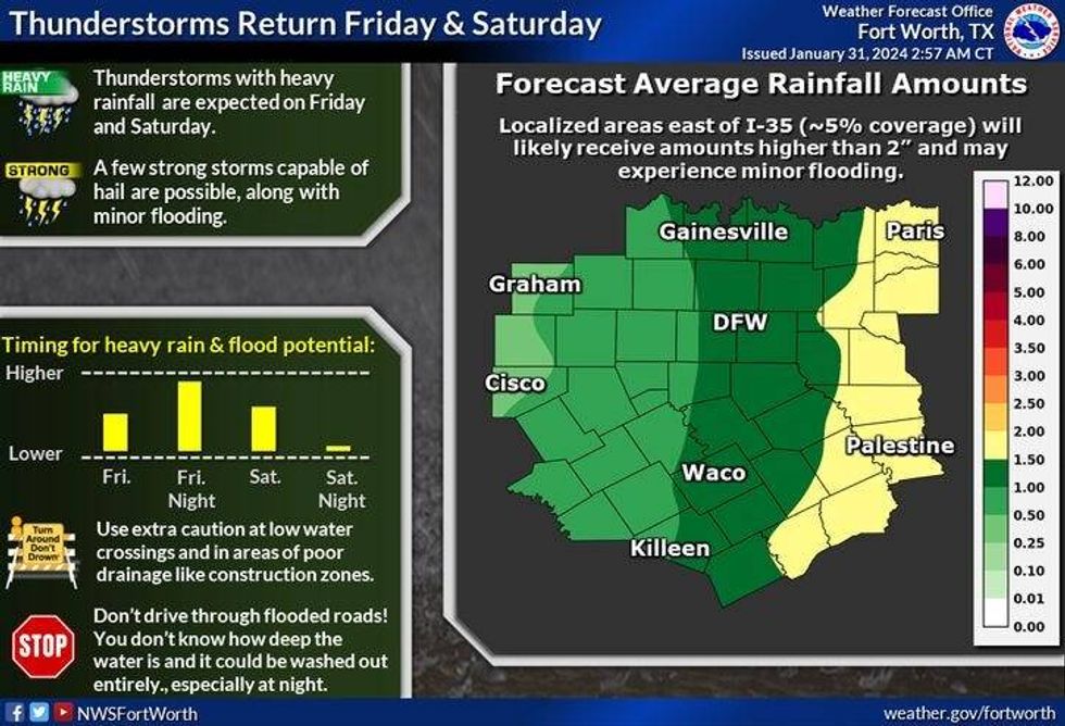
Our next weather change arrives late Friday afternoon especially through the evening, lasting through noon on Saturday. The rain should be east of the DFW area by Saturday early afternoon at the latest. Skies will briefly clear Saturday afternoon with highs in the upper 60s.
A windy cold front moves through the area early Sunday, with an increase in cloud cover by late afternoon and evening. There may even be a few sprinkles around. Afternoon highs will top out in the low 60s, with a north wind gusting to 35 mph. It will be a blustery day.
Monday and Tuesday look delightful with afternoon highs in the low 60s on Monday, Mid 60s by Tuesday. Morning lows will be in the upper 30s to low 40s.
*Yest Rain: 0.00"; Yest High: 77 Low: 44
*Today's Averages: High: 58; Low: 37
*Record high: 93 (1911); Record low:-2 (1949)
*January Rain: 3.20"; Surplus: 0.74"
*2024 Rain: 3.20"; Surplus: 0.74"
*Sunrise: 7:24am; Sunset: 5:59pm
LISTEN on the Audacy App
Tell your Smart Speaker to "PLAY 1080 KRLD"
Sign Up to receive our KRLD Insider Newsletter for more news
Follow us on Facebook | Twitter | Instagram | YouTube


