


We're waking up this Friday to extensive low cloud cover and some drizzle and fog, but the measurable rain is now pressing east and southeast of DFW. Temperatures are in the mid to upper 50s. This is where we should be during the afternoon hours. We will have some breaks in the clouds today as afternoon highs creep up into the upper 60s.
Clouds roll back in overnight tonight with morning lows in the mid to upper 50s. There will be some drizzle, light rain and some fog tomorrow morning.
 National Weather Service - Fort Worth
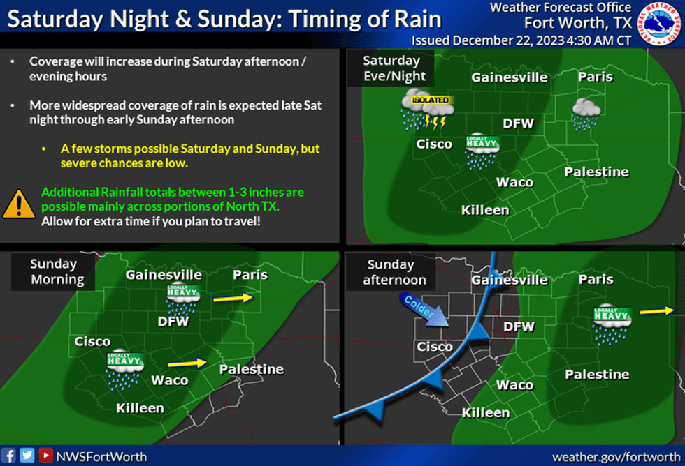
Our next weather change arrives late Saturday afternoon into the evening hours, as a very strong upper-level disturbance cruises close to the area. Widespread rain will move in from the west and intensify through the early morning hours, ending from west to east by noon on Sunday. Don't be surprised if you hear some thunder and experience some gusty winds in the stronger thunderstorms. Nothing severe is expected at this time. Rainfall totals will range between 1 to 2 inches before all is said and done. Afternoon highs on Sunday will reach the upper 60s again.
 National Weather Service - Fort Worth
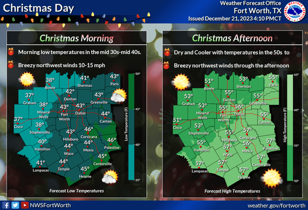
By late Christmas Eve, a strong cold front will plow through the area. Temperatures will fall into the low to mid 40s by Monday morning, with a north wind gusting to 30 mph. This will create wind chills in the 30s as you wake up Christmas morning.
Skies will clear on Christmas Day, but temperatures will struggle to warm above 52°. Wind chills will be in the 40s all day.
 National Weather Service - Fort Worth
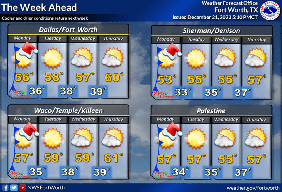
Tuesday through Thursday will be uneventful, with morning lows in the 30s, and afternoon highs in the mid to upper 50s.
*Yest Rain: 1.16"; Yest High: 60; Low: 57
*Today's Averages: High: 57; Low: 37
*Record high: 81 (1964); Record low: 3 (1989)
*December rain: 1.16"; Deficit: 0.15"
*2023 Rain: 27.52"; Deficit: 8.56"
*Sunrise: 7:27am; Sunset: 5:26pm
Today: Morning clouds, showers (east), drizzle and fog. Some afternoon breaks in the clouds. High: Mid to upper 60s. Wind: South 5-10 mph.
Tonight: Cloudy, mild and muggy. Patchy drizzle and fog. Low: Mid to upper 50s. Wind: South 5-10 mph.
Saturday: Cloudy. mild and muggy. A few morning showers, then widespread rain with thunder move in by late afternoon (1.00" -1.50"). High: Mid to upper 60s. Wind: South 10-20 mph.
Christmas Eve Day: Morning showers and storms (0.25-0.75"), then partial late afternoon clearing. Late evening cold front. High: Upper 60s.
Christmas Day: Morning clouds, afternoon sun. Windy and colder. High: Low 50s.
Tuesday - Thursday: Partly cloudy to mostly sunny and cool. High: Mid to upper 50s.
LISTEN on the Audacy App
Tell your Smart Speaker to "PLAY 1080 KRLD"
Sign Up to receive our KRLD Insider Newsletter for more news
Follow us on Facebook | Twitter | Instagram | YouTube


