


NOTE: This article is no longer being updated. Check here for the latest.
We're now less than 24 hours away from an Arctic blast hitting Central Texas, with freezing precipitation and likely travel impacts across much of the northern half of the state.
**Ice Storm WARNING for Travis, Williamson, Hays until Noon Sunday...
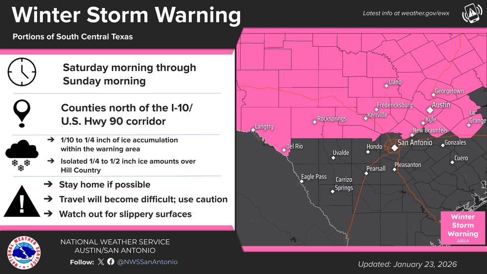
**Winter Storm WARNING for Caldwell, Bastrop until Noon Sunday...
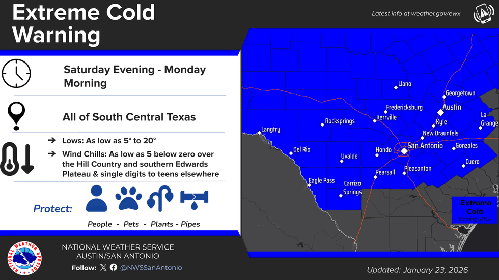
**Extreme Cold WARNING from 6 PM Saturday-Noon Monday...
That Arctic front is expected to arrive in Central Texas late Friday evening into Saturday morning. Friday will feature increasing rounds of showers and thunderstorms as moisture flows in from a Pacific low pressure system.
[shortcode-inline-related expand="1" link="/talk1370/news/local/area-leaders-continue-preparations-ahead-of-winter-blast" headline=""Winter is here:" City, county leaders continue preparations ahead of weekend winter blast" image="/media-library/image.png?id=65116471"]The front will cause temperatures to start falling, reaching the freezing mark in the Hill Country early Saturday morning. By late afternoon into the evening hours Saturday, the Austin metro and eastern counties will transition to freezing rain as well.
Precipitation will come to an end by late morning on Sunday, but temperatures are expected to stay near or below the freezing mark all the way into Monday.
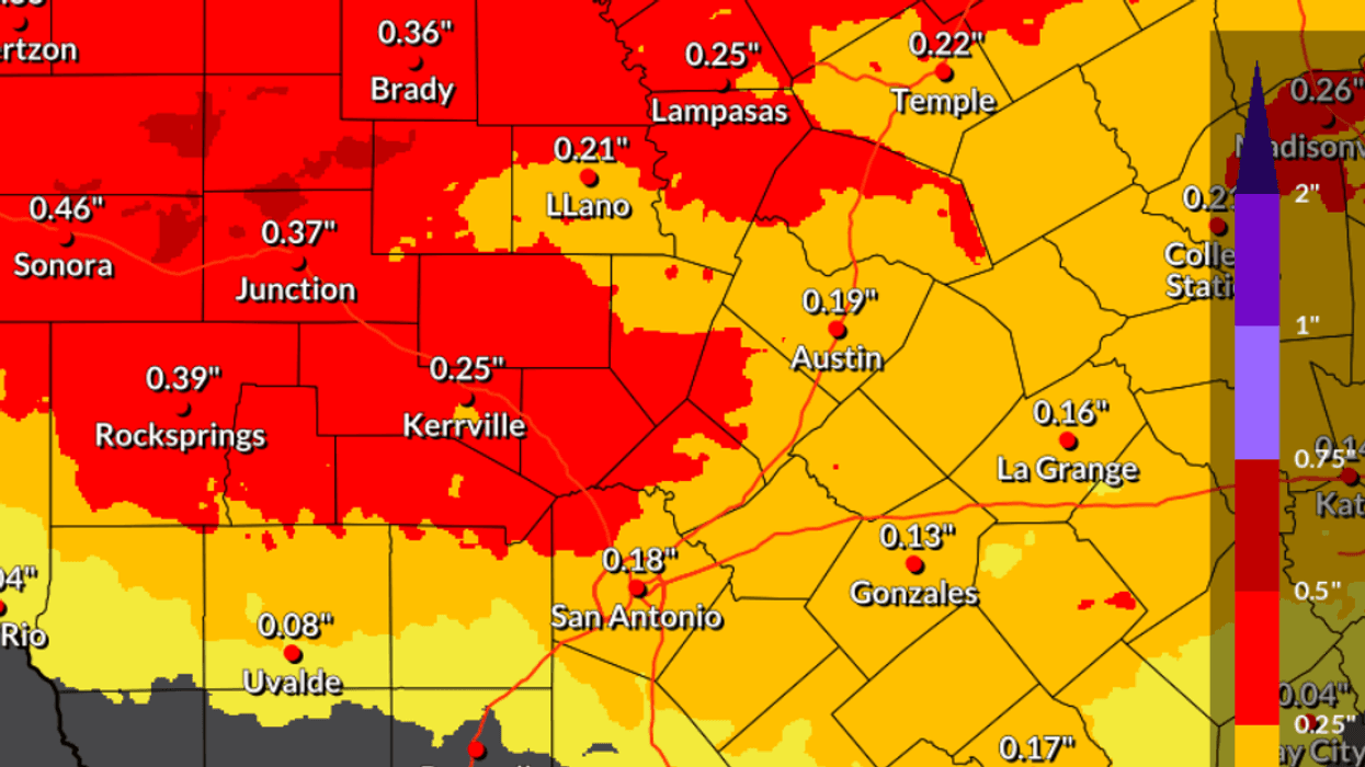
Widespread accumulations of a few hundredths of an inch are expected along the I-35 corridor, up to about 0.15"; points north and west could see up to a quarter of an inch with higher isolated totals.
 NOAA/National Weather Service
Sunday morning, lows will fall into the lower 20s in Austin with lower to mid teens likely outside of the city. Monday morning will see the coldest temperatures, with a forecast low in the upper teens in Austin and single digits possible in parts of the Hill Country. A final hard freeze is expected on Tuesday morning before temperatures start to rebound.
Wind chill values are expected to remain dangerously low throughout this winter weather event, falling down to as low as single digits in Austin and zero degrees in the Hill Country.
 NOAA/National Weather Service
Stay tuned for regular forecast updates and other important information, on-air and online, throughout the weekend.