AUSTIN (Talk1370.com) -- Temperatures are expected to rise to near 80 degrees by Wednesday afternoon, before a strong Arctic cold front moves through late Wednesday into Thursday morning, sending temperatures plummeting into the lower 30s, along with a chance for possible wintry precipitation through the day on Thursday into Friday morning.
It's very important to note that this potential wintry weather situation will be nothing like the February 2021 winter storm - travel impacts are likely to be limited to bridges, overpasses, and other elevated surfaces.
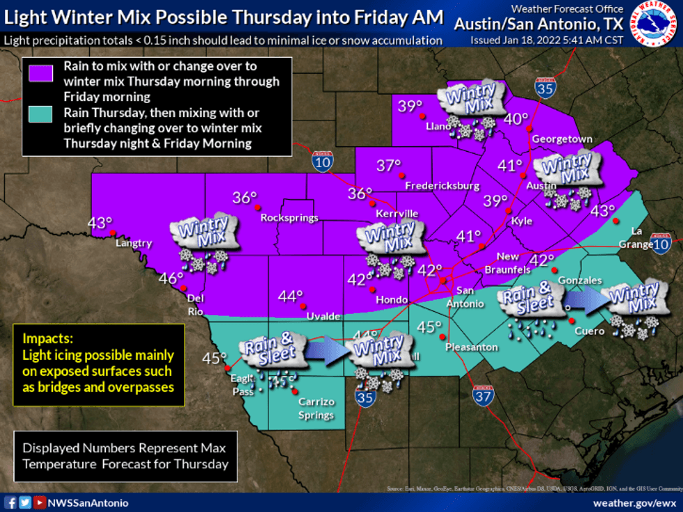
While temperatures will fall to just above or at freezing Thursday morning in the Austin metro, temperatures will rebound into the upper 30s by Thursday afternoon. The same will continue through the weekend - morning lows in the upper 20s to lower 30s, while afternoon highs will rise above the freezing mark, allowing any wintry precipitation that does fall to melt.
 National Weather Service Austin-San Antonio
Ground temperatures are also expected to remain warm enough to prevent significant accumulations on surface roadways, unlike in February where we saw multiple days where temperatures did not rise above the freezing mark.
The disturbance bringing the precipitation chances should clear the area by Friday morning, leaving behind cold but dry conditions for the rest of the weekend.
Stay tuned for the latest developments as this forecast continues to be fine-tuned over the next 48 hours.