


AUSTIN (Talk1370.com) -- A risk for strong to severe thunderstorms is growing for Friday afternoon and evening into early Saturday morning.
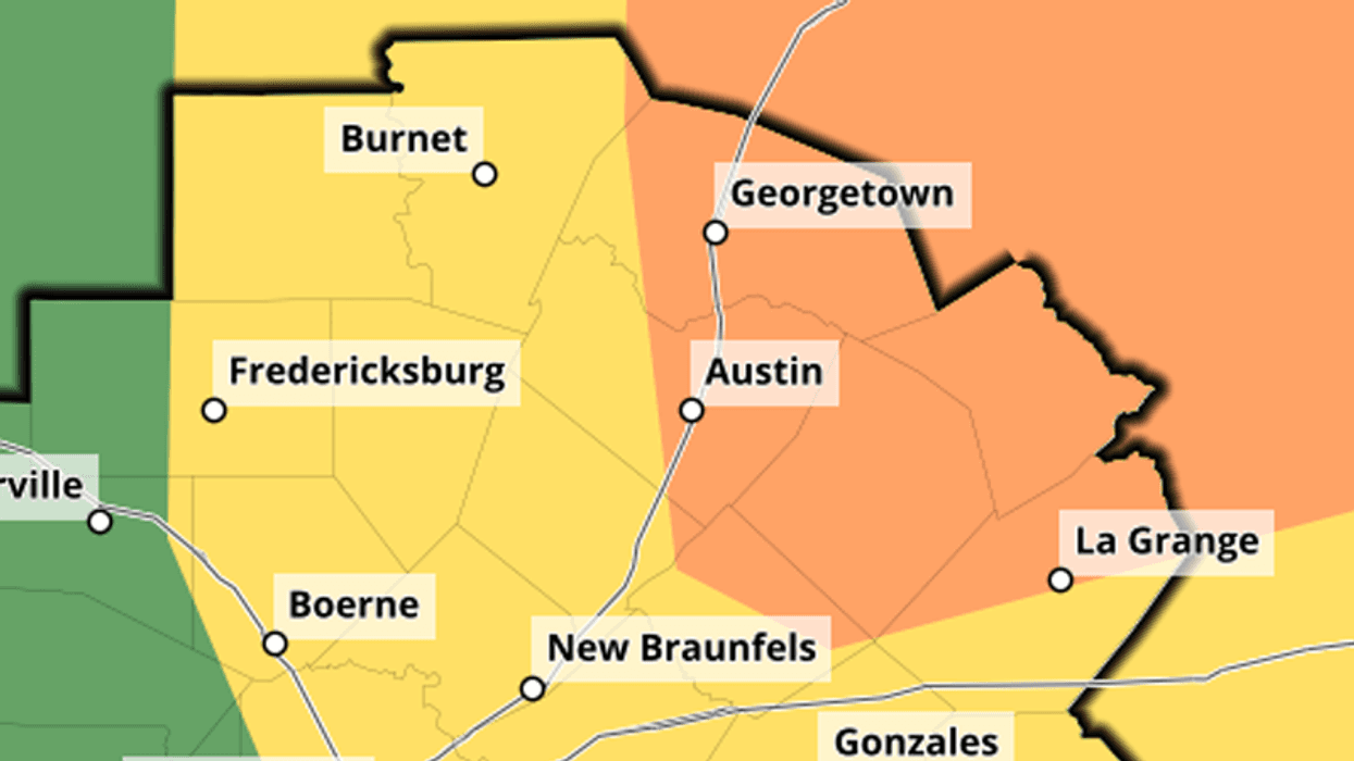
The latest outlook from the National Weather Service brings an "enhanced" risk of severe storms, or a "3 out of 5" risk on the agency's five-level scale, to the city of Austin and points north and east.
That "enhanced" risk area has continued to slide further south and west as new forecasts have been issued.
A cold front will approach the area Friday, providing an area of focus for storms to build up. Tornadoes, large hail, and damaging winds could all be possible within the path of these storms.
The concern for severe weather prompted a number of area high school football teams to move their games to Thursday night, including Weiss and Hutto, Lehman and Hays, Johnson and Westlake, and Lago Vista and Jarrell.
Storms are expected to move through the area quickly, which means they aren't expected to drop a lot of rain. Only about a quarter inch of rain is expected across the metro area, with chances gradually increasing from west to east.
The storms will clear out by early Saturday morning, leaving behind cooler temperatures but gusty winds.


