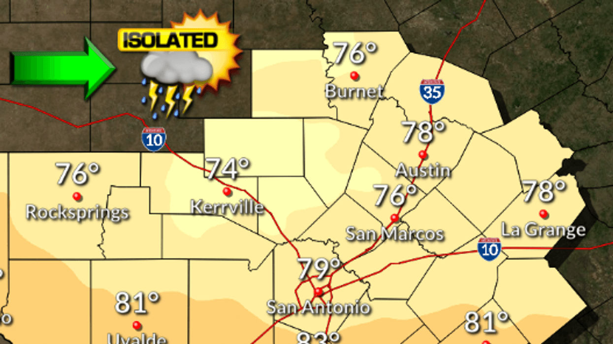
(Talk1370.com) -- Warm and humid conditions will prevail Wednesday, with a chance for showers and thunderstorms late Wednesday night - some of which could be severe.
Wednesday will see partly cloudy skies with a slight chance of showers in the morning, turning mostly cloudy with a chance of showers and thunderstorms continuing in the afternoon. Highs will reach into the upper 70s to 78 in Austin, with southeast winds 10 to 15 mph.
A potential severe weather situation is quickly developing, with parts of the Hill Country and Austin metro now under an Enhanced risk for severe storms. The latest update from the Storm Prediction Center places a good bit of the western side of Williamson County, extreme northwest Travis County, much of Burnet and Llano Counties, and parts of Blanco and Gillespie Counties under the enhanced risk - the third of five levels. Other parts of Travis and Williamson, and portions of Hays are under a Slight risk.
Large hail and strong, damaging winds are possible with these storms as they may develop, with an isolated tornado possible as well. Make sure you have multiple ways to receive weather alerts as the afternoon and evening progress.
Here's a look at the extended forecast:
THURSDAY...Partly cloudy with a 20 percent chance of showers in the morning, then sunny in the afternoon. Highs in the mid 70s. Northwest winds 10 to 15 mph with gusts to around 25 mph.
THURSDAY NIGHT...Clear. Lows around 50. East winds 5 mph shifting to the southeast after midnight.
FRIDAY...Sunny. Highs in the lower 80s. South winds 10 to 15 mph. Gusts up to 25 mph in the afternoon.
FRIDAY NIGHT...Mostly clear before midnight then becoming cloudy. Lows around 60.
SATURDAY...Mostly cloudy. A 20 percent chance of showers and thunderstorms in the afternoon. Highs in the lower 80s.
SATURDAY NIGHT...Partly cloudy before midnight then becoming mostly cloudy. Lows in the upper 50s.
SUNDAY AND SUNDAY NIGHT...Partly cloudy with a 20 percent chance of showers. Highs in the mid 70s. Lows in the mid 50s.
MONDAY...Partly cloudy. Highs around 80.
MONDAY NIGHT AND TUESDAY...Mostly cloudy. Lows around 60. Highs in the mid 80s.