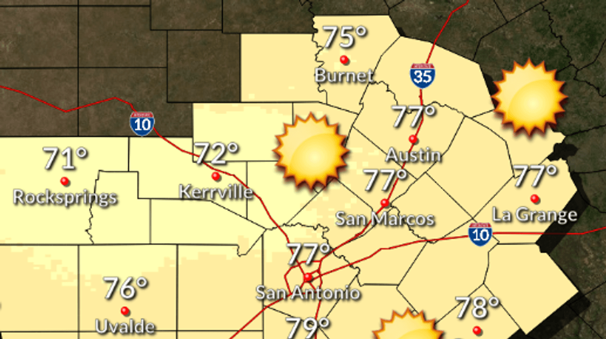
AUSTIN (Talk1370.com) -- Temperatures will be about 50 degrees above where they were this time a week ago, as Central Texas continues to recover from the effects of last week's winter storm under mostly sunny skies Tuesday.
Highs Tuesday will reach into the mid to upper 70s, with Austin shooting for a forecast high of 77. Skies will remain clear until late tonight, when clouds will start to build in. Lows will fall into the mid 50s, gradually rising after midnight, with southerly winds gusting up to 25mph after midnight.
Here's a look at the extended forecast:
WEDNESDAY...Mostly cloudy in the morning then becoming partly cloudy. Highs in the mid 70s. Southwest winds 5 to 10 mph shifting to the northwest in the afternoon.
WEDNESDAY NIGHT...Partly cloudy before midnight then becoming cloudy. Lows in the upper 40s. North winds 10 to 15 mph.
THURSDAY...Cooler. Cloudy with a 50 percent chance of showers. Highs in the upper 50s. North winds 10 to 15 mph.
THURSDAY NIGHT...Cloudy. Showers likely before midnight, then showers likely and slight chance of thunderstorms after midnight. Lows in the mid 40s. Chance of rain 60 percent.
FRIDAY...Cloudy with a 20 percent chance of showers in the morning, then partly cloudy in the afternoon. Highs in the lower 60s.
FRIDAY NIGHT...Partly cloudy before midnight then becoming cloudy. Lows in the upper 40s.
SATURDAY...Cloudy. A 20 percent chance of showers in the afternoon. Highs in the upper 60s.
SATURDAY NIGHT...Warmer. Cloudy with a 20 percent chance of showers and thunderstorms. Lows in the upper 50s. Temperature steady or slowly rising after midnight.
SUNDAY...Cloudy. Chance of showers and thunderstorms in the morning, then a slight chance of showers and thunderstorms in the afternoon. Highs in the mid 70s. Chance of rain 30 percent.
SUNDAY NIGHT...Cloudy. A 20 percent chance of showers and thunderstorms after midnight. Lows in the mid 50s.
MONDAY...Cloudy. A 20 percent chance of showers in the morning. Highs around 70.