


CHICAGO (WBBM NEWSRADIO) - Another winter storm has arrived, and it's already making its presence known.
Earlier this morning, wet snow fell rapidly throughout the entire area with, at times, blizzard-like conditions. The system is expected to stick around until tomorrow.
A Winter Storm Warning remains in effect for most area counties-Cook, Lake, DuPage, Kane, Will, DeKalb, McHenry, Kendall, Grundy, and LaSalle- until noon Saturday.
The snow fell heavy at times, falling at rates of 1 to even 2 inches per hour for areas mainly near and north of I-80, the National Weather Service said.
Later this morning, warmer air came in and, the precipitation has changed over to either a rain/snow mix or just plain rain closer to the lakefront and south of the city, AccuWeather says.
By the late afternoon, as temperatures begin to dip, the snow will once again become more widespread and continue into Saturday morning. With gusting to up to 40 mph, blizzard conditions will also return.
Ultimately, the highest snow totals will be north and west of Chicago, with 8 to 12 inches projected to fall by Saturday morning, the NWS says. Four to 8 inches are estimated for the city and near southern suburbs, AccuWeather says.
The snow has already piled up for some.
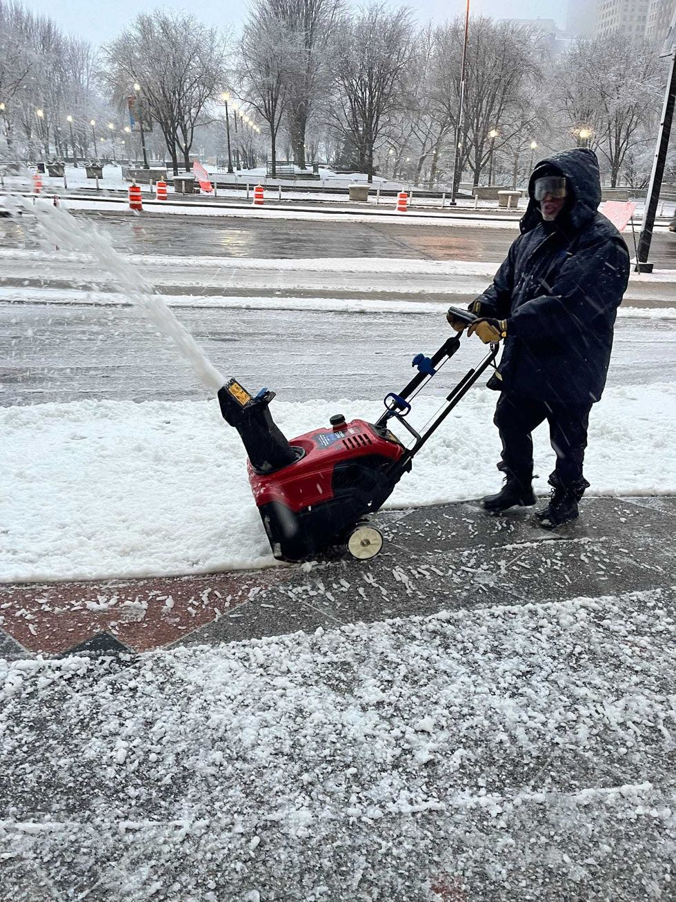 A major winter storm rocked the Chicago area Friday, with heavy, wet snow rapidly falling in the morning.Craig Schwalb
Snow totals as of 12:30 p.m:
Elgin: 8.5 inches
Elburn: 8 inches
Lockport: 7.5 inches
LaSalle: 7.4 inches
St. Charles: 6.5 inches
Naperville: 6.5 inches
Barrington Hills: 6.5 inches
Volo: 6.5 inches
Campton Hills: 6.4 inches
Geneva: 6.3 inches
Manhattan: 6.2 inches
Peotone: 6.1 inches
Carol Stream: 6 inches
Minooka: 6 inches
Marengo: 6 inches
Aurora: 6 inches
McHenry: 6 inches
DeKalb: 6 inches
Sugar Grove: 6 inches
Hampshire: 5.6 inches
Batavia: 5.5 inches
Joliet: 4.2 inches
Midway Airport: 3.8 inches
O'Hare Airport: 3.4 inches
The storm has significantly impacted both road and air travel, affected school operations for numerous districts and resulted in significant power outages.
Blowing snow has created poor visibility and area roads are extremely slick. Several jack-knife semi crashes were reported on local expressways, and the CTA rerouted several buses off of DuSable Lake Shore Drive.
Air travel has come to a halt. As of 2 p.m, over 1,100 flights have been canceled at Chicago airports, 832 at O'Hare, 279 at Midway.
ComEd crews have been dealing with power outages since early morning with tens of thousands of homes and businesses without electricity.
As of 1 p.m ComEd reported over 46,000 homes and businesses without power.
Currently most affected:
Chicago: 9,734
Skokie: 2,290
Niles: 2,184
Cicero: 1,607
Wheeling: 1,490
Des Plaines: 1,347
Maine Township: 1,318
Northlake: 1,241
At its worst, over 97,000 homes and businesses were without power. Edison spokesman Tom Dominguez said that if your power goes out you can call 1-800-EDISON-1 or report it on the ComEd app.
"Crews are already out. We saw the storm coming in, staying in touch, spike, get everybody restored as quickly as possible," Dominguez said.
Meanwhile, Nicor executive Rich Asiyanbi said you should be careful removing snow or ice from around your natural gas meter.
"Use your hands or a broom, hands with gloves, of course, and not a shovel. Take the time to use a broom to brush away the snow or ice from your meter and we'll ask that you never never kick or hit your gas meter," Asiyanibi said.
If your smell a natural gas leak or suspect carbon monoxide in your home, Nicor says you should leave the area immediately and either call 911 or Nicor at 888-Nicor-4U.
The weekend weather will only become more challenging and dangerous, with a deep freeze expected to begin by Saturday.
AccuWeather says temperatures will crash into the teens during the day and plummet into the single digits at night. By Sunday, high temperatures will barely be above zero, with wind chills as cold as 30 below zero.
The dangerous cold will last until midweek.
Listen to our new podcast Looped In: Chicago
Listen to WBBM Newsradio now on Audacy!
Sign up and follow WBBM Newsradio
Facebook | Twitter | Instagram


