


We're one week away from the 20th anniversary of Hurricane Katrina. According to forecasters, we will get through August 29th unscathed by storms.
"The good news for us is that we have nothing to worry about for at least the next 10 days," National Weather Service meteorologist Danielle Manning told WWL's Tommy Tucker.
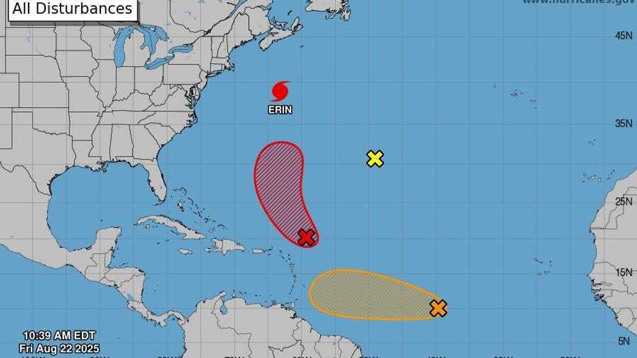
According to Manning, forecasters are paying attention to two systems that are in the Atlantic Basin. One of them is near the Leeward Islands, but Manning says we have nothing to fear. That's because a low-pressure tough over the East Coast is keeping Hurricane Erin and that other disorganized system out in the Atlantic Ocean.
"Thankfully it is forecast to remain out over the open ocean," Manning said.
The second system, Manning said, is over the central Atlantic, but it's too soon to tell where it will go. Manning says a high-pressure ridge over the United States could prevent that system from entering the Gulf.
We've got plenty of time to watch that one," Manning said.
However, Manning noted that any shift in either the low-pressure trough or the low-pressure ridge could put the Gulf back into play.
"Upper level patters and steering patterns could change with time, so it's really too soon to say for how long the Gulf is 'closed,'" Manning said.
Still, Manning urges people not to buy into forecast models posted online showing a hurricane making landfall along the Gulf Coast in the coming weeks. According to Manning, those models are picking up on the fact that we're entering the busiest part of hurricane season.
"Models really are unreliable as far as development is concerned the farther out you go," Manning said.


