


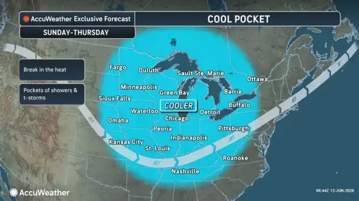
After our first taste of summertime heat and humidity, a cold front will usher in some 'cool change' the Buffalo-Niagara and Western New York region for the weekend, National Weather Service forecasters say.
Friday will still be a warm one, with above normal temperatures, high humidity, and some heat index values reaching the lower to mid 90's.
After morning scattered showers and thunderstorms, a dry afternoon is on tap for Friday to kickoff the weekend.
"A big change behind the cold front," NWS meteorologist Tony Ansuini tells WBEN. "Temperatures cool off, humidity lower, so much more comfortable around here starting this afternoon."
One more warm and humid day today with some showers and thunderstorms. Fair and less humid Saturday. Numerous showers and storms Sunday. #nywx pic.twitter.com/FAIK7DqyZz
— NWS Buffalo (@NWSBUFFALO) June 12, 2026
A pleasant weekend is in store, with mainly dry and seasonable conditions.
"The cooler temperatures are going to stay with us through the weekend," Ansuini notes. "More seasonable temperatures, upper 70's both weekend days, and then even cooler by Monday, perhaps just looking in the 60's."
"More seasonable temperatures, upper 70's both weekend days, and then even cooler by Monday, perhaps just looking in the 60's."
"More seasonable temperatures, upper 70's both weekend days, and then even cooler by Monday, perhaps just looking in the 60's."


