


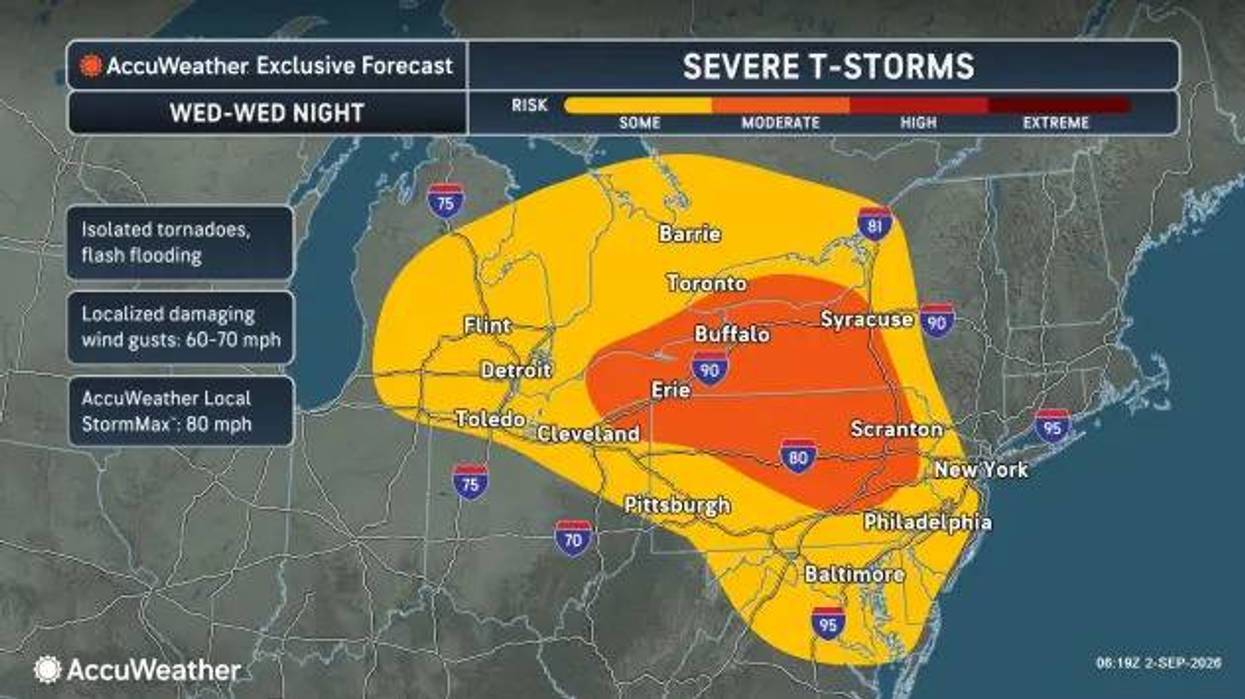

Buffalo, N.Y. (WBEN) - You'll need to be weather ready as strong storms and possibly an isolated tornado hit Western New York Wednesday.
Some scattered showers and storms will roll through the region Wednesday morning, but the most ominous skies will be overhead around 4pm-5pm.
"Damaging winds the main threat with the storminess but large hail is likely. Could see some flash flooding, and an isolated tornado is a possibility," WBEN meteorologist Aaron Mentkowski says.
Widespread clusters of storms will spare nobody throughout WNY.
"We have the more active weather coming through around 4 o'clock in the afternoon and then continuing throughout the overnight period," National Weather Service meteorologist Liz Jurkowski tells WBEN.
It will be another muggy one, too. Highs will be in the mid to upper 80s with heat indexes crossing into the 90s in some parts of Niagara county, southwest Erie county and bits of the southern tier.
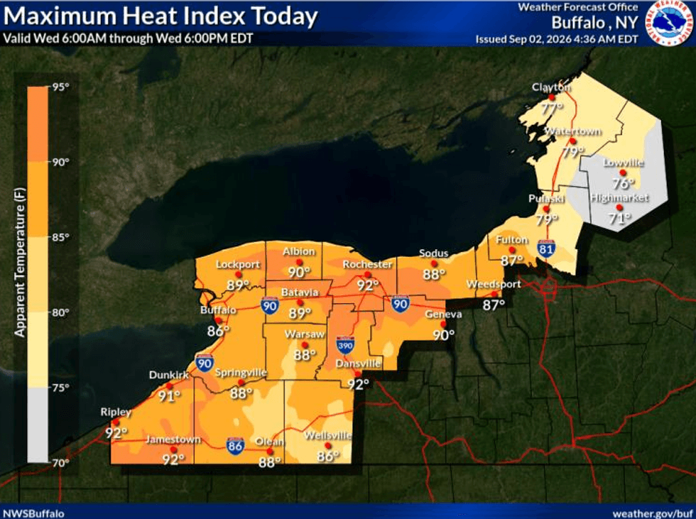 It will feel like 90 or above in certain parts of WNY Wednesday.National Weather Service Buffalo.


