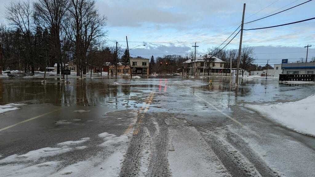
Buffalo, N.Y. (WBEN) - Despite the return to winter temperatures, icing over and snow that has fallen since Thursday's deluge of rain, flooding remains a concern in part of Western New York this weekend.
With water still flowing into creeks and streams from higher elevations, levels continue to rise in some of the slower to respond waterways, causing concern and the potential for additional weekend flooding.
Tonawanda Creek at Rapids and in Batavia are trouble spots being watched closely by forecasters for minor or moderate flood stage conditions.
In Buffalo, area creeks, streams and rivers are below flood stage.
The City of Buffalo this week was proactive in breaking ice along the Buffalo River, into which many area waterways empty as the water transits to Lake Erie. The city released the above drone footage used by engineers to determine the extent of ice jam flood potential.
CHECK: Detailed flood conditions on area waterways
Flood warnings continue for some spots as detailed below by the National Weather Service.
The Flood Warning is cancelled for the following rivers in New York...
Allegheny River At Olean affecting Cattaraugus County.
...The Flood Warning continues for the following rivers in New York...
Black Creek At Churchville affecting Monroe and Genesee Counties.
Tonawanda Creek At Rapids affecting Erie and Niagara Counties.
.There continues to be flooding on some slower responding rivers.
For the Black Creek...including Churchville...Moderate flooding is forecast.
For the Tonawanda Creek...including Attica, Batavia, Rapids...Minor flooding is forecast.
PRECAUTIONARY/PREPAREDNESS ACTIONS...
Turn around, don`t drown when encountering flooded roads. Most flood deaths occur in vehicles.
Please report observed flooding to local emergency services or law enforcement and request they pass this information to the National Weather Service when you can do so safely.
Caution is urged when walking near riverbanks.
Additional information is available at www.weather.gov.
The next statement will be issued this morning at 645 AM EST.
&& NYC029-063-202245- /O.CON.KBUF.FL.W.0013.000000T0000Z-220222T0630Z/ /RAPN6.1.RS.220220T1114Z.220220T1200Z.220222T0030Z.NO/ 545 AM EST Sun Feb 20 2022 ...FLOOD WARNING REMAINS IN EFFECT UNTIL EARLY TUESDAY MORNING...
* WHAT...Minor flooding is forecast.
* WHERE...Tonawanda Creek At Rapids.
* WHEN...Until early Tuesday morning.
* IMPACTS...At 12.0 feet, Flood stage, lowland flooding of farm areas along Tonawanda Creek between Rapids and the Tonawanda Indian Reservation. Flooding may impact Fletcher, Burdick, Kirby, and Tonawanda Creek Roads.
* ADDITIONAL DETAILS...
- At 5:00 AM EST Sunday the stage was 11.7 feet.
- Forecast...The river is expected to rise above flood stage this morning to a crest of 12.2 feet this morning. It will then fall below flood stage tomorrow evening.
- Flood stage is 12.0 feet.
- Flood History...This crest compares to a previous crest of 12.9 feet on 01/08/2019.