With much warmer conditions from what we felt Saturday, the more comfortable conditions will come with the price of some unsettled weather as the weekend ends and a new work week unfolds.
While much of Sunday will be dry, there will be an increasing chance of showers through the afternoon, especially across areas north of the NYS Thruway.
Shower chances will ramp up this afternoon into the evening , with the best shower chances north of I-90. Lower chances for a shower are in the offing toward the NY/PA line, with many areas there quite possibly remaining dry through the entire day.
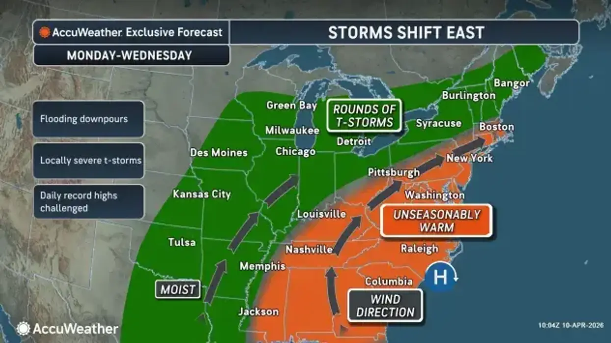
A cold front passing through overnight into Monday will refresh the chance for some showers early Monday.
A few more rounds of showers are likely Tuesday through Wednesday. The timing of the better rain chances becomes more uncertain from midweek on, but at least some rain is likely each day. Building warmth and higher dewpoints will also support at least some modest instability with a chance of a few thunderstorms as well.
 AccuWeather.com
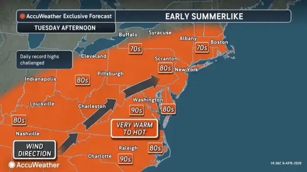
Warmth will continue to build through the week. Highs Monday will be in the 65-70 degree range in most areas, only held back by the early arrival of clouds and showers. Highs Tuesday through Thursday will be well into the 70's for most areas away from the influence of Lake Erie and Lake Ontario, with a few near 80 degree readings possible in the typical warmer spots in the Genesee Valley and Finger Lakes.