Slowly and steadily, the heat and humidity will be on the increase across the Buffalo-Niagara region as we work toward the 4th of July holiday weekend.
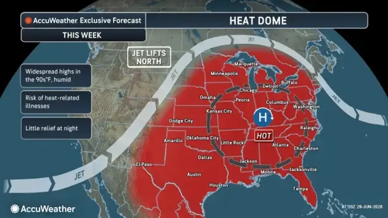
A large area of high pressure is the culprit and will build across the eastern portion of the country as the week unfolds, National Weather Service meteorologist john Rozbicki explains to WBEN.
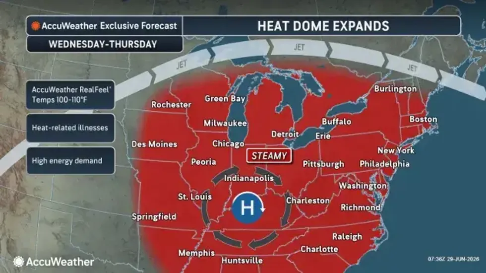
"It's going to pump increased heat and humidity across our area through midweek, with the heat and humidity peaking sometime in the Wednesday, Thursday timeframe," Rozbicki says."
Temperatures Monday will climb to the mid to upper 80's, with tolerable humidity, but then things begin to change.
"We're looking for highs pushing up into the upper 80's to low to mid 90's by Wednesday and Thursday, with more oppressive humidity by that time," Rozbicki cautions.
The temps will be warm enough, but with the humidity added in to the mix, the 'feels like' temps will be a challenge to be sure.
"During the peak, probably between the mid 90's to low 100's," Rozbicki warns of the heat values. "Areas closer to Lake Ontario could see heat indices as high as 105."
 AccuWeather.com
Rozbicki does say the heat and humidity will ease some later in the week for the holiday weekend, however it will be a fairly slow and steady process.
"For the holiday weekend it's still going to be pretty warm and humid."
Conditions will be mainly dry for much of the work week, following a few possible showers and storms overnight Monday into Tuesday.
The weather will turn somewhat unsettled as the weekend approaches.
"We'll start to see increasing chances of showers and storms as we push Friday through the holiday weekend, unfortunately."