As we welcome the month of May, Mother Nature seems more stuck in March when it comes to the weather across the Buffalo-Niagara region.
Unsettled and downright cold weather is in the weekend forecast, and through the middle part of the month, National Weather Service forecasters say.
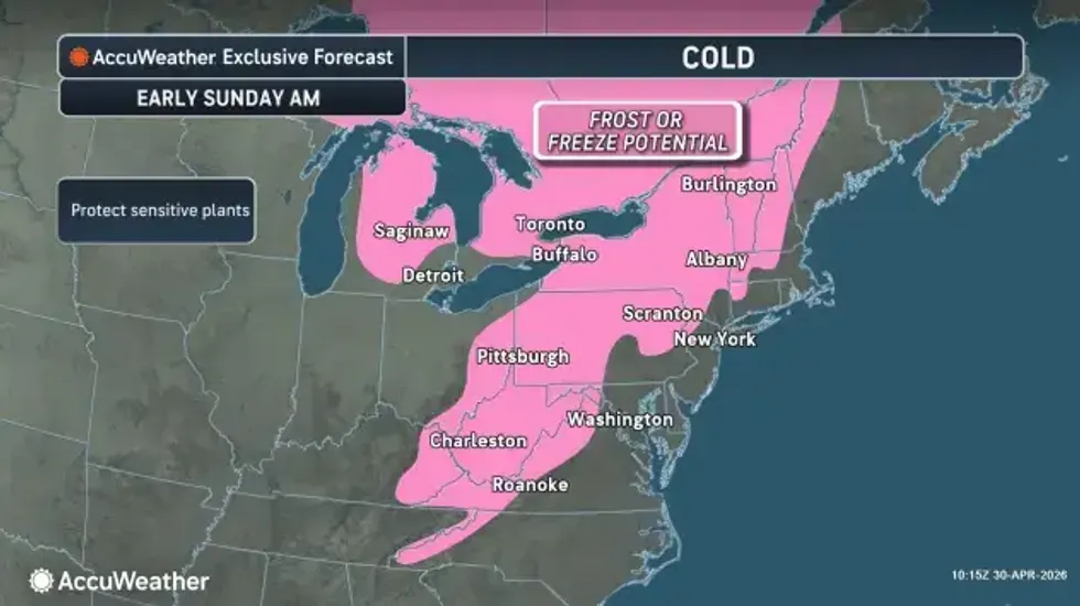
Western New York started the day Friday with temperatures in the 30's and areas of frost, particularly in areas away from the lakes. And that is something that will likely repeat itself as the weekend unfolds.
"It looks like we are going to stay locked-in with this colder weather pattern right through the weekend," NWS meteorologist Tony Ansuini tells WBEN. "Tonight will be another frosty night, with temperatures back into the 30's. The coldest night right now looks like it's going to be Saturday night, temperatures likely dropping down to near freezing, with even some 20's inland from the lakes,"
 AccuWeather.com
A Frost Advisory is posted for the Buffalo metro area and Niagara Frontier and a Freeze Warning is posted for Chautauqua County.
The frosty pattern is here to stay, too, forecasters caution.
"Right now it really looks like there is no warm air in sight," Ansuini says. "This cooler pattern pretty much stays locked-in across Western New York pretty much through at least the middle part of the month, possibly even a little bit longer."
In addition to the frigid overnight temps, daytime highs for the next couple weeks will likely top out in the 50's, when the 60's would be more the norm.