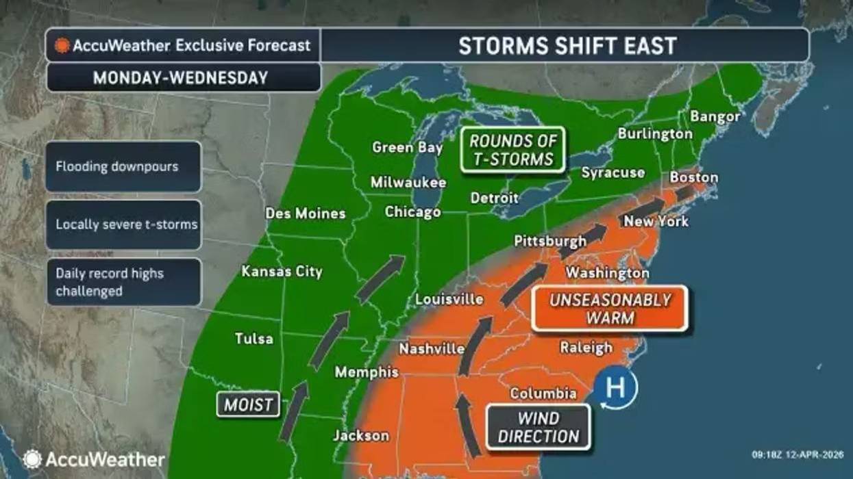
It will feel like spring across the Buffalo-Niagara region for the work week as it unfolds, with much warmer temps in the 60's and 70's, however each day will come with a chance for rounds of rain showers.
Warm but unsettled weather will impact Western and North-Central NY for much of the upcoming work week. Expect rounds of showers and storms, a few of which may become severe Tuesday through Wednesday. pic.twitter.com/BdHvt5ePwE
— NWS Buffalo (@NWSBUFFALO) April 13, 2026
Only scattered and light showers are in the forecast Monday, with mainly dry conditions expected later in the day.
It will be windy, however, with gusts in the 30-40 mph range in most areas, and up to 45 mph in the normally windy locations from the Niagara Frontier, National Weather Service forecasters say. Winds will quickly diminish early Monday evening.
Winds will increase early Monday morning, with strongest gusts likely through the afternoon hours. Strongest southwest gusts will be found northeast of Lake Erie, including Buffalo, Niagara Falls and Batavia. pic.twitter.com/12Dyh3tZYI
— NWS Buffalo (@NWSBUFFALO) April 12, 2026
The warmer conditions will then continue for the remainder of the work week, with rounds of showers in the forecast each day.
Rain chances are likely for the Tuesday through Thursday period, with the potential for 1 to 2 inches of rainfall cumulatively over the timeframe and a small chance for some severe storms in the Tuesday, Wednesday period.
Multiple rounds of showers and thunderstorms will cross the region Tuesday morning through early Wednesday morning, with each round possibly containing locally gusty winds. pic.twitter.com/x4RMgDoahj
— NWS Buffalo (@NWSBUFFALO) April 13, 2026
Rain chances are likely for the Tuesday through Thursday period, with the potential for 1 to 2 inches of rainfall cumulatively
Rain chances are likely for the Tuesday through Thursday period, with the potential for 1 to 2 inches of rainfall cumulatively