Damp and dreary. Continued.
That's the forecast for the Buffalo-Niagara region, in essence, through midweek, National Weather Service forecasters say.
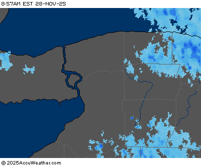
A slow moving low pressure system will maintain clusters of showers, and day time thunderstorms across our region through at least Wednesday.
"This pattern is probably going to continue through at least midweek," NWS meteorologist Jim Mitchell tells WBEN. "It's just kind of sitting and spinning, so we're going to see these on and off periods of showers right through Wednesday."
There will be dry periods, as was the case over the weekend, but showers will be frequent.
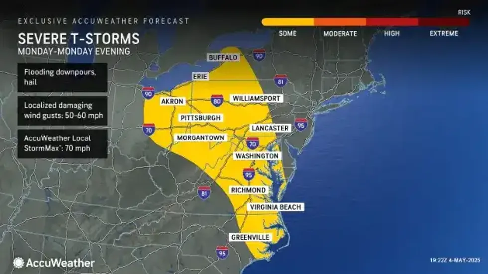
There is a good chance of some strong to severe weather across parts of the region late in the day Monday. "We're going to have some stronger storms possibly develop, mainly across the southern tier, but right here in Buffalo we'll be on the northern fringe of those storms," Mitchell cautions.
Storms may include some stronger winds, locally heavy rain and even hail.
 AccuWeather.com
One bright spot?
"We will see a nice bump in temperatures the next couple days," Mitchell says. "We should see highs around 70 today and tomorrow."
We're not alone in the dreariness either.
"It's pretty much effecting all areas east of the Mississippi."