Buffalo, N.Y. (WBEN) - Rapidly changing weather conditions are the order of the day Friday across the Buffalo-Niagara region, with extreme winds, falling temperatures and a changeover from rain to snow.
"It will turn colder behind this front," National Weather Service meteorologist Aaron Reynolds tells WBEN. "We will have some lake effect that develops east of the lake, and some minor accumulations."
The change from Thursday to Friday is readily apparent, with much colder temperatures to greet morning commuters.
"We had some readings yesterday and overnight into the 50's," Reynolds notes. "We had some readings of 52, 54...temperatures are going to start to fall here pretty quickly."
 AccuWeather.com
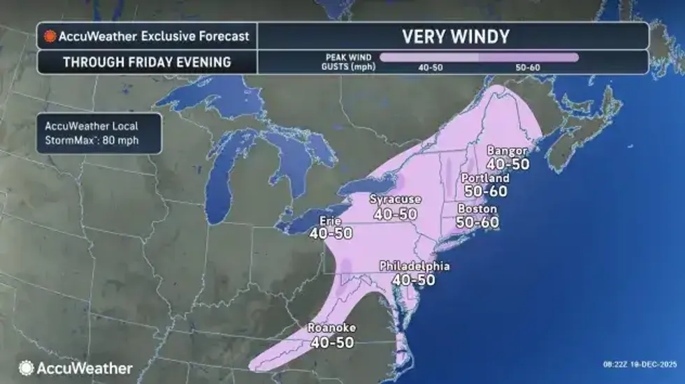
Very Windy
The front came crashing through during the early morning hours, bringing with it impressive wind gusts across the region.
"We've seen wind gusts between 50 and 57 mph," Reynolds says. "That's about what we're expecting." After a brief lull in the winds early Friday, winds will again increase before dying off later Friday night.
A Wind Advisory is posted for the Niagara Frontier through early Saturday.
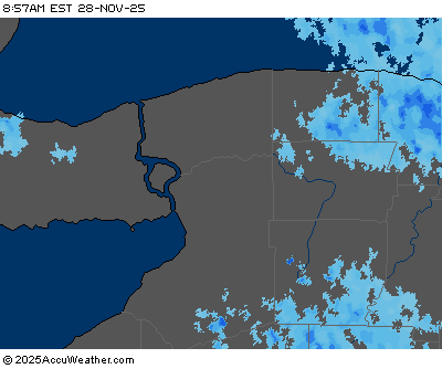
Changeover to Snow
The changeover from rain to snow will occur throughout the day Friday, and any accumulating snow will focus well to the south of the Buffalo metro area.
"In the most persistent snows, we could see anywhere from 2 to 4 inches, across mainly south of the city and across the southern tier and across the higher terrain." Only minor accumulations are expected across metro Buffalo.
A Winter Weather Advisory is posted for southern Erie County and the southern tier through early Saturday.
WIND ADVISORY REMAINS IN EFFECT UNTIL 1 AM EST SATURDAY
* WHAT...South winds 15 to 25 mph with gusts up to 50 mph expected this morning. West winds 20 to 30 mph with gusts up to 50 mph expected through this evening.
* WHERE...Erie, Niagara, Orleans, Monroe, Wayne, Northern Cayuga, Oswego, Genesee, Wyoming, Livingston, Ontario, Cattaraugus, and Allegany Counties.
* WHEN...Until 1 AM EST Saturday.
* IMPACTS...Gusty winds will blow around unsecured objects, including outdoor holiday decorations. Tree limbs could be blown down and a few power outages may result.
PRECAUTIONARY/PREPAREDNESS ACTIONS...
Use extra caution when driving, especially if operating a high profile vehicle. Secure outdoor objects.
WINTER WEATHER ADVISORY REMAINS IN EFFECT FROM 10 AM THIS MORNING TO 1 AM EST SATURDAY
* WHAT...Lake effect snow and blowing snow expected. Total snow accumulations 3 to 6 inches in the most persistent lake snows.
Winds gusting as high as 45 mph.
* WHERE...Wyoming, Chautauqua, Cattaraugus, and Southern Erie Counties.
* WHEN...From 10 AM this morning to 1 AM EST Saturday.
* IMPACTS...Plan on slippery road conditions. The hazardous conditions will impact the Friday evening commute. Gusty winds will lead to reduced visibility in blowing snow and down tree branches causing isolated power outages.
* ADDITIONAL DETAILS...Minor snowfall accumulations are expected early this morning as overnight rain transitions to snowfall.
Temperatures will rapidly fall below freezing between daybreak and late morning and create icy conditions.
PRECAUTIONARY/PREPAREDNESS ACTIONS...
Lake effect snow will fall in relatively narrow bands. If traveling, be prepared for rapidly changing road conditions and visibilities.