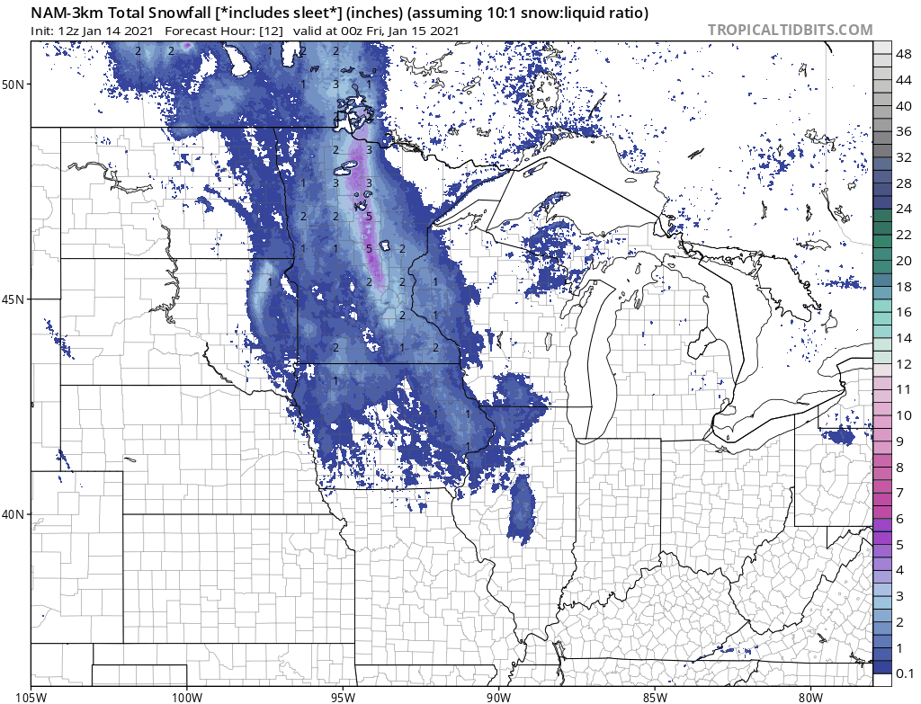
3KM NAM Snowfall Prediction.
The storm we've been tracking looks more impressive, a bit more formidable than it did yesterday at this time. Forecast to spin up over southwest Wisconsin and temporarily stall for about 24-36 hours, this will be a long-duration snow event, starting as a mix of snow, ice and rain (today) before a changeover to all snow tonight and Friday.
 Watches and Warnings(National Weather Service)
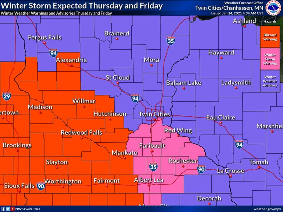
Watches and Warnings. Credit: Twin Cities National Weather Service
There are multiple threats with this upcoming storm, including a risk of blizzard conditions and localized white-outs just south and west of the Twin Cities, where winds may gust as high as 40-50 mph late tonight into Friday. The blizzard risk is lower for the immediate metro, but heaviest snow bands are expected to set up south of MSP, where Winter Storm Warnings have been issued by the local Twin Cities National Weather Service.
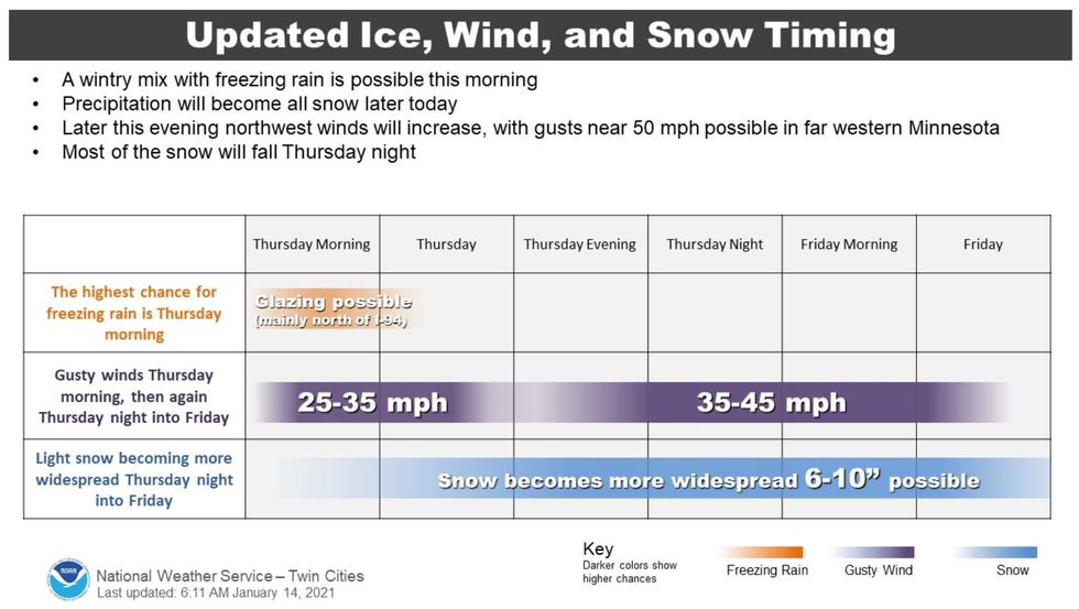 Storm Timeline(National Weather Service)
Storm Timeline. Credit: Twin Cities National Weather Service
This storm will have it all: ice, snow, and wind. But this will be a relatively warm storm in the Twin Cities, with temperatures close to 32F I expect a wet, slushy snow tonight. That said, colder air, more powdery snow and very strong winds will conspire to create widespread problems with blowing and drifting snow in more open areas south and west of the Twin Cities.
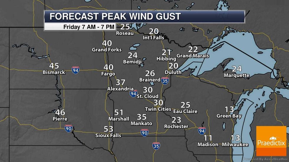 Peak Wind Gusts(Praedictix)
Peak Wind Gust Forecast for Friday. Credit: Praedictix
Winds are forecast to gust over 30 mph in the Twin Cities, but gusts as high as 50 mph are likely over far western and southwestern Minnesota, where blizzard potential is greatest. Winds will slowly ease Friday night and I expect travel conditions to improve on Saturday, statewide.
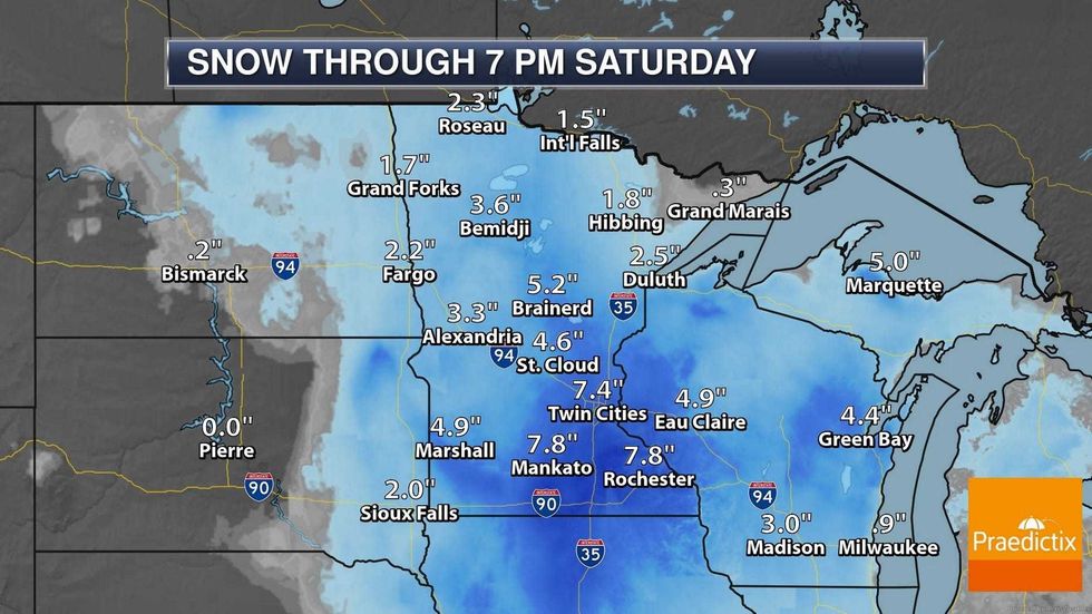 Snow through Saturday Night(Praedictix)
How Much Snow? Credit: Praedictix
This will be a plowable snowfall event for most of Minnesota, bordering on crippling for southwest counties due to high winds and near-zero visibilities in blowing snow at times. I still think a range of 4-8" makes sense, but models print out heavier amounts south of MSP, where some 8 to 10" snow totals can't be ruled out by Friday night.
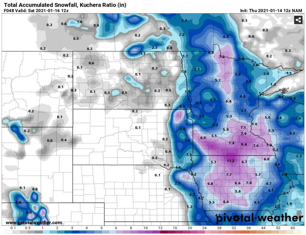 Snowfall guidance from the NAM Model(pivotalweather.com)
NAM Snowfall Guidance. Credit: pivotalweather.com
One more model for good measure, showing heaviest amounts over roughly the southern third of Minnesota, south of the Minnesota River. The farther south and west you drive tonight and Friday the worse travel conditions will be.
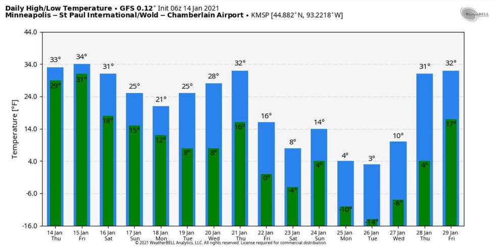 Temperature Outlook(ECMWF and weatherbell.com)
Turning Colder, But Not Ridiculously Cold. Credit: ECMWF and weatherbell.com
The much advertised arctic cold front is still coming (not that unusual at all for late January) but it doesn't look quite as cold as it did a few days ago. Expect a shot of numbing air after roughly January 28, with 7-8 moderately cold days and maybe 2-4 nights dipping below zero. I don't expect any record cold, but it will be chilly enough to get your attention.
A few big storm take-aways and predictions:
1). The heaviest snow will fall tonight, tapering off to light snow during the day on Friday.
2). Friday will be the roughest travel day statewide, especially AM rush tomorrow.
3). I don't expect blizzard conditions in the Twin Cities, but I might think twice about extensive travel south and west of MSP tonight and Friday morning, because of blizzard conditions and very low visibility. It may be difficult for MnDOT to keep roads open and passable tonight southwest of the metro area.
It's January, the snowiest month of the year over roughly the southern half of Minnesota, based on climate records since 1991. Snow, wind, cold - it's just business as usual as far as Old Man Winter is concerned. Hang in there, be safe out there - we'll have continuous updates during my show with Jordana Green from 3-6 PM today. I hope you'll tune in.