A foot? Maybe even more? It's looking more likely the Twin Cities and surrounding areas of Minnesota and Wisconsin are going to be dealing with a major March storm Saturday night and well into Sunday.
It begins later Saturday afternoon but the heaviest snow is expected to fall in the overnight hours. That will be accompanied by significant wind, blowing snow and drifting despite the snow being wet and heavy. The National Weather Service has now issues a Winter Storm Warning for the southern two-thirds of Minnesota, nearly all of Wisconsin.
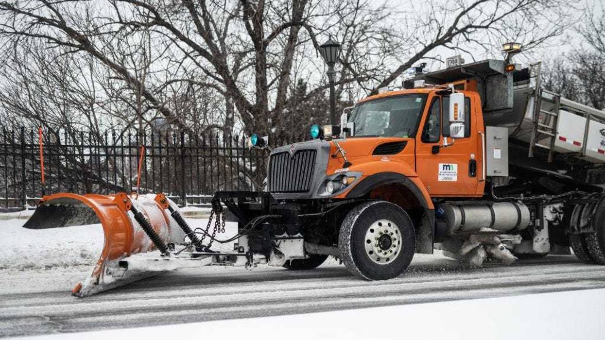
There is also a Blizzard Warning for areas just to the southwest and west of the Twin Cities where open areas could become extremely dangerous for anyone trying to drive. MnDOT is recommending no unnecessary travel overnight into Sunday morning. They have plow drivers at the ready but the blowing snow will make it difficult to keep roads clear.
And for those that aren't buying a foot in the Twin Cities yet? This tricky forecast is somewhat narrow but it looks like the real deal.
"Not really this time, it's looking like a pretty slam dunk," says National Weather Service forecaster Bill Borghoff. "This has been in the forecast for the last seven days or so, so the models have been pretty good with this one."
On Friday, WCCO-TV Chief Meteorologist Chis Shaffer was confident in at least 8-inches in the metro, but Borghoff says that's really the minimum, with bands going well over that amount.
"Still look like a good 12 to 18 inches, we're still trying to figure out exactly where the core of the heaviest band is gonna set up because wherever that sets up we could see closer to 20," Borghoff adds.
And there will definitely be pockets well over that.
"Certainly more than 12. The odds of even getting 18 are about 50-60%, so this is gonna be a pretty, pretty severe winter storm moving through," Borghoff said.
Those heavy winds, gusting over 40 mph, are going to add to the winter misery, and make travel at times treacherous, if not impossible.
"Travel is expected to become very difficult or impossible late tonight through Sunday evening," said a statement from the NWS. "In addition, the amount of water in the snowpack will make it very heavy, leading to the potential for infrastructure damage and a health hazard for those shoveling."
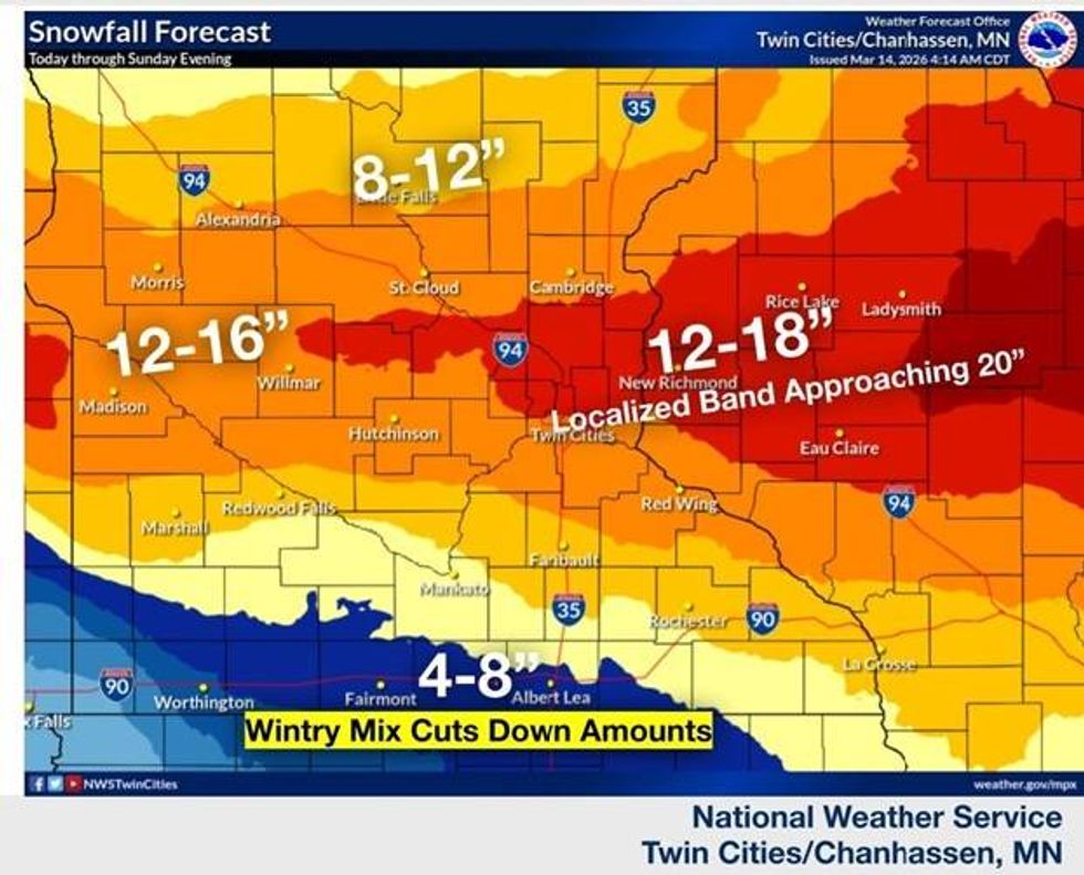
The NWS snowfall forecast shows a narrow band of snow over a foot from the Twin Cities east into Wisconsin.
(National Weather Service, Twin Cities)
WINTER STORM WARNING REMAINS IN EFFECT FROM 4 PM SATURDAY TO 4 AM MONDAY
* WHAT...Heavy snow and blowing snow expected. Total snow accumulations between 12 and 18 inches, with locally higher amounts possible near the Twin Cities metro. Some sleet may mix in across the far south metro late tonight. Winds gusting as high as 40 mph.
* WHERE...Benton, Sherburne, Stearns, Wright, Anoka, Carver, Chisago, Dakota, Hennepin, Isanti, Ramsey, Scott, Washington, and Goodhue Counties.
* WHEN...From 4 PM this afternoon to 4 AM Monday.
* IMPACTS...Travel could be very difficult to impossible. Widespread blowing snow could significantly reduce visibility. Gusty winds could bring down tree branches.
BLIZZARD WARNING REMAINS IN EFFECT FROM 10 AM SUNDAY TO 4 AM MONDAY
* WHAT...For the Winter Storm Warning, heavy snow expected. Total snow accumulations between 10 and 15 inches. Winds gusting as high as 35 mph. For the Blizzard Warning, blizzard conditions expected. Additional snow accumulations up to two inches. Winds gusting as high as 45 mph.
* WHERE...Kandiyohi, McLeod, Meeker, Renville, Chippewa, Lac Qui Parle, Pope, Stevens, Swift, and Yellow Medicine Counties.
* WHEN...For the Winter Storm Warning, from 4 PM this afternoon to 10 AM Sunday. For the Blizzard Warning, from 10 AM Sunday to 4 AM Monday.
* IMPACTS...Travel could be very difficult to impossible. Widespread blowing snow could significantly reduce visibility. Gusty winds could bring down tree branches. Whiteout conditions are expected and will make travel treacherous and potentially life-threatening.