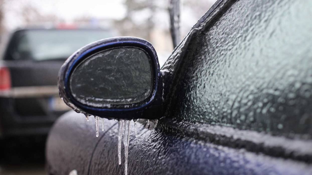
It could be a slippery one on the roads Monday into Tuesday, and there could even be issues getting around to start the day due to freezing rain.
WCCO-TV Chief Meteorologist Chris Shaffer says a Winter Weather Advisory takes effect later on Monday evening.
"9:00 tonight till about noon tomorrow," Shaffer says is the timing for the advisory. "The big concern will be walking around, driving around, so you really have to be careful tomorrow. We're gonna keep a close eye on the possibility that they may issue an ice storm warning if that ice thickness would be thick enough that it just makes it treacherous out there."
The window for the biggest ice threat will be after 10:00 p.m. Monday night until around 10:00 a.m. Tuesday morning. Temperatures should rise above the freezing mark by midday Tuesday.
"We're gonna have some rain coming in, the air aloft higher up in the atmosphere is warm enough that it comes down as rain," Shaffer explains. "Trouble is our temperatures at the surface are gonna dip just below freezing. So, when those little raindrops hit your sidewalk, your steps, your car, any surfaces, they will freeze on contact."
The area affected by this ice is roughly from the Twin Cities south to the Iowa border with a sharp cutoff in the north metro.
The rest of the week should be a bit quieter across the state with temperatures staying in the 30s, well above normal for January, heading into the weekend.
WINTER WEATHER ADVISORY 9:00 P.M. MONDAY-NOON TUESDAY
WHAT...Freezing rain expected. Total ice accumulations up to two tenths of an inch.
* WHERE...McLeod, Sherburne, Sibley, Wright, Anoka, Carver, Chisago, Dakota, Hennepin, Isanti, Kanabec, Mille Lacs, Ramsey, Scott, and Washington Counties.
* IMPACTS...Difficult travel conditions are possible. The hazardous conditions could impact the Tuesday morning commute.
Chris Shaffer's Forecast
MONDAY: Cloudy. High: 34. SE 3-6 mph.
MONDAY NIGHT: Winter Weather Advisory. Freezing rain possible. Low: 31. SE wind 3-5 mph.
TUESDAY: Mostly cloudy. High: 35. NW wind 5-10 mph. Winter Weather Advisory expires after 10:00 a.m.
Staying mild all week. Could see a hit-or-miss snow on Friday. Average high and low: 24/10.