


 White-Out PotentialTwin Cities National Weather Service
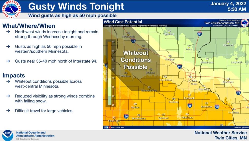
Another wind-whipped snow event is shaping up over the next 24 hours, with the greatest impact predicted for far western Minnesota tonight as winds gust over 35 mph, producing localized white-out conditions and ground blizzards. I might think twice before hitting the roads, especially over western counties after the dinner hour today.
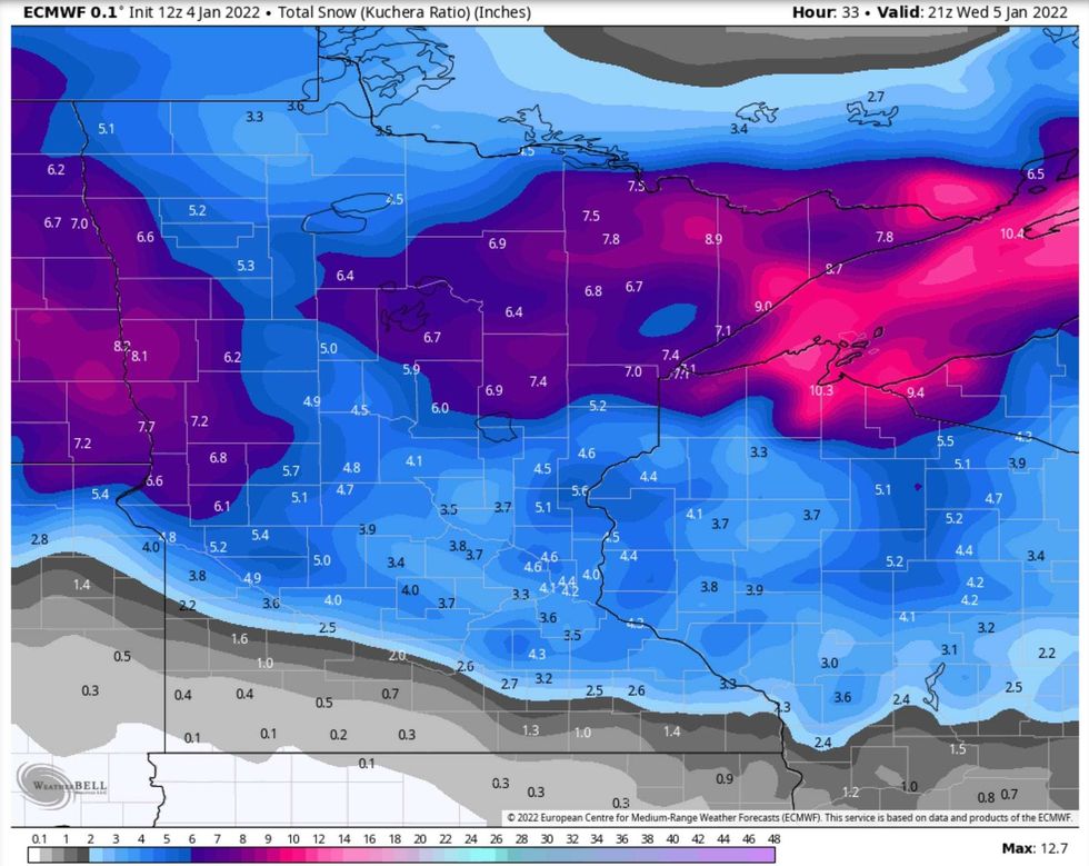 ECMWF
ECMWF
A few inches of snow will blow around tonight and tomorrow, probably in the 3-5" range for most spots. It will be blowing around, so tricky to measure. Plowable, but just barely so. The combination of high winds, blowing snow and very low windchills will create very rough travel conditions into Wednesday night.
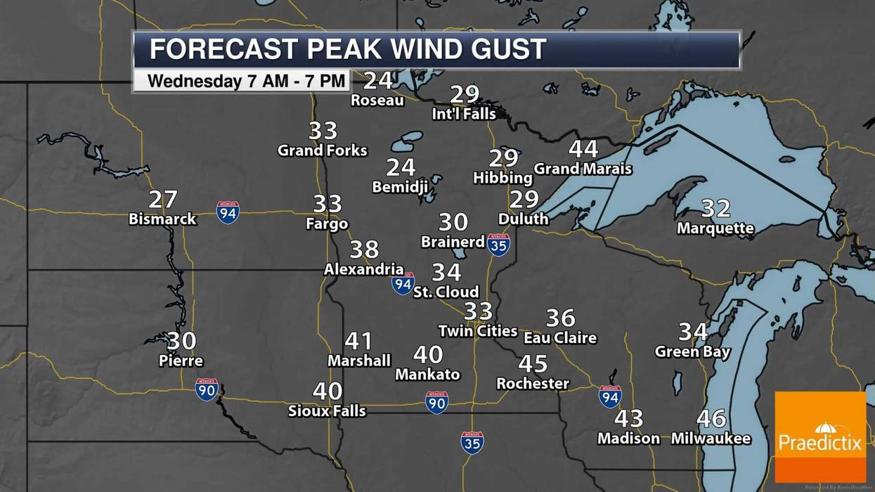
 Blustery Wednesday WindsPraedictix
Winds gust over 30 mph tomorrow in the MSP metro and over 40 mph closer to the Buffalo Ridge in southwestern Minnesota. As temperatures fall through the teens into single digits the snow will be dry and powdery, more prone to blowing and drifting (and occasional white-out conditions).
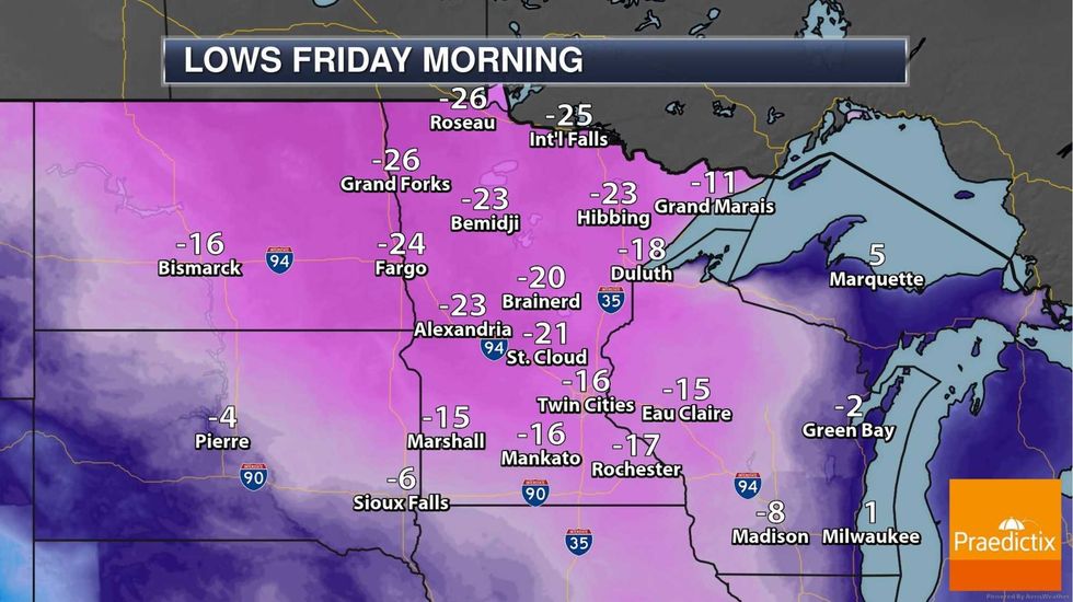 Fun with Negative Numbers. We may wake up to air temperatures close to -20F Friday morning. The sun should be out with temperatures rising above 0F by late Friday and recovery into the 20s on Saturday.Praedictix
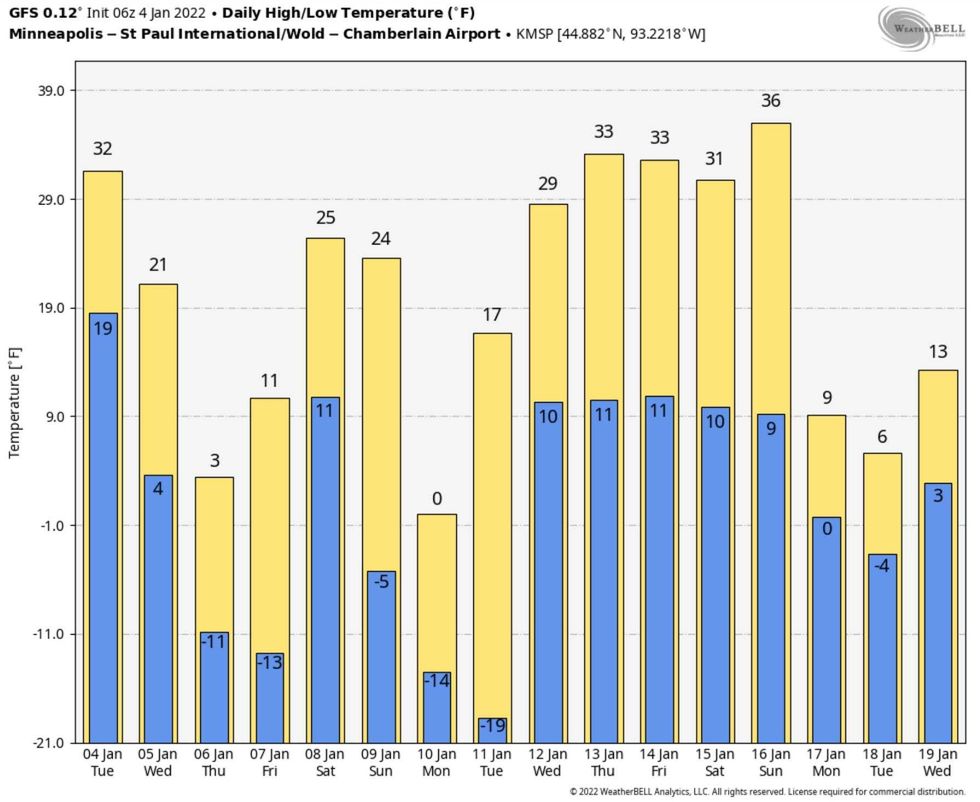 A Real January Thaw? NOAA's GFS model is hinting at an extended run above 32F by mid-January. Confidence levels are low, but it won't stay Nanook indefinitely. No signs of an extended Polar Vortex event, like February of last year.Weatherbell.com
Blowing snow tonight and tomorrow with just a couple inches of accumulation. Temperatures stay below zero on Thursday into midday Friday before a quick rebound on Saturday. But daylight is increasing (we've picked up an additional 8 minutes of daylight since December 21, the Winter Solstice). Progress!
Within 3 weeks average temperatures start to rise again, for the first time in 6 months. Spring is right around the corner. But it's a big corner.
Details on our snow/wind/polar temperature event with Jordana and me from 3-6pm today. I hope you can join us.


