False spring number one just came to a halt. Just when you thought it was smooth sailing, winter rears its ugly head again.
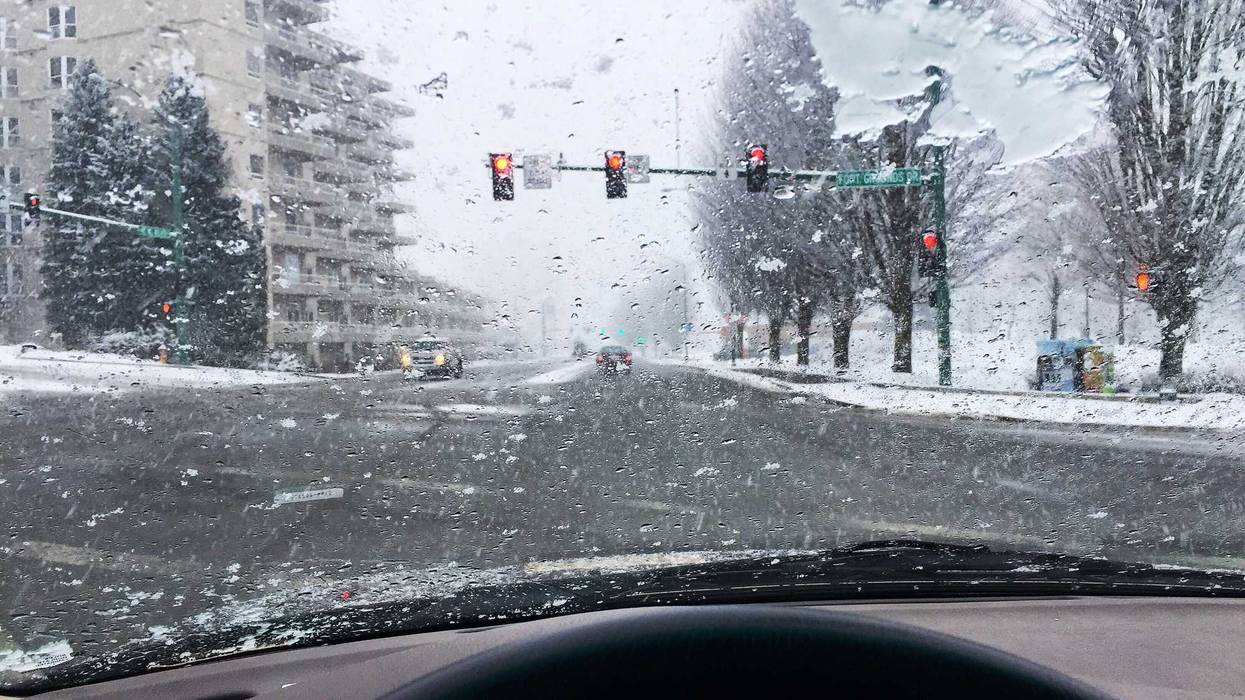
A winter storm warning goes into effect later Tuesday with the Twin Cities metro expected to be hit by more white stuff than originally predicted. For areas directly south and southeast of the metro, a blizzard warning will go into effect.
"That heavy snow will be coming with winds gusting up as high as 45 MPH," explains National Weather Service forecaster Mike Griesinger. "And then you get down along the I-90 corridor there near the Iowa border, and they could see wind gusts closer to 55 MPH down there."
We could get at least two inches of snow in the metro before the storm moves out tomorrow. The father south you go, the more snow is expected, but the actual track of this storm matters a lot when it comes to totals.
"If that snow band jogs a little bit farther east, then we're looking kind of, for at least the core of the Twin Cities metro here in Minneapolis-St. Paul, you're only looking maybe 2 to 3 inches," Greisinger says. "It doesn't take much of a jog west with that to see those snow totals push up more 6 to 8."
Want some good news? The timing of this one won't affect drives as much according to WCCO Meteorologist Chris Shaffer.
"The main slug of moisture doesn't come in until later Tuesday, and it stays warm enough that it's rain," Shaffer said on the WCCO Morning News. "So getting to school, coming back from school, getting to work, coming back from work, no problem. It'll just be rain and still be warm enough for it."
The bulk of the snow comes in the overnight hours.
"By the time you wake up tomorrow morning, it's moving out west to east," says Shaffer. "So the western suburbs probably done snowing already, Minneapolis, St. Paul getting close and then lingering a little longer in the eastern suburbs.
Shaffer says since forecast models they saw on Monday night, the track shifted just enough to the west to increase amounts in the core of the metro and expect it to be a wet, heavy mess.
With temperatures still on the rise, Sahffer says much of this new snowfall is expected to melt away by the end of the week.
WINTER STORM WARNING LATE TUESDAY EVENING INTO WEDNESDAY
* WHAT...Heavy snow expected. Total snow accumulations between 4 and 7 inches. Winds gusting as high as 50 mph.
* WHERE...In Minnesota, Sibley, Anoka, Carver, Chisago, Hennepin, Ramsey, Scott, and Nicollet Counties. In Wisconsin, Polk County.
* WHEN...From 7 PM this evening to 3 PM CST Wednesday.
* IMPACTS...Plan on slippery road conditions. The hazardous conditions could impact the Tuesday evening and Wednesday morning commutes. Gusty winds could bring down tree branches.
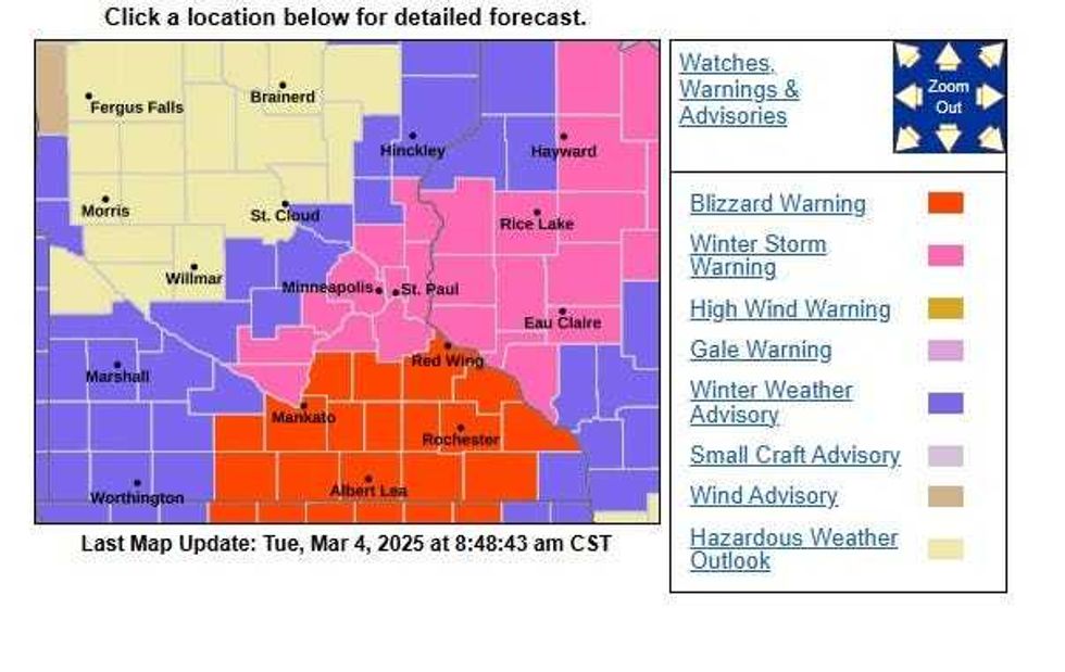 A winter storm warning goes into effect later Tuesday with the Twin Cities metro expected to deal with some wintery conditions. For areas south and east of the metro, it's a blizzard warning due to some very high winds.(National Weather Service / NOAA)
BLIZZARD WARNING IN EFFECT FROM 9 PM THIS EVENING TO 3 PM CST WEDNESDAY
* WHAT...Blizzard conditions expected. Total snow accumulations between 4 and 8 inches. Winds gusting 45 to 55 mph.
* WHERE...Blue Earth, Faribault, Freeborn, Le Sueur, Martin, Rice, Steele, Waseca, Watonwan, and Goodhue Counties.
* WHEN...From 9 PM this evening to 3 PM CST Wednesday.
* IMPACTS...Whiteout conditions are expected and will make travel treacherous and potentially life-threatening. Travel could be very difficult. The hazardous conditions could impact the Wednesday morning commute. Strong winds could cause damage to trees and power lines.
* MORE...There is also a Winter Weather Advisory for southwestern Minnesota in a line north east through St. Cloud, Hinkley and Duluth. The main concern for those areas is high wind and blowing snow.