
We start the weekend with wind - and we'll end it with snow. Perhaps the most snow we've seen in a single storm in quite a while.
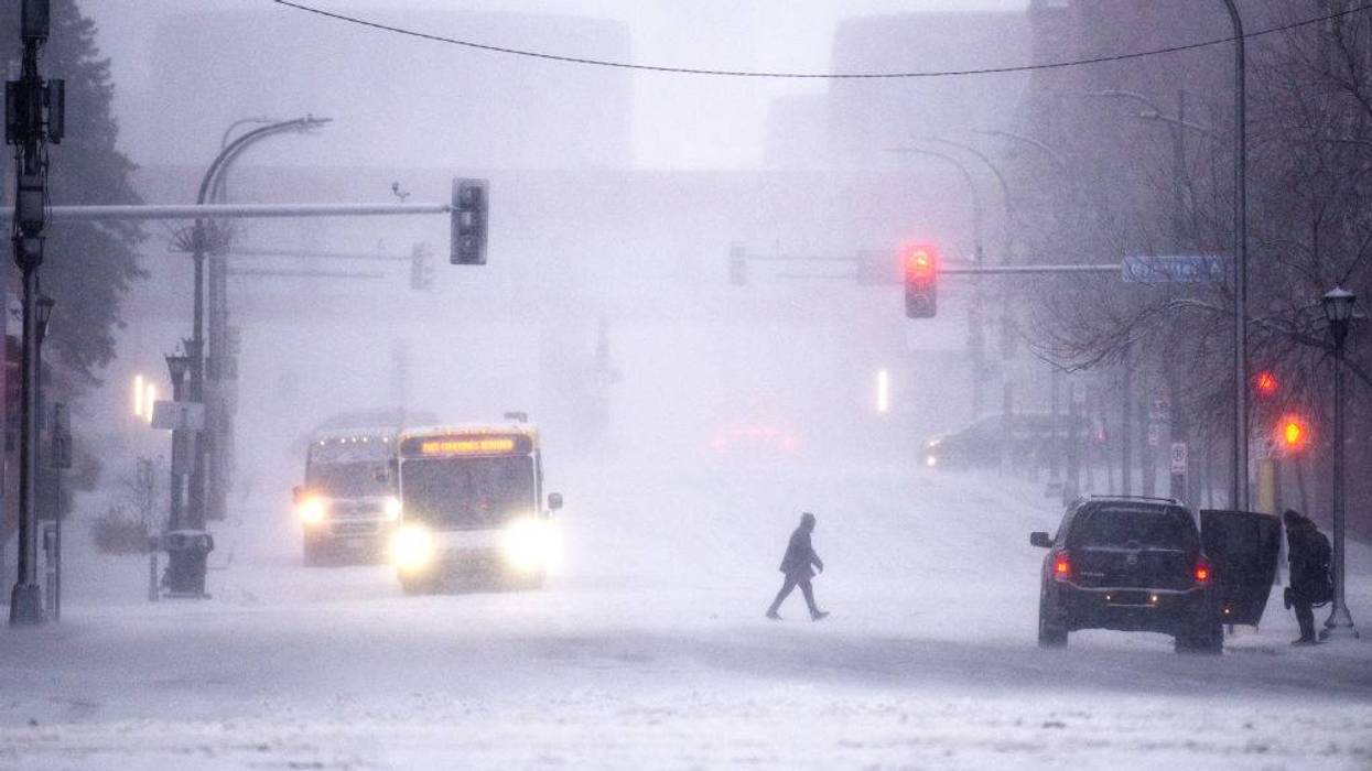
But first, we remain under a High Wind Warning which is expected to expire at 10:00 a.m. Friday morning, with gusts up to 60 miles an hour in some areas.
That is making it feel colder than it actually is. Wind chill temps in the single digits Friday morning across much of the state.
There will be a bit of a break before the next storm rolls in Saturday night and Sunday, and a Winter Storm Warning is in place for a substantial snowfall, according to WCCO-TV Chief Meteorologist Chris Shaffer.
"Most of the models are coming in at 8 to 16 inches of snow," Shaffer says. "Most of them are targeting the Twin Cities on the northern edge of the heavy band, and the southern edge of it pushing down to Owatonna, Rochester. So that's kind of the sweet spot for the heavy snow. I have seen some models go even higher, but I haven't seen any under 8 (inches)."
The National Weather Service, in a mid-morning update Friday, says snowfall amounts of 10-16 inches are likely, with possibly more where the heaviest band of snow sets up. A narrow swath of 15 to 20 inches are possible, and totals across portions of western and central Wisconsin could approach 2-feet.
The snow will taper off on Sunday but wind will still be an issue on the roads with blowing and drifting snow through the day. Blizzard conditions are likely Sunday into Monday as winds increase to 40-50 mph.
"I haven't seen storms like this in a while," Shaffer adds. "2018 is the last time we had over a foot of snow, a January storm. And these models are hinting at snow totals that rival the one that took the (Metrodome) down in 2010."
The storm will also have a major impact across western Wisconsin where snow totals could also rise over a foot with serious impacts on the roads, but if there is good news, most of the heaviest snow will fall overnight.
"t doesn't arrive until later, tomorrow," Shaffer explains. "So if you have plans during the day, get at it. If you want to run some errands, whatever, you've got plenty of time. I don't think the flakes start to fly until late afternoon till around suppertime, and really doesn't start to stack up until probably after 8:00, 9:00 on Saturday. So plenty of the day is salvageable for whatever you have going on. But once it starts, it's going to continue into the overnight hours. It's going to continue during the day on Sunday as well."
The National Weather Service is saying this is a significant event, and advising no travel late Saturday through Sunday morning.
"Model guidance continues to illustrate a remarkable precipitation footprint across the region which will yield heavy snow accumulations on the order of 1 to 2 feet," according to a statement from the NWS. "Totals across portions of western and central Wisconsin could exceed 2 feet. The combination of heavy snow and gusty winds will reduce visibility and create periods of blizzard conditions on Sunday across western and southern Minnesota. Travel is expected to become very difficult or impossible late Saturday night and Sunday. In addition, the amount of water in the snowpack will make it wet and very heavy, leading to the potential for infrastructure damage and a health hazard for those shoveling."
On Monday, Shaffer says expect highs only in the teens as cold air settles in. That lasts through Tuesday, before we begin to see a spring-like warmup again.
WINTER STORM WARNING IN EFFECT FROM 7 PM SATURDAY TO 7 AM MONDAY
* WHAT...Heavy snow expected. Total snow accumulations between 10 and 18 inches. Winds gusting as high as 40 mph.
* WHERE...Sherburne, Stearns, Wright, Anoka, Carver, Hennepin, Ramsey, and Washington Counties.
* WHEN...From 7 PM Saturday to 7 AM Monday.
* IMPACTS...Travel could be very difficult to impossible. Widespread blowing snow could significantly reduce visibility. The hazardous conditions will impact the Monday morning commute.
FORECAST
FRIDAY: High Wind Warning until 10a for gusts to 50 mph. Decreasing clouds and still windy. High: 35. NW 15-25 mph. FRIDAY NIGHT: Partly cloudy. Low: 24. N wind 3-6 mph.
SATURDAY: Snow by late afternoon. High: 37. SE wind 5-10 mph.
WINTER STORM WATCH: 7p Sat - 7a Mon. Snow Saturday night into Sunday. Windy Sunday.
Average high and low….40/24
At least 8 inches expected in the Twin Cities with travel conditions becoming near "impossible" in parts of Minnesota and Wisconsin
At least 8 inches expected in the Twin Cities with travel conditions becoming near "impossible" in parts of Minnesota and Wisconsin