


DETROIT (WWJ) - Get those shovels ready. A winter storm making its way toward Michigan could dump up to half-a-foot of snow on the metro Detroit area.
What WWJ AccuWeather Meteorologist Dean DeVore is calling a "sizable storm" is set to strike mid-week.
"After a little spring warm-up this past week and early this week, winter's coming back,"DeVore said, speaking live on WWJ on Tuesday. "You're kinda feeling it today: the wind is picking up, it's colder feeling."
Metro Detroit will see some sprinkles and flurries Tuesday, while areas south of Detroit could get some light snow Tuesday night.
"Then comes the storm that is worrisome," DeVore said. "Snow pushes back in tomorrow (Wednesday) night, and this is when it gets really dicey: tomorrow night into Thursday, with snow that could mix with a little sleet.
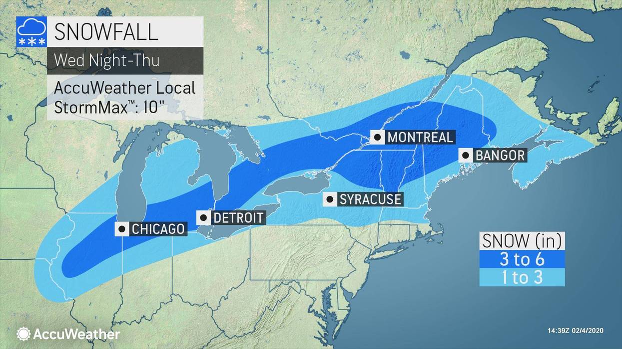
"Right now we're looking at a general accumulation of three to six inches by the time this wraps up by end of Thursday. It could be a little more or a little bit less, depending on how much sleet mixes in....so I'll keep an eye on that."
Areas to the north and west of Detroit should expect to see the most accumulation.
For now, the primary concern is the Thursday morning commute. It is expected to be a slick one, so plan to give yourself some extra time.
Then on Friday, AccuWeather is calling for some more snow showers, before a still cold but drier weekend.
While temperatures will reach around or above 30 degrees for the remainder of the work week, DeVore says metro Detroiters should dress for bone-chilling real-feel temps in the 20s.
Know before you go! Stay tuned to WWJ Newsradio 950 on the AM dial, or 97.1 HD2 on FM, for the latest forecast during traffic and weather, every 10 minutes on the 8s. You can also hear WWJ live on the Radio.com app. >>LISTEN LIVE NOW!


