
DETROIT (WWJ) - Winter appears to be clinging on to Metro Detroit as hail, windy gusts up to 30 mph and frigid temperatures move into the area Saturday afternoon.
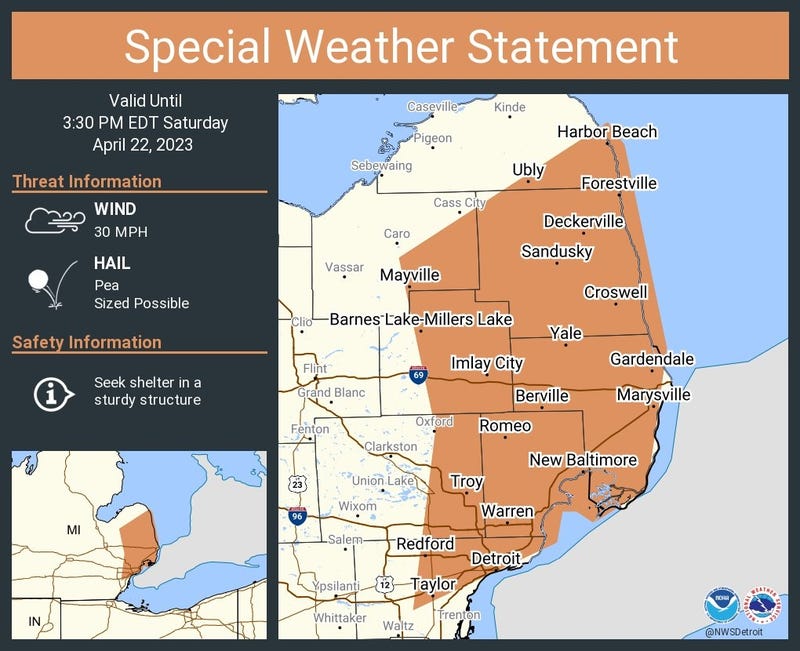
The National Weather Service has issued a Special Weather Statement for portions of southeastern Tuscola, Sanilac, Lapeer, northeastern Wayne, eastern Oakland, Macomb, St. Clair and southeastern Huron Counties until 3:30 p.m. as fluctuating weather creates potentially hazardous conditions.
Meteorologists said a line of showers are causing most of the issues, extending from Mayville and Oxford to near Dearborn and moving northeast at 25 mph.
Winds in excess of 30 mph and pea size hail are expected with the rain storms, with several crashes already reported to the WWJ 24 hour traffic center.
Meteorologists said any hail storms should be brief, but that's not all Metro Detroiters are in for.
Following a temperature surge on Thursday that saw Metro Detroit climb into the 70s and near 80s, a new burst of chilly air will cause both daytime highs and overnight lows to nose-dive once again.
"It is possible that some locations could even rival low marks set earlier this month during the final week of April," AccuWeather said.
Temperatures are forecaster to dip into the low to mid-30s in Michigan this weekend into next week, putting the entire state at risk for a late-season freeze.
According to AccuWeather, a relatively mild winter and a spring "heat-wave" in Metro Detroit and beyond has caused bud-break and leaf-out much earlier than expected, but the chilly weather in store over multiple nights will threaten sensitive plants and flowers.
"Home and business owners who may have already purchased annual flowers and vegetable plants may need to cover their investment or bring them indoors," forecasters warn.
>>>>>>>>>>>>>>>>>>>For the latest updates, listen to WWJ LIVE traffic and weather together on the :08s <<<<<<<<<<<<<<<<<<<<