


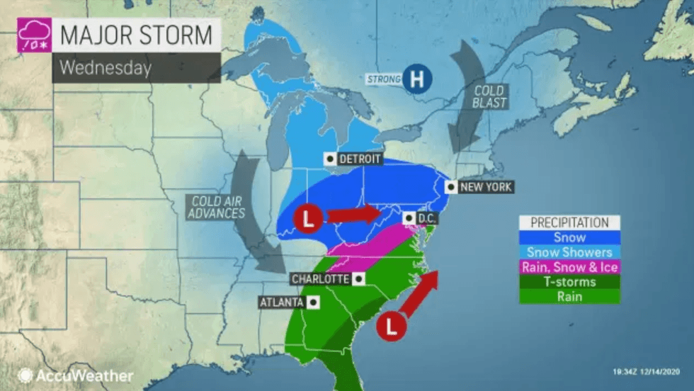
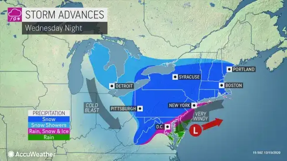
NEW YORK (1010 WINS) -- While Michigan deals with a day full of flurries, a winter storm warning has been issued by the National Weather Service for New York City, northwest Long Island and northeast New Jersey from Wednesday at 2 p.m. until Thursday at 1 p.m. ahead of a storm that could bring a foot of snow to the city.
 AccuWeather
 AccuWeather
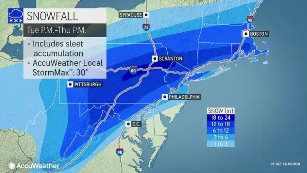
Heavy snow is expected, with total snow accumulations of 1 foot looking likely in the city, according to AccuWeather meteorologist Dean DeVore. Expect more than a foot for the many New Jersey and Hudson Valley suburbs. Totals in far west New Jersey could be near 2 feet. Less amounts where the wintry mix lingers at the coast.
If the storm tracks further east, higher totals of over a foot seen to the west of the city could hit the five boroughs.
 AccuWeather
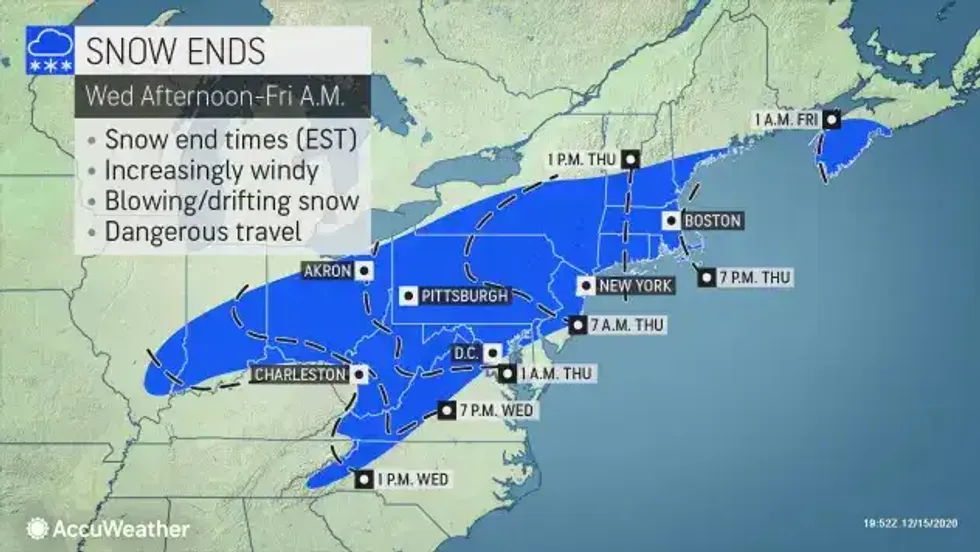
Snowfall amounts could be a bit lower than forecast along south coastal portions of the region if sleet mixes in Wednesday night, according to AccuWeather.
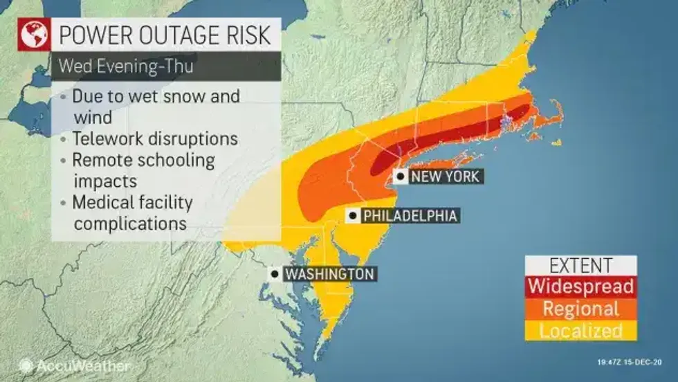
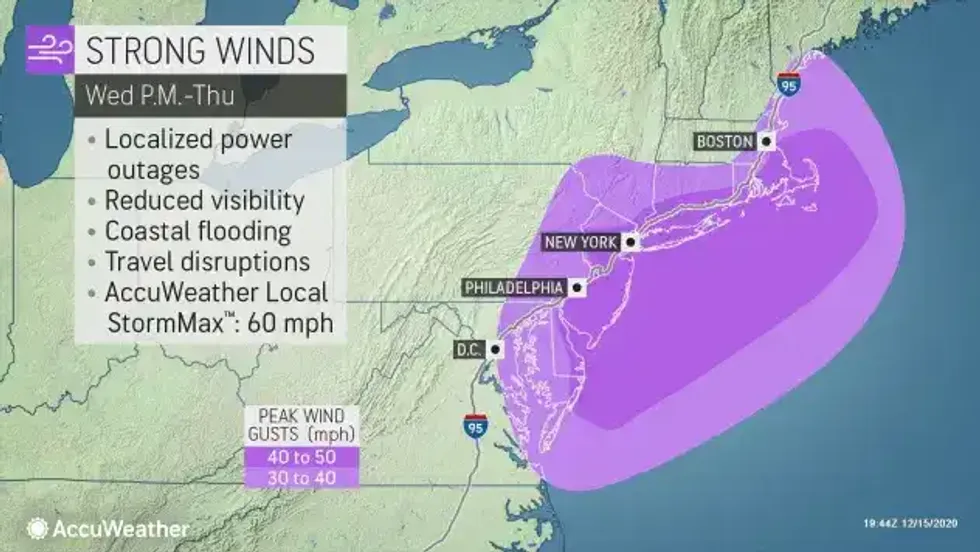
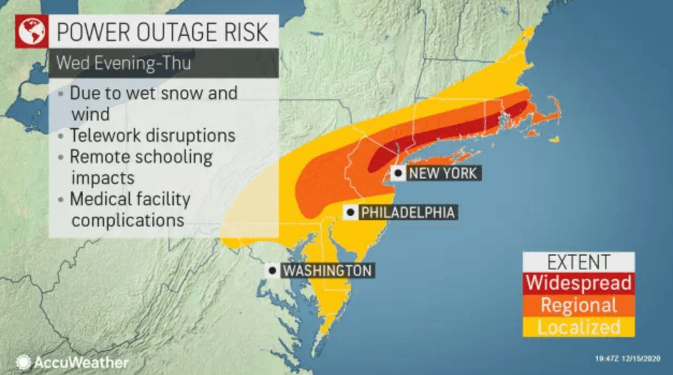
Winds may also gust as high as 40 mph to 60 mph during the course of the storm.
Wind and heavy snow for the city and inland spots will create "near blizzard conditions" Wednesday night into Thursday; any wintry mix near the coast goes back to all snow Thursday morning.
The low Wednesday night is 25. Thursday's high is 30. RealFeels during the storm may be in the single digits and teens.
 AccuWeather
 AccuWeather
Looking ahead at Friday, expect it to be brisk and cold. High 32.
This weekend will probably be dry. It'll still be cold Saturday with highs in the
mid 30s; not as cold Sunday with highs in the low 40s.
 AccuWeather
 AccuWeather
 AccuWeather


