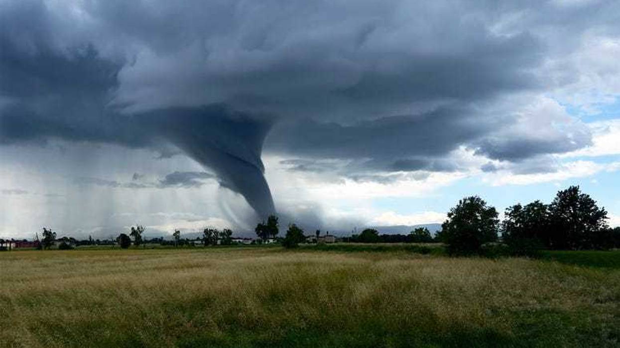
If it seems like there are more tornadoes than ever sweeping through wide swaths of the United States, you're not wrong.
There have been 25 tornadoes already this year in Michigan alone, according to meteorologist Steve Considine with the National Weather Service. This year is the third most active tornado season to date, MSN reported, only trailing the record-breaking 2011 season and "last year’s hyperactive season."
A series of storms caused widespread damage and more than 25 deaths across several states the last few days. Several tornadoes damaged thousands of buildings in Kentucky and Missouri. Last week, more than 20 million people from Minnesota to Michigan and Indiana – including Minneapolis, Milwaukee and Chicago – were under a level 3-of-5 risk of severe thunderstorms.
And there's more to come: NBC News reported that today, at least 31 million people are at risk for severe storms from central Texas to Iowa, with "hazards including large hail, damaging winds and several possibly strong tornadoes." The NY Times reported a "continued risk of severe weather on Tuesday, as the storm moves east to a large area stretching from Missouri and Illinois through Kentucky, Tennessee and into parts of the Ohio Valley.
“There’s the potential for a couple of strong tornadoes, centered on parts of southern Kentucky, western and middle Tennessee and into portions of northern Mississippi and Alabama,” the Times reported.
"It's a little surprising certainly, but we looking back at the records, the last time we kind of had an act as active of an early season like this was in 2001 we had 23 tornadoes by May 21st. And then you got to go back to 1976 where there was 23 by May 2nd. So, yeah, this is a bit unusual," Considine said.
He added: "It's been active... Active in terms of tornadoes across not just the state of Michigan, but certainly across the Mississippi and Ohio valleys. I think if you look back at our tornado statistics. You know, while the state, I think averages around 16 or so per year. We have a lot of variability from year to year. Some years we may only get a handful. And then in some years, we may get upwards of two dozen in the state. But having that many by this early in the season certainly is... Certainly is a lot."
So, what's driving the surge?
"(It) depends on getting the storm systems that are capable of bringing the instability up into this far north into Michigan," he said. "And to get a tornado development, you need the combination of instability. And strong level. Uh... Strong when the law and during the springtime it's very easy to have strong winds aloft. Uh... Much more so than it is in the summer our issue in Michigan in the springtime is to be able to get the instability this far north that's why You know, in springtime, we typically see tornadoes farther south, Ohio Valley, deep south, and the Plains states. So this particular season, we've just had a, we've been in a pattern that has produced fairly strong upper level low pressure systems that have been able to deliver instability up into the state of Michigan. And there's there's many times where we just don't quite have that."
And here's the big question: What's next? It's too early to tell, Considine says.
"It's very possible that in the summertime maybe we start quieting down with the severe weather. It certainly looks like the rest of the month of May is going to be on the cool side and like I said, it just does not look like we're going to get the instability this far north, but if we can maintain some strong systems in June, I mean, that's certainly possible that we can get some more, but it's just a little too soon to tell."