


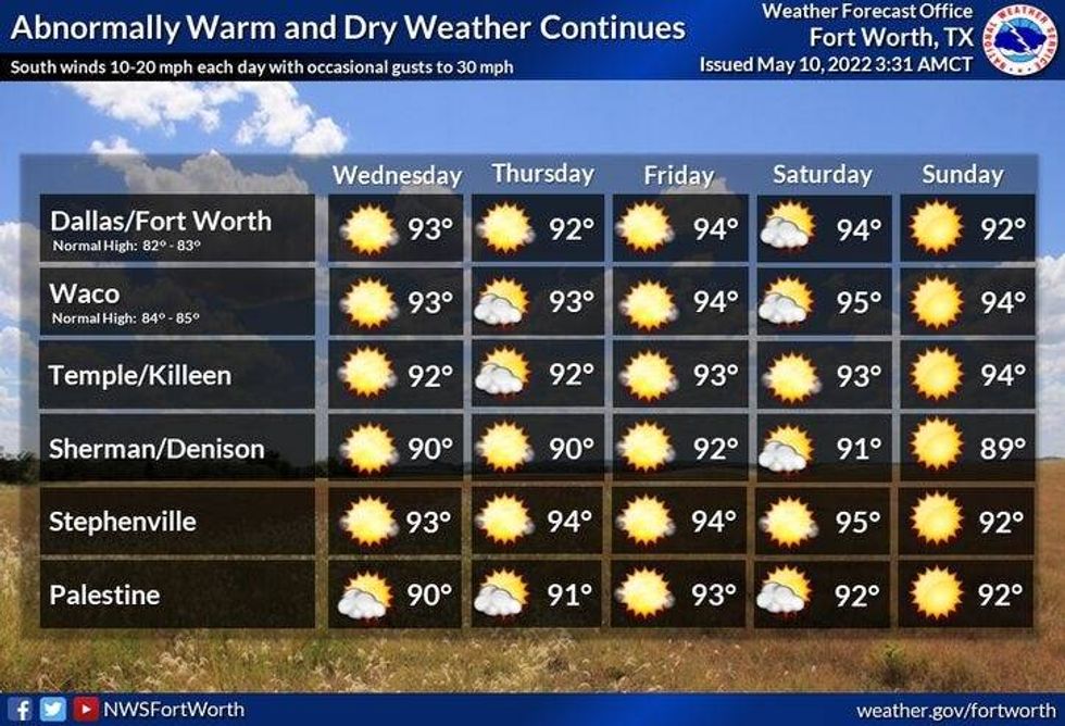
A strong upper level ridge of high pressure will continue to dominate our weather across north Texas for at least the next 7 to 10 days. This ridge may intensify even more next week. This being said, afternoon highs will reach the low 90s through the rest of the week and into the upcoming weekend. Morning lows will be in the mid to upper 70s. Low clouds will also invade each morning, but burn off by late morning into the early afternoon. We will also be dealing with a ton of humidity and a south wind gusting to 25 mph. Heat index values will hover near 100 degrees.
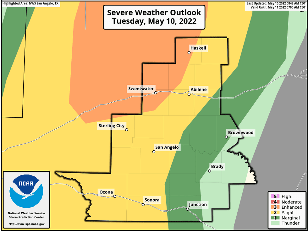
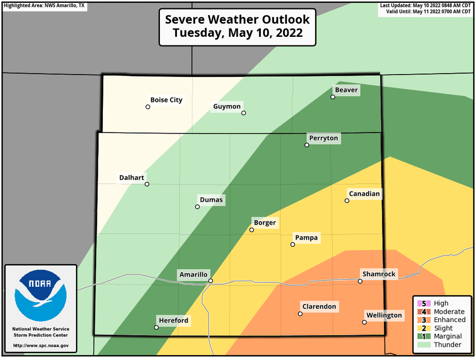
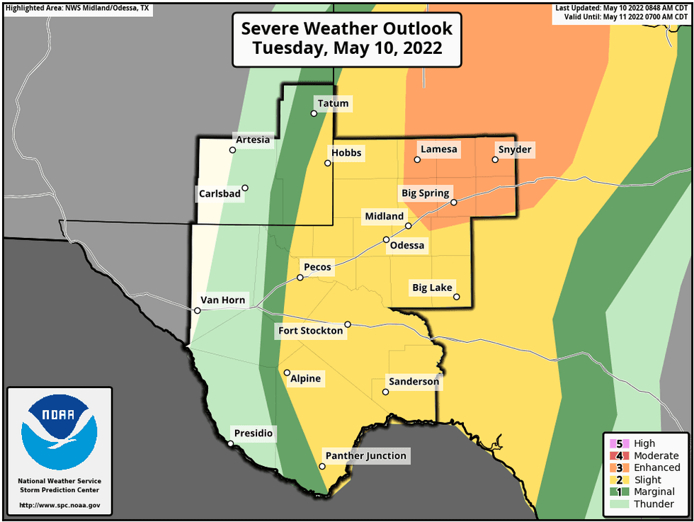
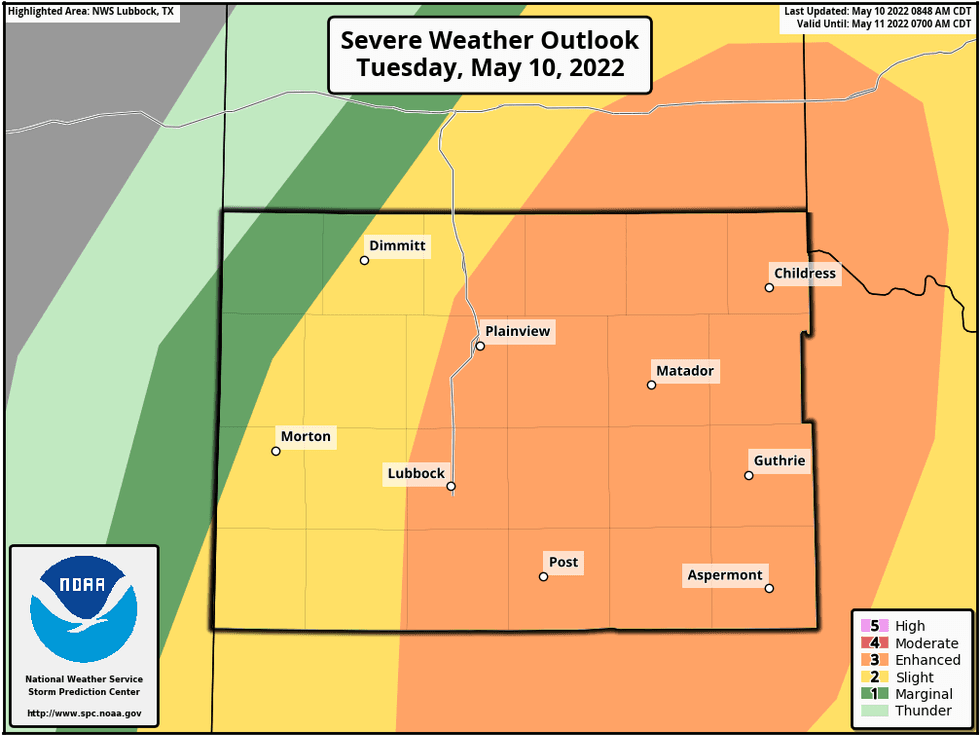
In other news, there'll be some severe storms a good 200 to 350 miles west of DFW for the next couple of late afternoons and evenings. Unfortunately, this rain will stay well to the west of DFW. Please be careful if you have travel plans into west Texas or the Big Country. Some of these storms will become severe with large hail and damaging wind being the primary threat. These storms will weaken by midnight.
The 8 to 14 day outlook just put out by NOAA, keeps temperatures above average next week with below average precipitation. Next week may be even hotter than this week!
 DFW WeatherNational Weather Service - Fort Worth
Please remember to stay hydrated, take frequent breaks, wear light-colored loose-fitted clothing, apply sunscreen and wear a hat. Also, make sure your pets have a nice cool place to stay or at least a shady area in your backyard if you have to leave for a few hours. Also make sure you put plenty of water out for them.
*Yest Rain: 0.00"; *Yest High: 93; Low: 76
*Today's Averages: High: 82; Low: 63
*Record high: 95 (1901); Record low: 47 (1909)
* May rain: 1.63"; May surplus: 0.29"
*2022 rain: 8.40"; 2022 deficit: 4.75"
*Sunrise: 6:33am; Sunset: 8:17pm
Today: Morning clouds, afternoon sunshine. Slight late day storm chance 70 miles west of 35W. High: Low 90s. (Record 95 degrees). Heat index near 100. Wind: South 15-25 mph.
Tonight: Partly cloudy, breezy, mild and muggy. Low: Low to mid 70s. Wind: South 15-25 mph.
Tomorrow: Morning clouds, afternoon sun. Hazy, hot, breezy and humid. Slight storm chance well west of DFW. High: Low 90s (Record is 96 degrees). Heat index near 100. Wind: SSE 15-25 mph.
Thursday: Morning clouds, afternoon sun. Breezy, hot, hazy and humid. High: Low 90s (Record is 98 degrees). Heat index values near 100.
Friday and Saturday: Morning clouds, afternoon sun. Breezy, hot, hazy, and humid. Slight chance of late day storms. Highs: Near 90.
Sunday and Monday: Morning clouds, afternoon sunshine. Hot, hazy and humid. High: Low 90s.
 National Weather Service
 National Weather Service
 National Weather Service
 National Weather Service

LISTEN on the Audacy App
Sign Up and Follow NewsRadio 1080 KRLD


