
Buffalo, N.Y. (WBEN) - Finally!
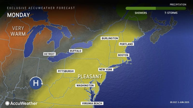
We can ditch the hoodies and jackets as a run a dreary, dank and cold weather comes to an end and a shift to fair, dry and warm weather moves into Western New York.
"We're going to see a warming trend this week, as we break out of the cool pattern that we've seen of late," National Weather Service meteorologist Tony Ansuini tells WBEN. "Temperatures warming into the 70's, with even 80 degree weather scheduled for Tuesday and Wednesday."
The summer warmth extends into midweek, with Wednesday being the warmest day of the week. "Inland areas away from the lakes getting as warm as 85 to 90 degrees."
Conditions become more seasonable with a return to more unstable weather later in the week, however. "We'll still see temperatures in the 70's, where we should be for this time of the year," Ansuini assures us.
The Buffalo-Niagara region will be rain-free through midweek, with some showers returning to the forecast Wednesday night and Thursday.
The trend seems to be real, Ansuini notes, with the return to warmer air seemingly lasting a bit. "It looks like we will stay in a general warming trend through at least the middle part of June."
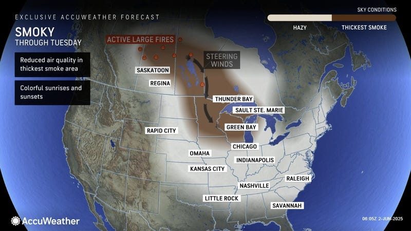
Canadian wildfire smoke may play a role in our visual weather pattern as the warmup takes hold, Ansuini says.
"We will see an increase in the Canadian wildfire smoke, looks like Tuesday and Wednesday," Ansuini says. It will remain 'aloft' in the atmosphere. "Our sunny skies that we'll see might look a little hazy or milky at times, but that looks like the extent of the impacts for Western New York."