
Buffalo, N.Y. (WBEN) - Finally, the lake effect machine has been switched to 'off' in Buffalo and most of Western New York. And most would say it overstayed its welcome.
While some light snow is in the Friday forecast, it will be a 'walk in the park' compared to what the region has withstood over the past week.
"Today the wind is going to be out of the northeast ... so that takes Lake Erie out of play and lake effect snow out of play for today," National Weather Service meteorologist John Hitchcock assures us.
Forecasters have been busy collecting snow total data from across the area from two separate lake effect events that were separated by a period of about 24 hours with little snowfall, Hitchcock notes. "Looks like the highest so far, just over 37 inches in West Seneca. We had quite a few reports of 20 to 24 inches from South Buffalo, through Lackawanna, Elma, Orchard Park, Hamburg." In general across that southtowns area about 2 to 3 feet of snow fell in the second lake effect snow this week alone.
Only a light general snowfall is expected Friday across the metro Buffalo area with an inch or two accumulating. Higher amounts will fall well south of Buffalo in Chautauqua County where a Winter Weather Advisory is posted.
What about game day Sunday?
Conditions should be dry through Sunday afternoon and into Sunday night, Hitchcock says. "Relatively light winds and typical winter temperatures in the 20's for Sunday afternoon and Sunday evening."
CHECK: WBEN Closings!
Related

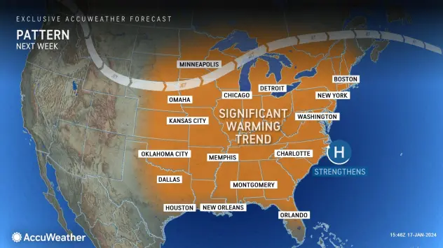
Warming next week?
"We have some warming weather returning next week," Hitchcock previews. Some snow will change to rain beginning Tuesday as the warmer air arrives. "We very well could be in the 40's by Wednesday and Thursday of next week."

WINTER WEATHER ADVISORY IN EFFECT UNTIL 1 AM EST SUNDAY
* WHAT...Snow expected. Total snow accumulations of 4 to 8 inches from today through Saturday night. Most of the snow will fall in two batches, with 2 to 4 inches this morning through this evening, and another 2 to 4 inches Saturday afternoon and evening.
* WHERE...Chautauqua county. The greatest accumulations will be localized to the Chautauqua Ridge.
* WHEN...Until 1 AM EST Sunday.
* IMPACTS...Travel will be difficult at times with snow covered roads and reduced visibility. The hazardous conditions will impact the morning and evening commute today.
PRECAUTIONARY/PREPAREDNESS ACTIONS...
Periods of snow will result in snow covered roads and limited visibilities. Slow down and use caution while driving.