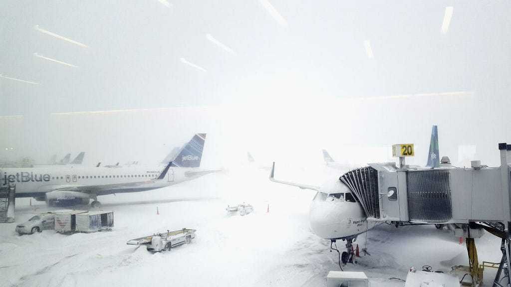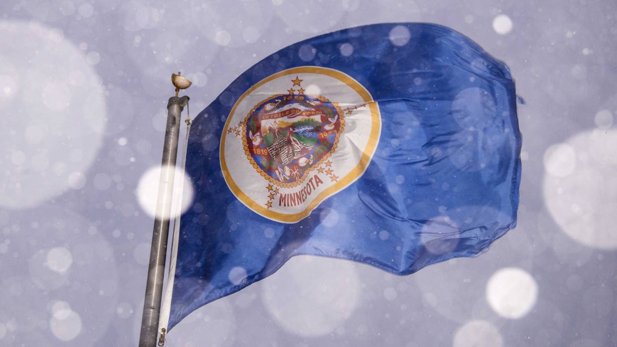
The day has come. The snow has started to move into Western Minnesota. The term “Ground Blizzard” will now join Polar Vortex and Derecho in Minnesota weather lore. And it comes at a time when many of us are trying to move about the state for the holidays.
Minnesotans know how to drive in this stuff, right? Hello?
WCCO Chief Meteorologist Paul Douglas says the cold that accompanies this snow is the real conundrum.
“Here’s the problem, it’s five below right now, and usually, when it’s this cold the main storm track is shoved way south,” explains Douglas. “Then they get snow in Kansas or Kentucky when it’s this cold. But, this time around, this storm powerful enough to pull up moisture despite the fact that it’s five below.”
That means very light, fluffy, powdery snow that is prone to blowing and drifting. Another tricky factor is that when the temperature is below 15 degrees (in this case well below that), ice and snow don’t melt using salt.
There will be slippery roads Wednesday but nothing too unusual. It will be Wednesday and tonight when the bulk of the snow will fall.
“I’m still thinking 5-8 inches, a few spots could get 10, very light, fluffy snow,” Douglas says. “The wind not a big problem today. Tomorrow the winds pick up later in the day, Thursday night and Friday. It still looks like the peak winds come Friday, but not quite as windy as we thought yesterday. Instead of gusts to 50, now maybe gusts to 40 but it’s still going to be windy and that snow will still be whipping around.”
Plowable snowstorm with travel getting tougher as the day goes on Wednesday; 5-10" MSP totals by midday Thursday. Greater risk from 30-45 mph winds Friday, creating ground-blizzards and dangerous windchills as cold as -40F. @NWSTwinCities says weather will be "life threatening" pic.twitter.com/CjeSYtewgS
— Paul Douglas (@pdouglasweather) December 21, 2022
And here is the fun part. Despite almost no new snow falling on Friday (or even Thursday), there is still likely to be a blizzard, and a rare blizzard for the Twin Cities metro area. That’s because sustained winds over 35 mph for three hours, and visibilities less than a quarter of a mile. Douglas says we should easily reach those thresholds.
“Much of the state will have that, especially on Friday, especially to the south and west of the metro, the open areas that are under blizzard warnings right now, and I wouldn’t be shocked if that blizzard warning extended into the Twin Cities.”
Travel should improve on Christmas Eve as the winds back off a bit. If you wait until later on Saturday, you shouldn’t have much of a problem.
Then there is the cold. It is a very cold storm. The wind chills will be very dangerous Douglas says.
“The wind chills will be 30, 35, maybe even 40 below by Friday,” Douglas says. “So if you do get stuck, run out of gas, go into a ditch, what would normally be an inconvenience could be life-threatening. That’s why you hear the term life-threatening. It’s not because of the snow or even the wind. It’s the combination, the low visibilities, the ground blizzards, and people getting stuck. This could again be an issue, especially by Friday.”
The storm affecting us in Minnesota and Western Wisconsin is not an isolated incident. This is a massive storm that has travel ramifications all across the country with snow, wind and cold from the plains, Midwest and East Coast. This is likely to be the coldest Christmas in decades.

Here’s some good news from Paul.
“Today is the Winter Solstice. Eight hours, 46 minutes of daylight, shortest daylight of the year. Tomorrow we pick up an additional one second of daylight. Very excited about that. By the end of this month we pick up four minutes of daylight.”
One more silver lining too. Next week we are looking at 30s. Above zero. It’ll be a warm-ish New Year after this one gets past us. Hang in there.
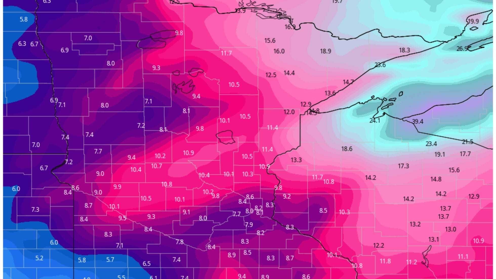
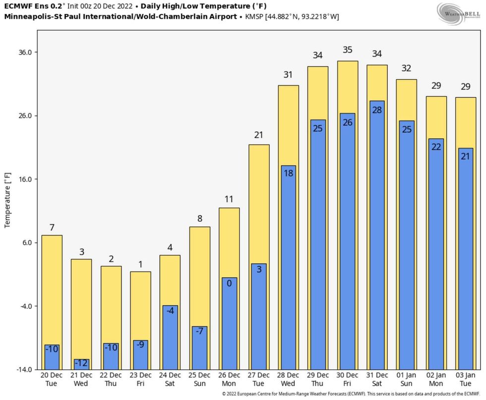 Thaw Next Week! You will be amazed how good "freezing" will feel by the middle of next week.Credit: weatherbell.com