


NEW YORK (1010 WINS) -- Heat warnings and watches are in effect across the Tri-state area with an excessive heat warning in parts of New York City.
Torrential downpours and damaging wind gusts are also a possibility for the area Tuesday evening.
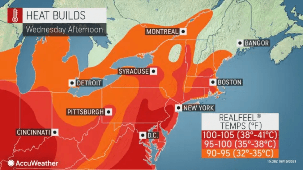
The high on Tuesday is expected to be 85, but high humidity levels will make it feel like the 90s as temperatures continue to rise over the next three days.
 AccuWeather
An excessive heat watch also remains in effect in counties to the north and west of the city.
Due to the rising temperatures, New York City cooling centers are currently open.
Temperatures will remain in the 90s for the rest of the week with heat and humidity over the Northeast set to bring heavy to severe thunderstorms Tuesday evening and continue through the end of the week.
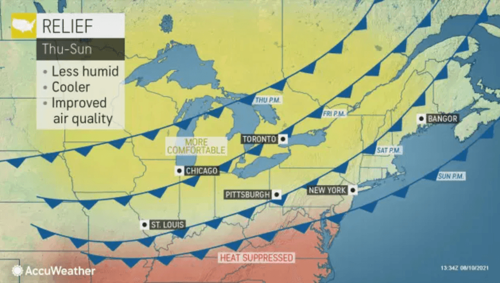
By midweek, temperatures will drop for the first time in nearly a full week with a cold front ushering in cooler and more comfortable conditions to the Northeast.
 AccuWeather


