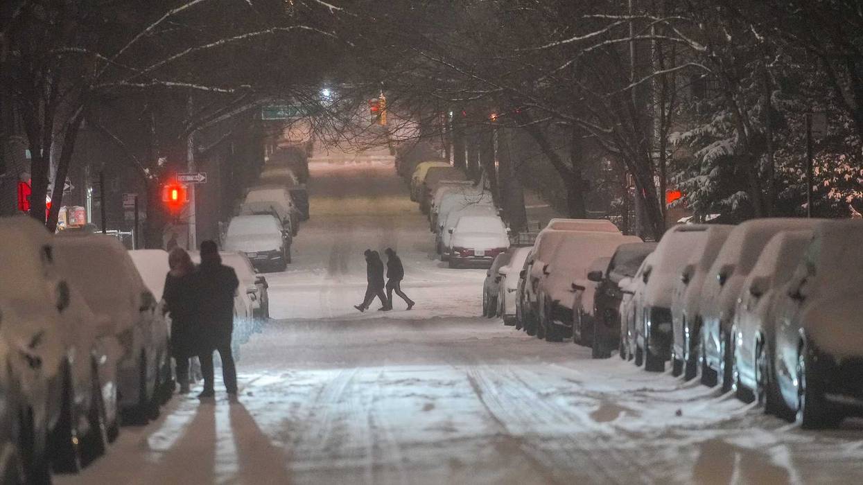
NEW YORK (1010 WINS) – New York City was preparing for back-to-back snowstorms on Tuesday and Wednesday nights ahead of a third winter storm that's set to take aim at the city over the weekend.
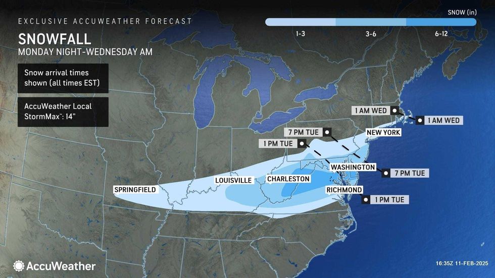
An accumulation of 2 to 4 inches of snow is expected to fall across much of the Tri-State area, including New York City, late Tuesday. Between a coating and 2 inches of snow is in the forecast for areas further north.
Tuesday's high of 36 degrees will dip to a low of about 30 overnight as the system rolls through.
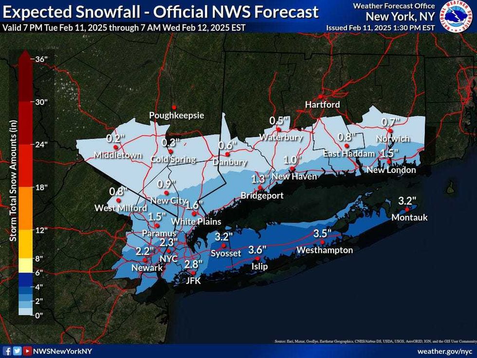 Forecasters are predicting 2-4 inches of snow for the NYC area on Tuesday night.National Weather Service
 AccuWeather
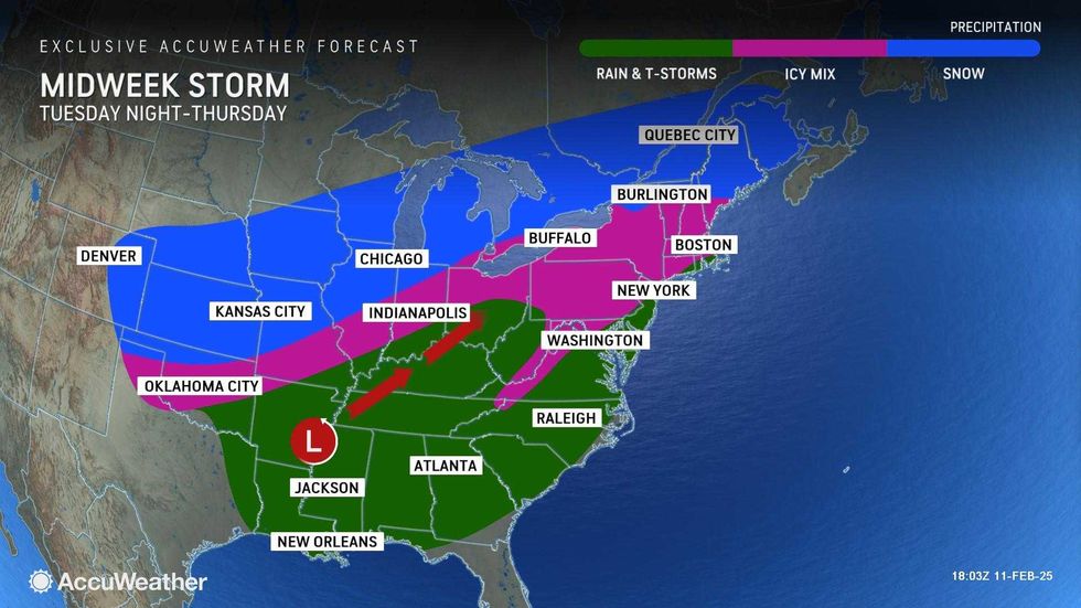
Drivers should prepare for flurries Wednesday morning, as well as slow and slippery travel. Alternate Side Parking has been suspended in NYC. The high will be 35.
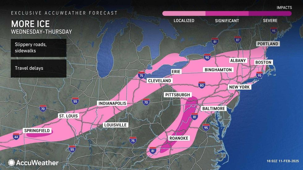
A second round of snow and ice is then forecasted for Wednesday night. This second system is set to be slushier and wetter than Tuesday's storm.
A slushy coating to 1-2 inches of snow may accumulate, mainly in NYC and north of the city. Wednesday night's low will be 32.
 AccuWeather
 AccuWeather
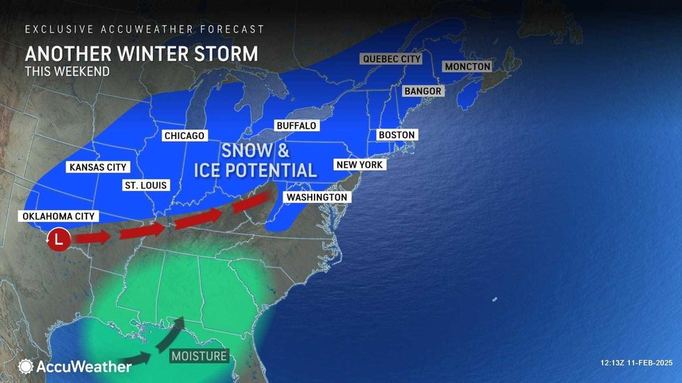
Temps will steadily rise to about 44 on Thursday, and the wintry mix overnight is expected to end entirely as rain by Thursday morning before the system moves out.
The cold will return Friday, with a high of 35, but it will otherwise be sunny and dry ahead of the third storm system of the week, which is expected to start Saturday afternoon and include snow, sleet and possibly rain.
 AccuWeather