


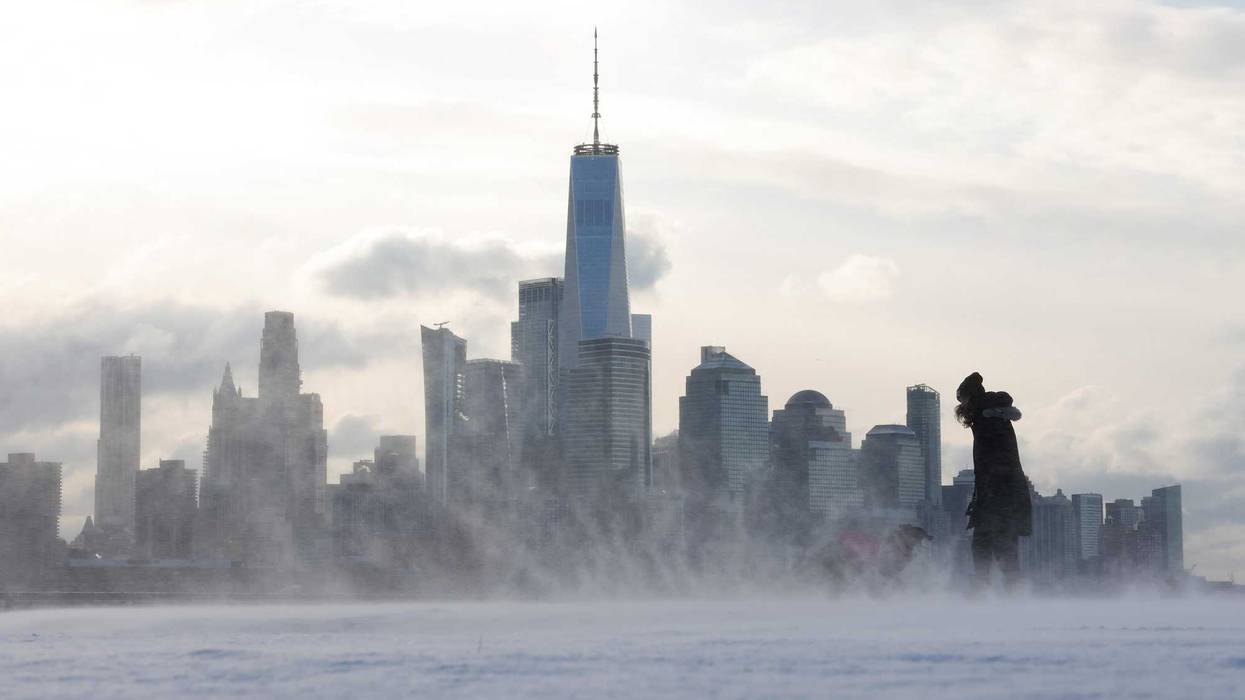
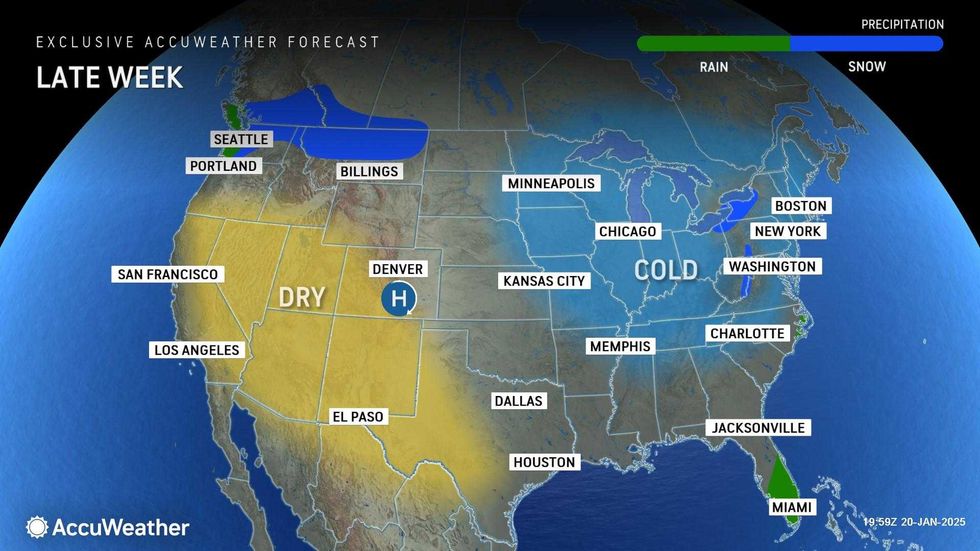
NEW YORK (1010 WINS) – The polar vortex has summoned Arctic cold to the New York City area—and below-freezing wind chills are in the forecast for the entire work week.
A Code Blue was issued overnight, and is set to be renewed every night all week, as the dangerous cold grips the region. During a Code Blue, the normal intake process for shelters is suspended to get people off the streets.
Meanwhile, the Department of Sanitation is working Tuesday to clear snow, ice and trash after Sunday's snowstorm and delays from the MLK Day holiday on Monday. Alternate Side Parking is suspended Tuesday.
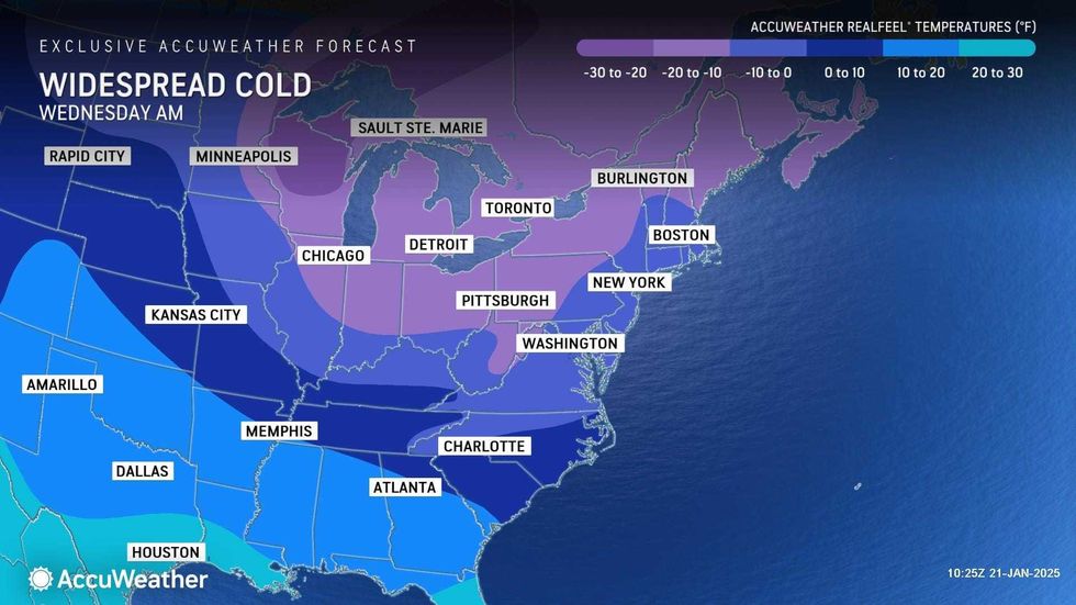
The National Weather Service warned hypothermia and frostbite are possible, with wind chills between -10 and 0 degrees on Tuesday night and between 0 and 10 degrees on Wednesday and Thursday nights.
Indeed, AccuWeather RealFeels were below 0 on Tuesday morning across much of the city.
"New Yorkers, as you head out the door today be sure to bundle up!" Mayor Eric Adams posted on X Tuesday morning. "We're expecting extremely cold temperatures throughout the day and remaining through the end of the week."
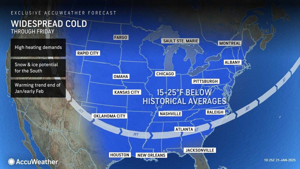
The frigid temps moved in following Sunday's snowstorm and are forecasted to stick around, with daytime highs at or below freezing through Friday.
 AccuWeather
 AccuWeather
Tuesday's high will be 21 degrees in Manhattan; Wednesday's will be 22; Thursday's will be 30; and Friday's will be 32. Winds chills will make it feel much colder.
The overnights will be especially dangerous. Lows will plunge into the teens on Tuesday and Wednesday nights, and into the 20s on every night into next week, even as daytime highs begin to rise above freezing starting this weekend.
 AccuWeather
 AccuWeather
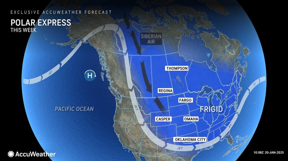
The cold is being caused by the polar vortex, which is a low-pressure area of swirling cold air at the North Pole that expands in winter. When the vortex is disturbed by other systems, parts of it can break away and drift south, causing cold spells like this one.
The National Weather Service has warned that this will be the "coldest air mass of the season to date" for a swath of the U.S.


