


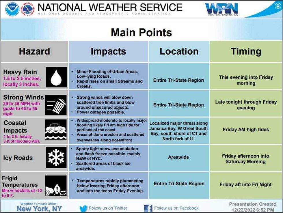
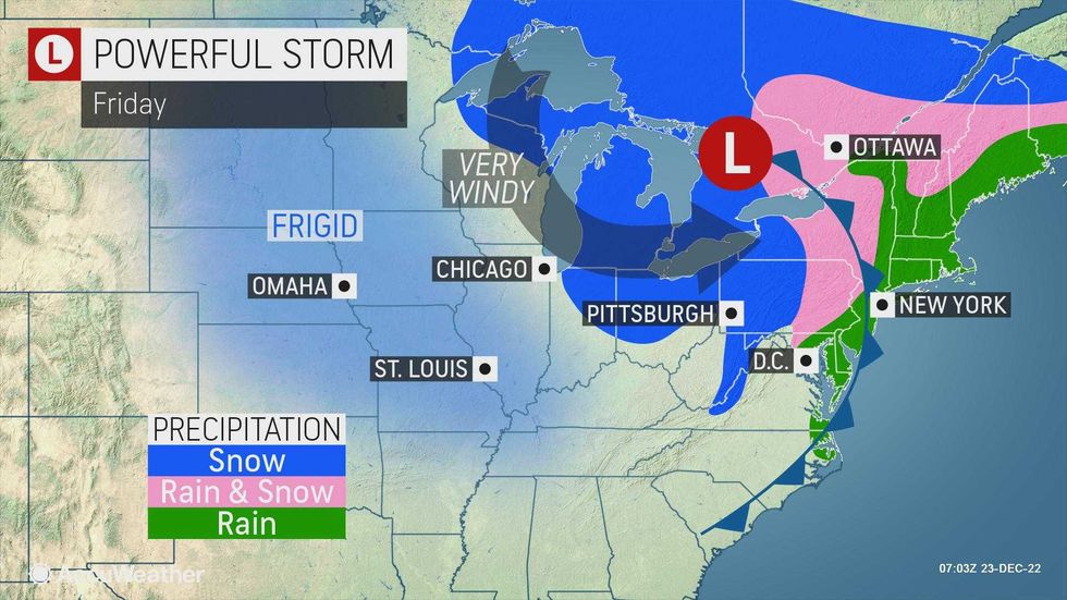
NEW YORK (1010 WINS/WCBS 880) -- As a monster holiday weekend storm roared across the U.S. Friday, powerful wind gusts and blistering cold moved in on the New York City area, threatening to rapidly freeze flooded areas and cause icy road conditions and even more power outages.
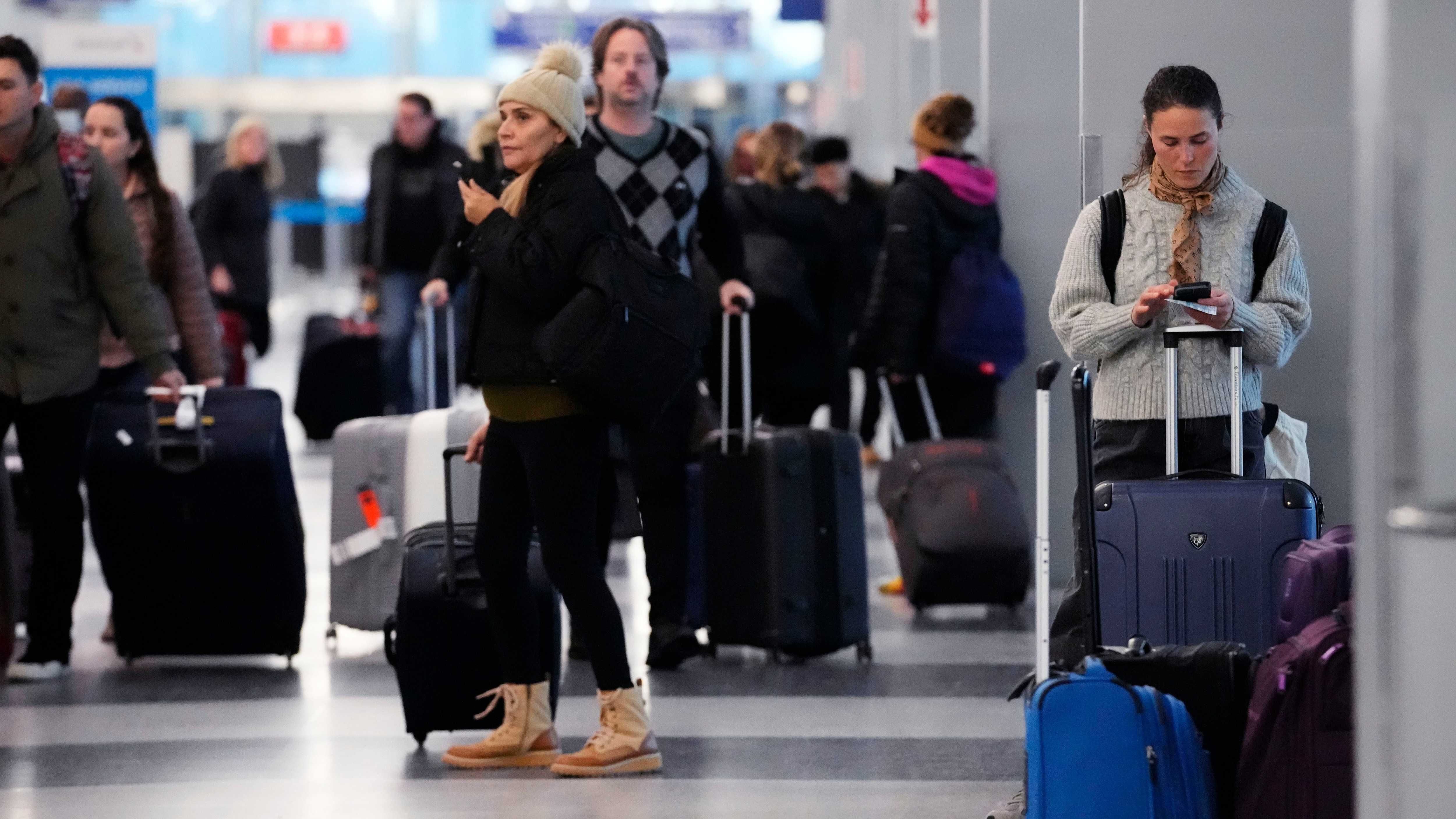
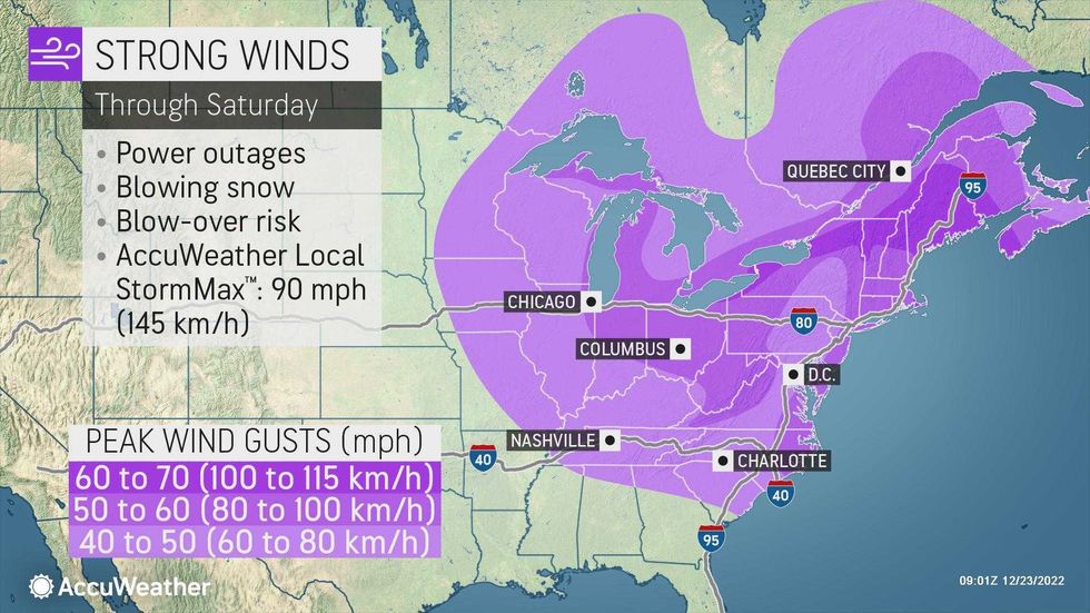
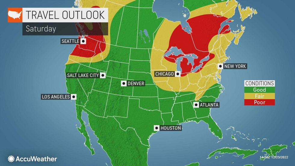
The heavy rain moved out Friday, but not before flooding communities across the area. And the worst of the storm was still moving in: 60 mph wind gusts and an arctic blast that will plunge temps into the teens, with RealFeels below zero. Thousands of flights were canceled and officials warned drivers to avoid travel if possible.
Gov. Kathy Hochul declared a state of emergency for New York, saying, "Mother Nature will throw everything she has at us this weekend." Among other things, the state has deployed thousands of plows as utilities in the state have some 7,700 workers on hand to deal with power outages.
 National Weather Service
 AccuWeather
 AccuWeather
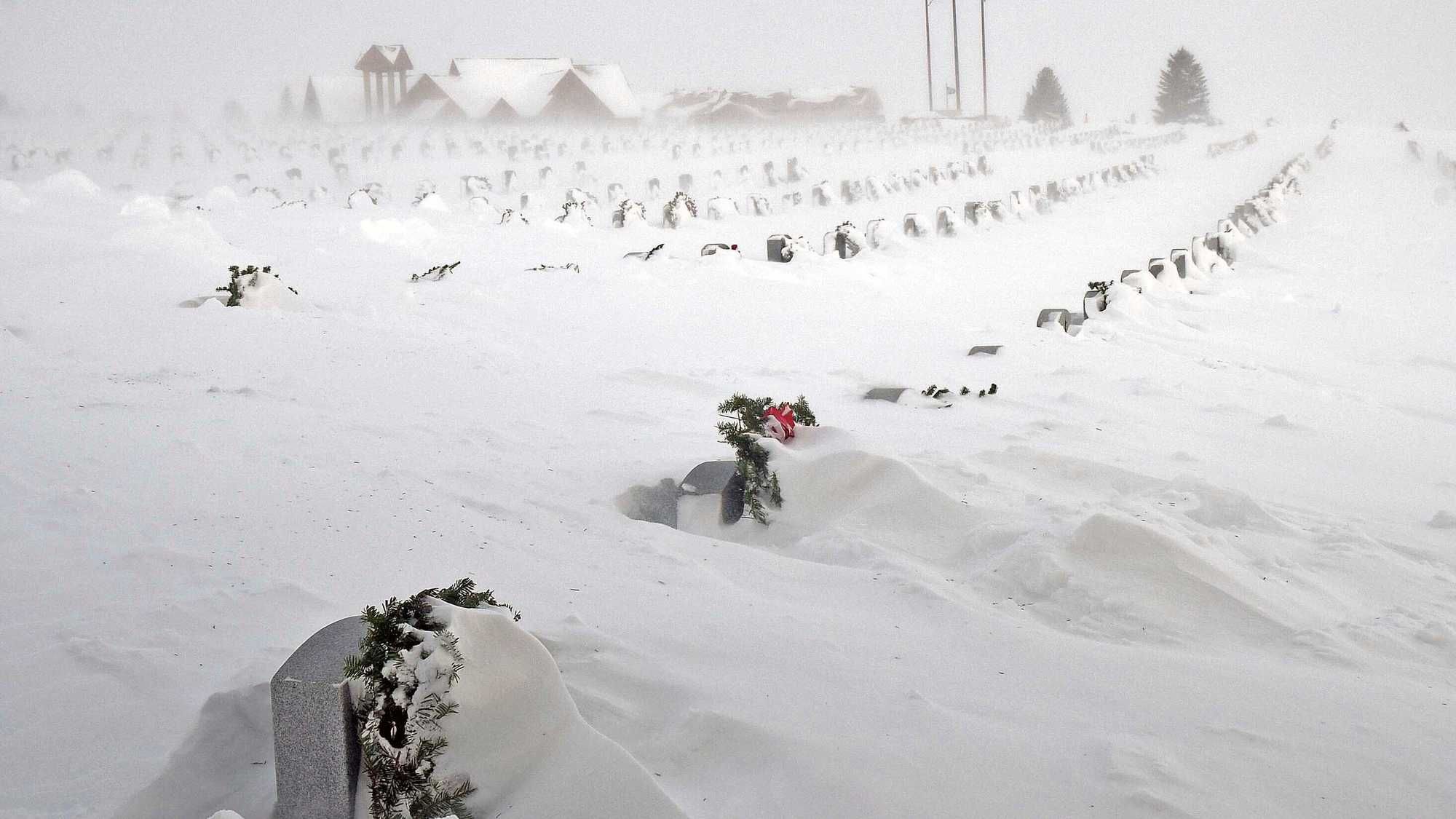
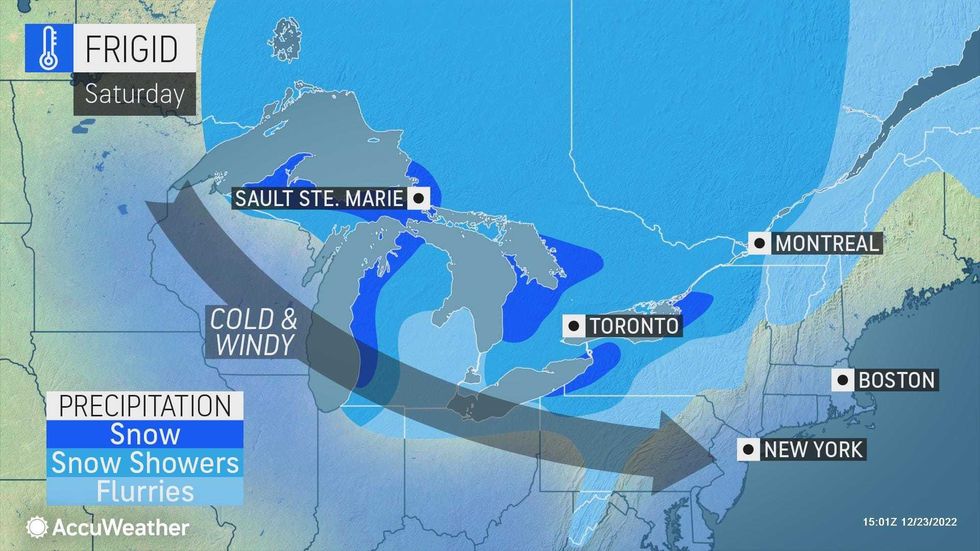
Upstate New York was getting hit especially hard. The National Weather Service predicted Buffalo will experience a "once-in-a-generation" storm event, with 2 to 3 feet of snow in the forecast amid brutal winds and temperatures.
The state-run MTA is monitoring conditions for any changes to subway, bus, LIRR and Metro-North service. MTA Bridges and Tunnels has banned tractor-trailers and tandem trucks until Friday night. NYC Sanitation issued a winter operations advisory to make sure streets were treated amid a threat of black ice.
 AccuWeather
 AccuWeather
 AccuWeather
A wind advisory is in effect for most of the New York City area, including all five boroughs and Long Island, until Friday night.
The city's Department of Health has declared a cold weather emergency that will end at 8 a.m. Saturday.
Flooding was seen in low-lying communities on Friday morning, from Hoboken, to Far Rockaway, Freeport and Jones Beach. In Howard Beach, at least a half-dozen water rescues were made, the FDNY said, as the NYPD had a Level 3 mobilization to assist homes flooded by rising waters.
Thousands of customers were without power across New York City and Long Island throughout the day, according to utilities Con Edison and PSEG Long Island.
 Flooding in Far Rockaway, Queens, on the morning of Dec. 23, 2022.Citizen App
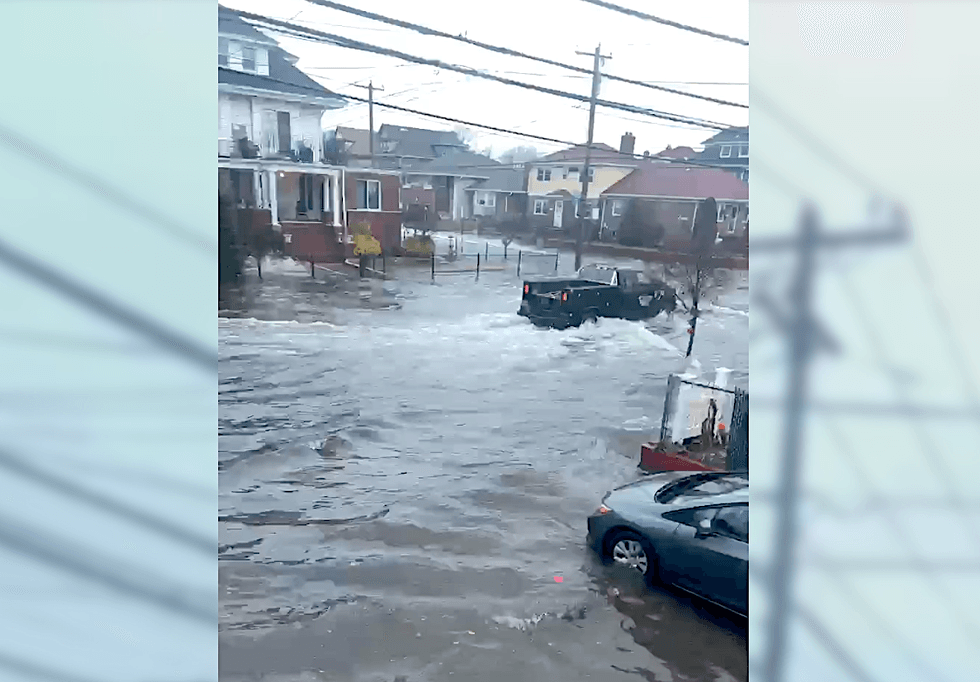 Flooding in Howard Beach, Queens, on the morning of Dec. 23, 2022.Citizen App
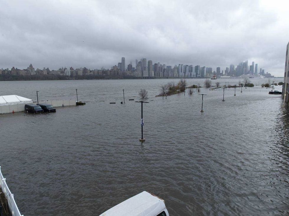 Storm clouds are seen as the Hudson River spills over a river wall in front of the skyline of lower Manhattan in New York City during an severe flooding due to the winter storm in New Jersey on Dec. 23, 2022.Lokman Vural Elibol/Anadolu Agency via Getty Images
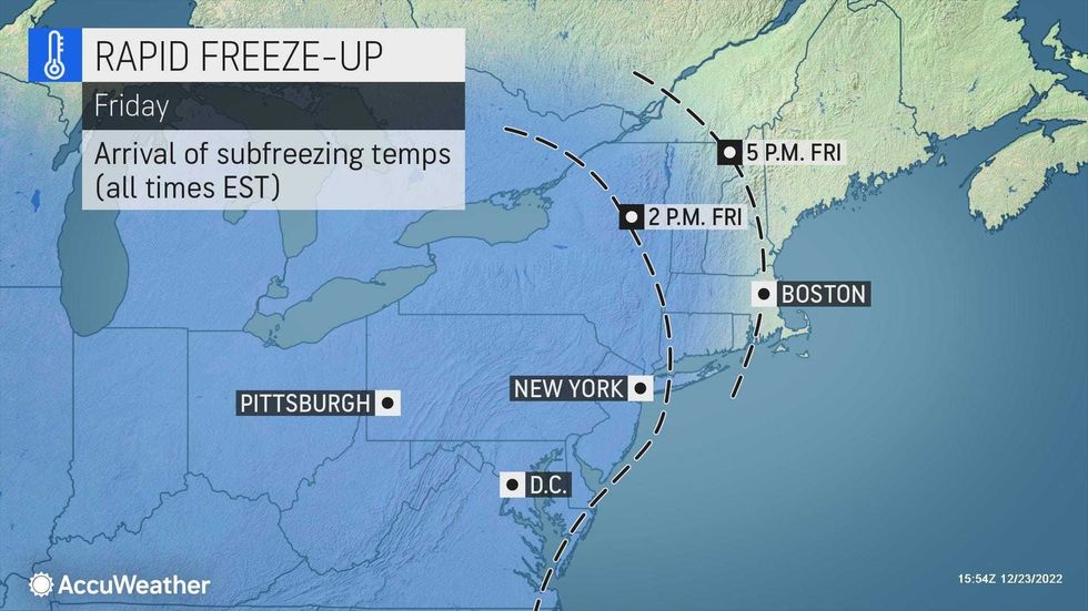
While the heavy rain moved out of New York City earlier Friday, powerful winds with gusts up to 60 mph were set to hammer the region into the night.
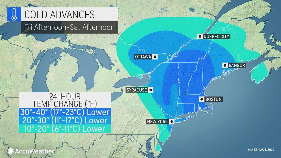
The relentless wind will come as temps rapidly drop out. Highs will plunge from about 50 degrees at noon Friday to 40 by 2 p.m. and 20 by 6 p.m. It will be 15 degrees by 10 p.m. with RealFeels of -12.
 AccuWeather
 AccuWeather
The deep freeze will ice over roadways and sidewalks Friday, creating hazardous travel conditions.
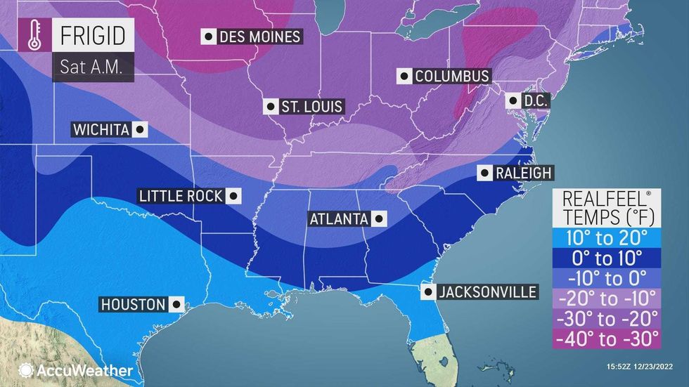
It will be brutally cold and windy overnight with a low of 11 degrees in the city. Lows will drop to the single digits further inland. The RealFeel temp will go as low as -20.
 AccuWeather
 AccuWeather
Saturday will be partly sunny but windy and extremely cold. The high will be 21 as RealFeels stay below zero in the morning and only go into the single digits by afternoon.
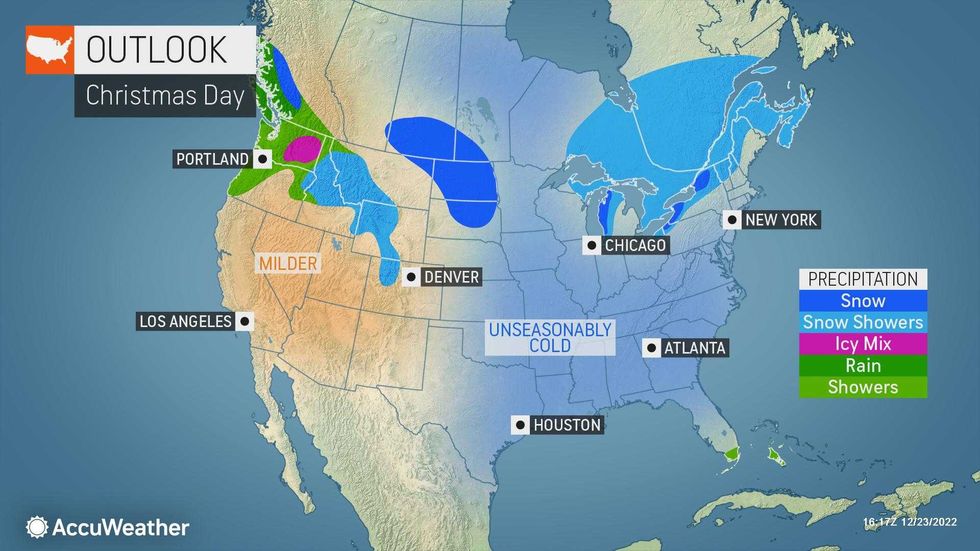
Christmas Day on Sunday will be cold but not nearly as windy with some sunshine. The high will be 25.
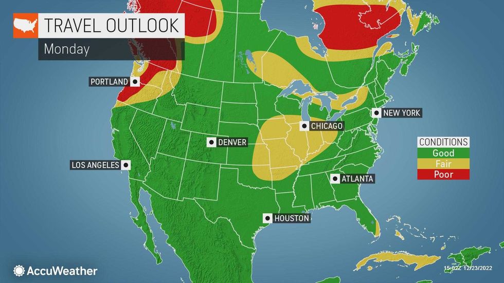
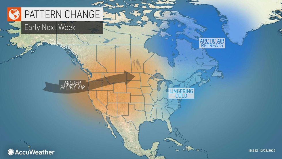
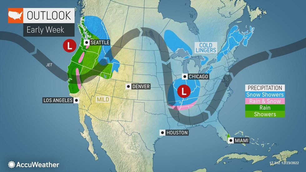
Temps rise a bit to start the week on Monday, with a high of 31 under partly sunny skies. Temps will be back in the 40s by midweek.
 AccuWeather
 AccuWeather