NEW YORK (1010 WINS) – Torrential rain and dangerous winds will hammer the New York City area on Wednesday as a developing "bomb cyclone" strikes the East Coast, sparking a wave of weather warnings for the area.
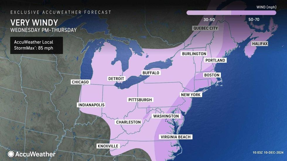
Winds could gust upwards of 50 mph around NYC and up to 60 mph on Long Island, according to AccuWeather. The heaviest winds are expected late Wednesday and could cause power outages.
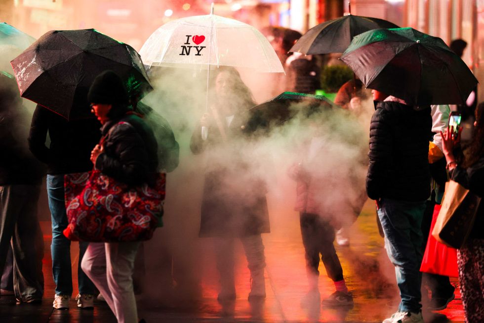 People hold umbrellas as they walk through Times Square on Nov. 22, 2024.CHARLY TRIBALLEAU/AFP via Getty Images
A Wind Advisory is in effect for the five boroughs and nearby suburbs, while a High Wind Warning is in effect for most of Long Island and parts of Connecticut through Wednesday night.
 AccuWeather
 AccuWeather
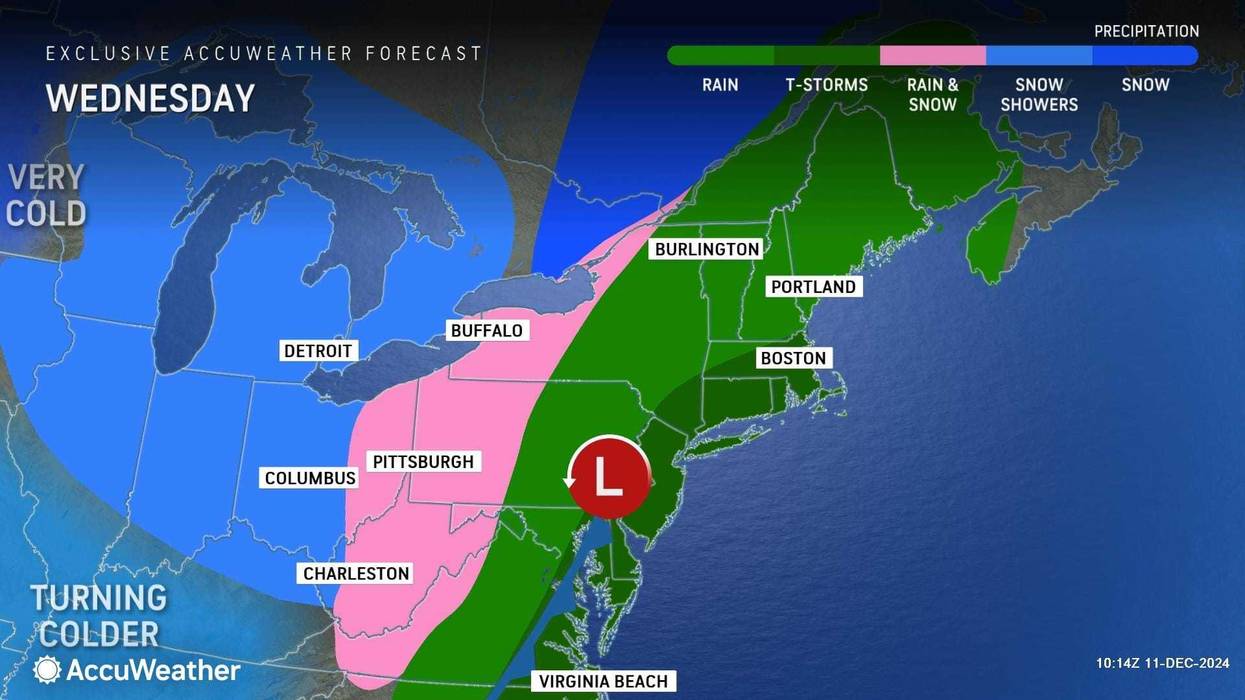
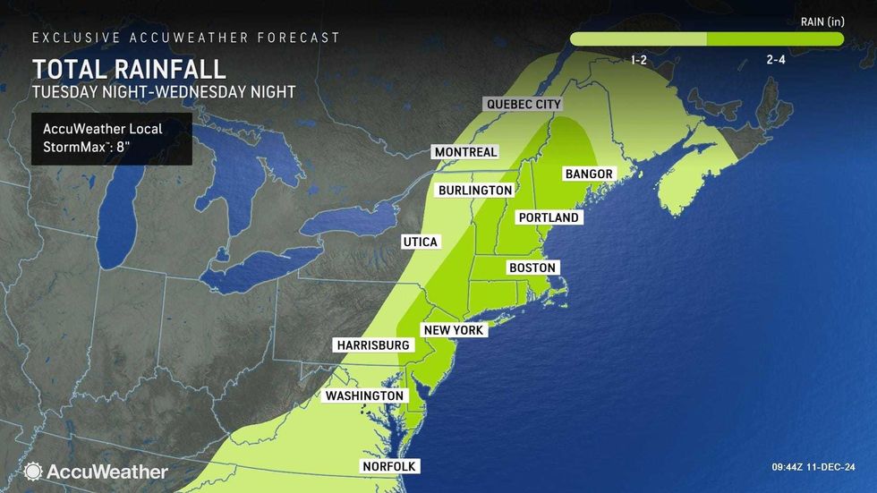
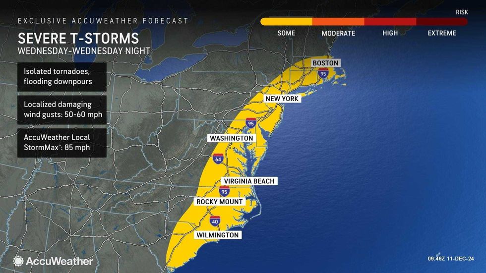
In addition to the gusty wind, the forecast shows heavy rain and thunderstorms that could be heavy at times and lead to flooding and travel issues.
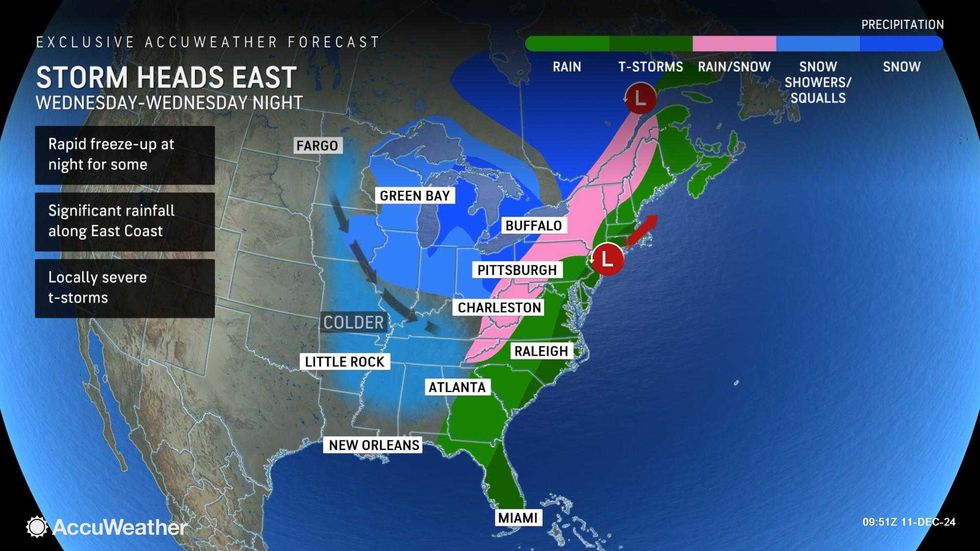
Forecasters said the storm system has the potential for a bombogenesis, or a "bomb cyclone." That is the rapid intensification of a cyclone in a short period of time, and it has the ability to bring severe rainfall. At least 2 inches of rain is expected in New York.
 AccuWeather
 AccuWeather
NYC Emergency Management warned the wild weather may "disrupt the Wednesday evening commute," while the MTA announced it would implement a ban on tractor-trailers and tandem trucks on its bridges until at least 6 p.m.
It'll otherwise be very mild for December, with a high of 63 degrees in Central Park.
The rain will end by Wednesday night, but it will remain windy as temps plummet into the low 30s overnight. Wind gusts will drop AccuWeather RealFeels into the 20s.
 AccuWeather
 AccuWeather
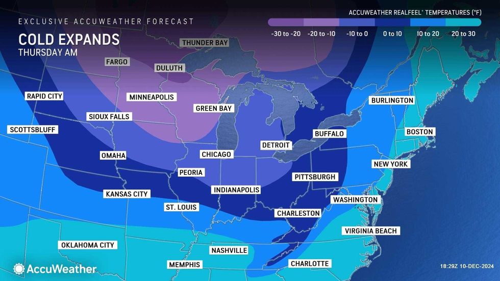
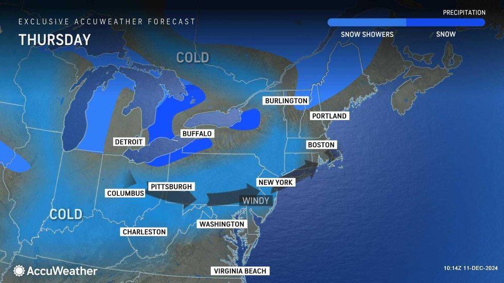
It'll be sunnier but much colder on a blustery Thursday. The high will be 38 in Central Park, but RealFeels will be in the 20s.
The colder conditions stick around going into the weekend, with highs around 40 on both Friday and Saturday under mostly sunny skies.