


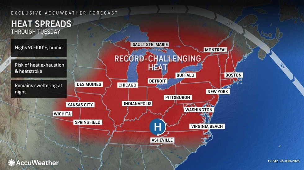
NEW YORK (1010 WINS) -- The extreme heat continues to grip the Tri-State area and a swath of the eastern U.S., with the heat index soaring above 100 degrees and highs breaking 137-year-old records in NYC.
An Extreme Heat Warning is in effect for all of New York City, North Jersey and the Hudson Valley until Tuesday night. A Heat Advisory has also been issued for Long Island over that same time period. An Air Quality Alert is also in effect Monday for the entire area.
Gov. Kathy Hochul on Sunday declared a State of Emergency in 32 counties across the state due to the extreme heat, as well as deadly storms upstate. The impacted counties include all of NYC, Long Island, Westchester and the Hudson Valley.
Here are some tips for staying cool during the heat wave.
Outages were reported as the heat settled in on Monday, with Con Edison saying in the morning that it had restored power to more than 1,600 customers in southeast Queens and was working to restore service to more than 6,200 additional customers.
The record highs in Central Park for Monday and Tuesday are both 96 degrees, set during a heat wave in 1888.
According to AccuWeather, the high in Central Park reached 96 on Monday, tying the old record. It's expected to reach 98 in the park on Tuesday.
Newark shattered its old record for June 23—99 degrees, set last year—with a high of 101 degrees. Records also fell in Islip and Bridgeport on Monday.
 New Yorkers soak up the sun in Central Park.KENA BETANCUR/AFP via Getty Images
 AccuWeather
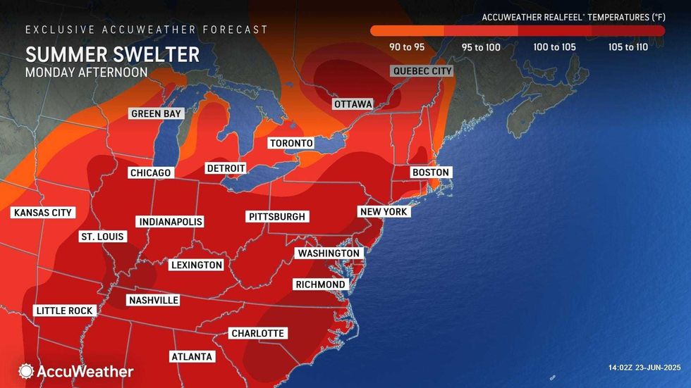
The blazing sun and high humidity will pus AccuWeather RealFeels past 100 degrees on both Monday and Tuesday.
Wednesday's high is set to reach a still sizzling 94, as the humidity sticks around and makes conditions even more miserable.
 AccuWeather
There will be little relief at night, with lows only dropping to the 70s and 80s through the middle of the week.
The cooldown finally begins on Thursday, when the high will be 85, and continues on Friday, when highs will be in the upper 70s.
 AccuWeather


