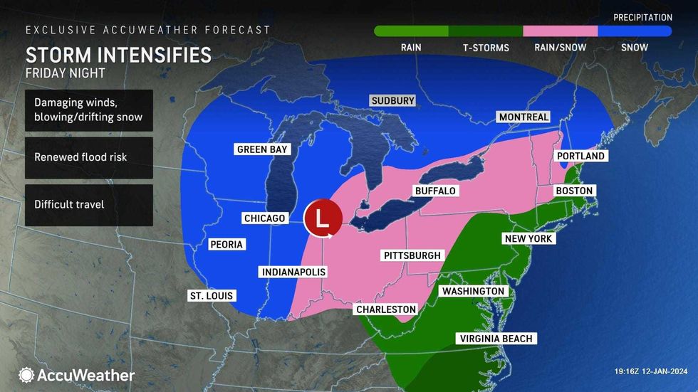
NEW YORK (1010 WINS/WCBS 880) – Yet another storm is expected to hit the NYC area on Friday night, with a downpour of rain causing big concern for coastal Tri-State towns that are still reeling from significant flooding caused by Tuesday's severe weather.
Friday afternoon is expected to see the morning's sunshine give way to increasing cloudiness before rain hits in the evening and continues throughout the night, AccuWeather said. Temperatures will rise into the 50s.
 AccuWeather
The rain will be heavy at times, prompting renewed or worsened flooding, and wind gusts from 50-60 mph make power outages possible, according to AccuWeather.
 AccuWeather
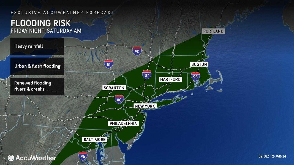
From Friday evening through Saturday morning, a Flood Watch is in effect for New Jersey, the lower Hudson Valley and Connecticut.
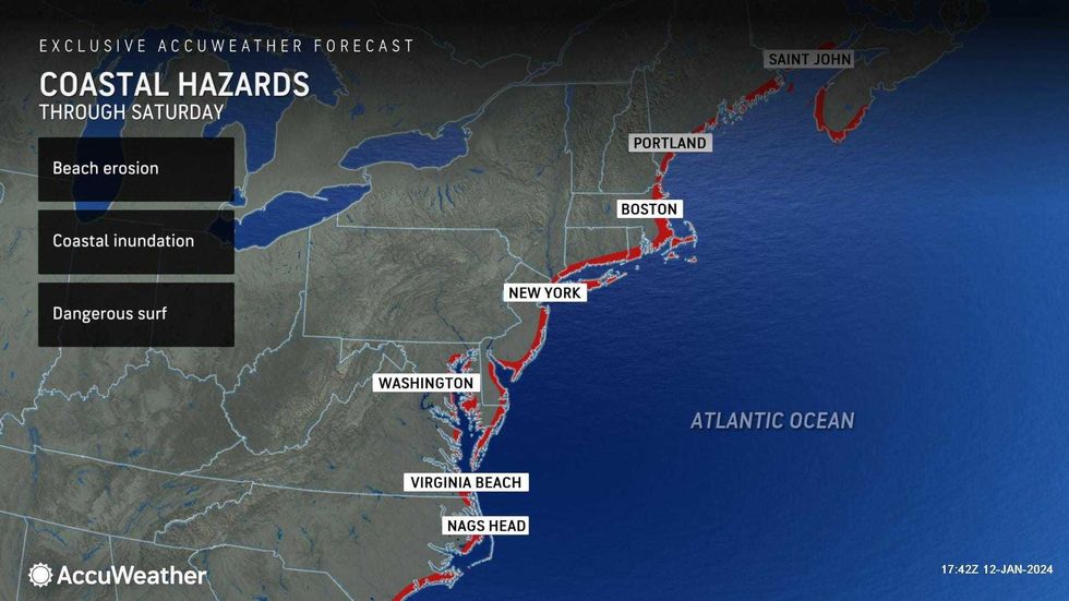
Flood Warnings continue in many area rivers, and Coastal Flood Warnings are in effect for south-facing shorelines in Queens, on Long Island, in Connecticut and elsewhere.
 AccuWeather
According to AccuWeather, these coastal areas face a possible two to three feet of inundation and beach erosion.
Wind Advisories are also in effect from 10 p.m. on Friday through Saturday morning.
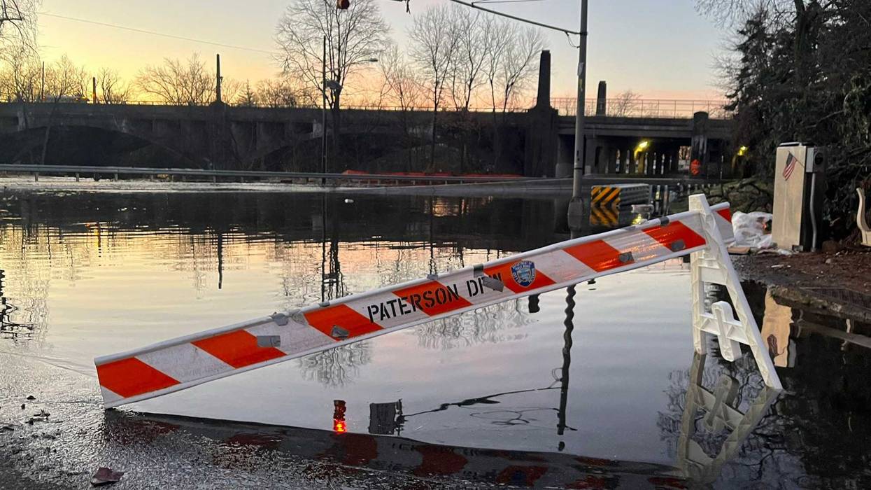
These advisories, warnings and watches come as areas of NJ struggle to recover from the flooding of the Passaic River, which, as of Friday morning, was still a couple feet above flood stage.
In Paterson, three rescues were necessary on Friday, including the evacuation of two families on Bergen Street that required boats to go near their homes to get them out, Mayor Andre Sayegh told 1010 WINS/WCBS 880.
This follows 12 rescue operations from Thursday, Sayegh told ABC7.
Over two dozen streets in Paterson remain closed due to flooding, and schools are closed, with hopes to reopen after Martin Luther King Jr. Day.
"Now here's what's going to compound the situation. We're expecting an inch, maybe two inches of rain, so that means the river is going to go back up," Sayegh told 1010 WINS/WCBS 880, concerned about Friday's storm.
New Jersey isn't the only water-adjacent area to struggle with flooding; Fire Island, just off the southern coast of Long Island, was hit hard.
According to what Suffolk County Executive Ed Romaine told CBS2, some of the dunes have been completely washed away, and the area needs emergency federal aid.
"We need help. We've asked the Governor for an emergency order. We're hoping we can qualify for federal aid so we can help communities like Ocean Beach rebuild after devastation," Romaine said.
In a briefing on Friday afternoon addressing the oncoming storm, Gov. Kathy Hochul prepared the already battered Long Islander coastline for high winds and more coastal flooding.
"It will not be as much rainfall as earlier this week, but the low-lying areas near the rivers and the coastal areas, that are already flood prone and dealing with floods, are going to be vulnerable once again," Hochul said.
Hochul encouraged New Yorkers to avoid driving if possible, noting that despite forecasts predicting "only a few inches of rain," the precipitation could have a dangerous effect on corroding bridges and roads.
New York City Emergency Management posted a Weather Alert on Friday afternoon, predicting 1-1.5 inches in rain totals and minor flooding, with the heaviest rain falling between 10 p.m. and 5 a.m.
The agency also posted notices warning New Yorkers of the Wind Advisories for the city and the Coastal Flood Warnings and Advisories for Saturday in North and South Queens and the Bronx.
At 2:22 p.m., the National Weather Service New York NY posted a simulated radar of what Friday's storm system could look like, with the heaviest rain expected to happen after midnight.
The storm will linger into the morning on Saturday with an early leftover shower, beginning a very windy day with peaks of clouds and sun, AccuWeather said.
Temperatures on Saturday will reach a high of 56 before falling into the 40s, but continued wind gusts reaching up to 45 mph will cause the AccuWeather RealFeel temperatures to fall through the 30s in the afternoon.
The weekend will end on a chillier note, with a blustery and cold Sunday that could see an afternoon rain or snow shower. Temperatures will reach a high of 40, despite RealFeels in the 20s, per AccuWeather.
 AccuWeather
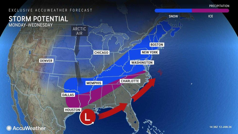
Looking forward, AccuWeather warns, like clockwork, that there could be another storm next week, especially later Tuesday and into Wednesday. This storm could potentially bring snow.