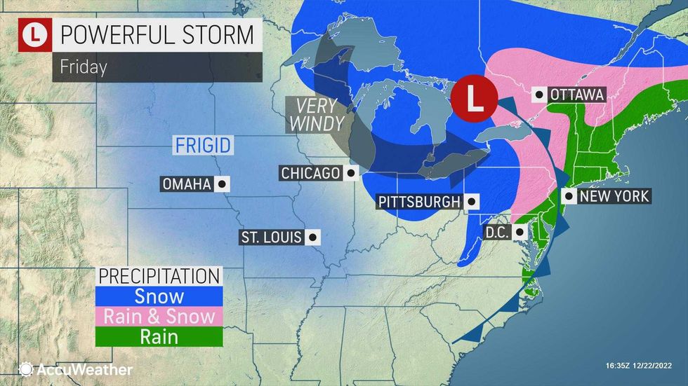
NEW YORK (1010 WINS/WCBS 880) -- A massive winter storm will hammer the New York City area with pounding rain and 60 mph wind gusts before an arctic blast causes temps to plunge and ice to form on roadways as millions travel for Christmas.
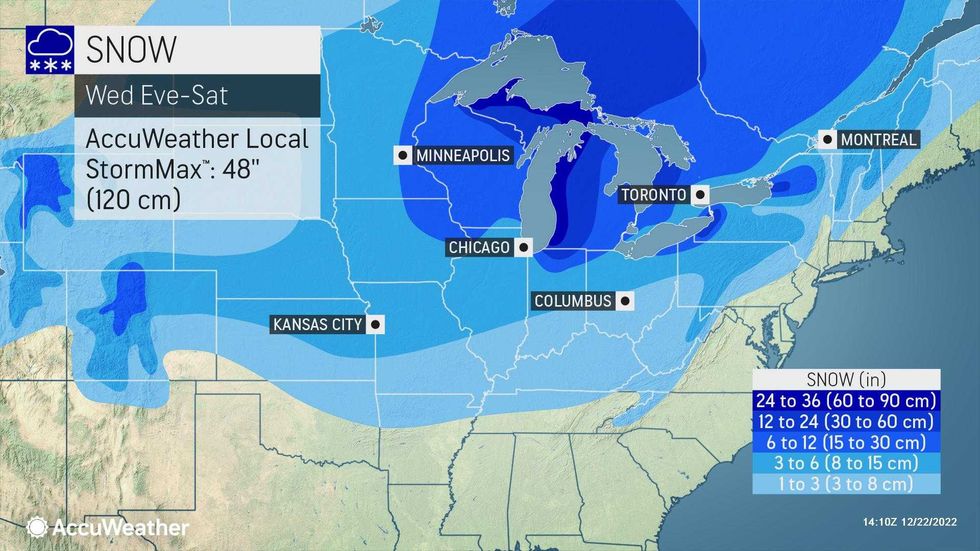
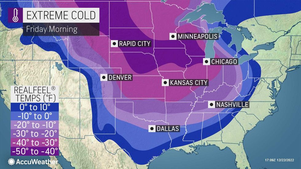
The extraordinary system has placed more than 190 million people in the U.S. under winter weather alerts in dozens of states across the Northeast, Midwest and South. With an arctic blast on tap, it will be the coldest Christmas weekend in decades for much of the country, as well as a "once in a generation type event" for upstate New York.
 AccuWeather
 AccuWeather
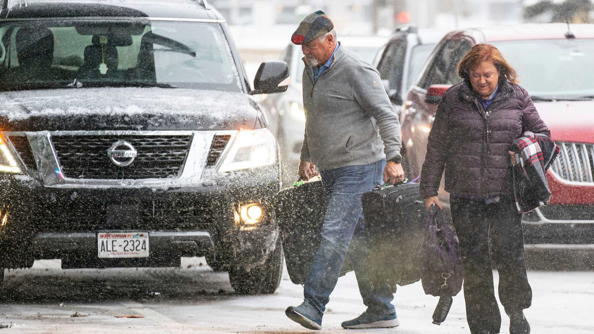
The winter weather madness comes as a near-record 113 million Americans are expected to travel more than 50 miles from home between Dec. 23 and Jan. 2, according to AAA estimates. Well over 1,000 flights were already canceled by Thursday.
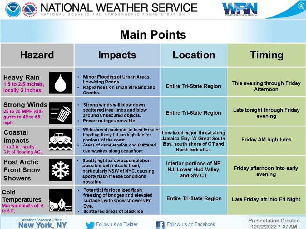
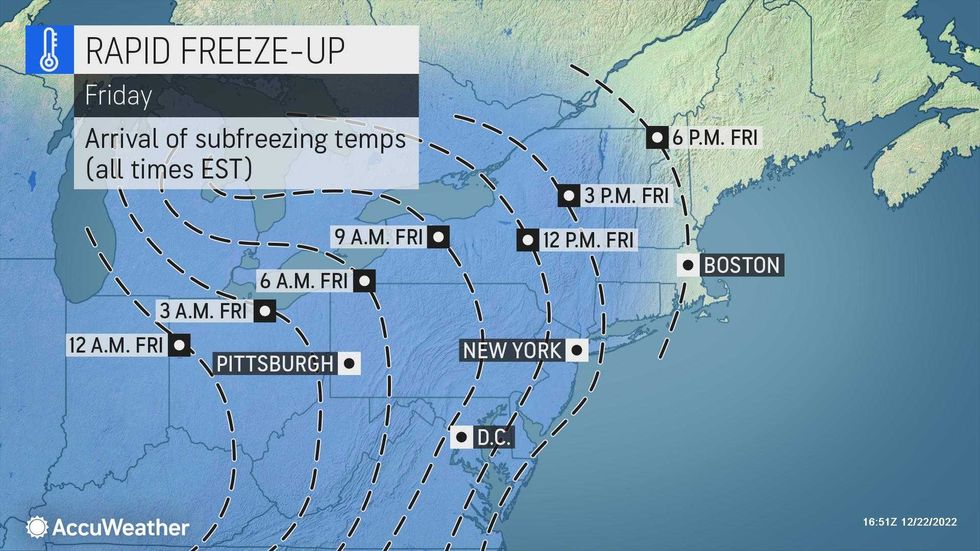
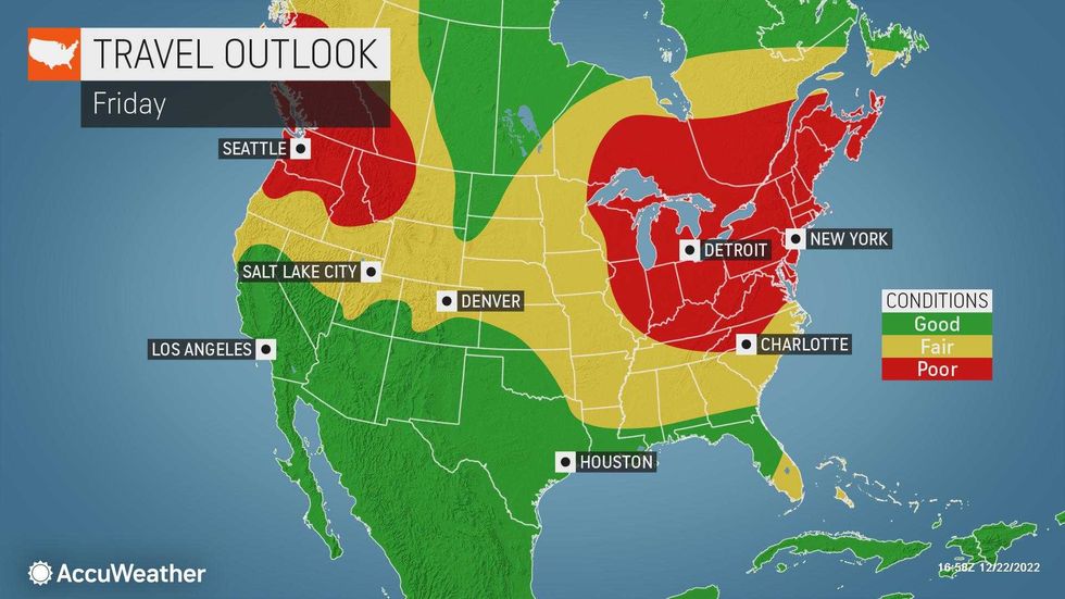
In the New York City area, the storm will mean heavy rain and whipping winds on Thursday and Friday before frigid air swoops in and temps crash starting Friday night.
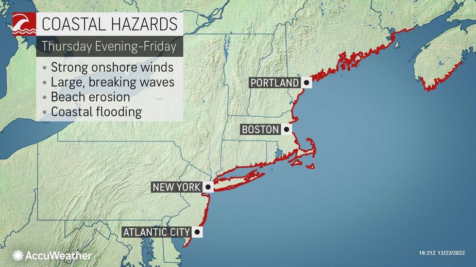
Ahead of the storm, the National Weather Service issued a coastal flood watch for New York City, Long Island and parts of New Jersey, Westchester and coastal Connecticut from Thursday night to Friday morning. A hazardous weather outlook was also issued for parts of North Jersey and the Lower Hudson Valley, which may see a mix of rain and wet snow.
The MTA said it was preparing for potential impacts to the subway, buses, LIRR and Metro-North. MTA Bridges and Tunnels will also ban empty tractor-trailers and tandem trucks from 8 p.m. Thursday to 8 p.m. Friday.
 National Weather Service
 AccuWeather
 AccuWeather
Rain that started Thursday was set to continue and grow more intense into Thursday night. The high will be 49.
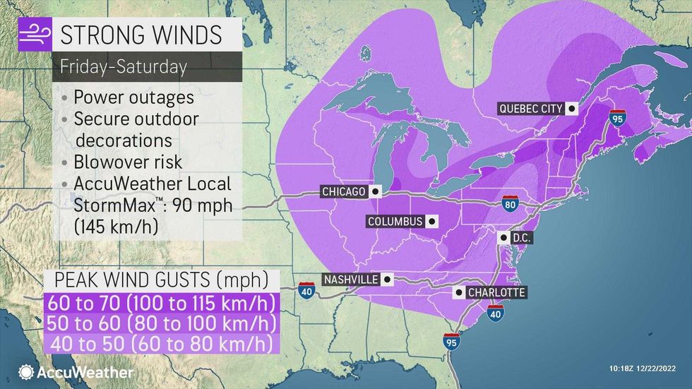
Rain will be heavy at times, and a thunderstorm can't be ruled out, overnight Thursday as winds kick up. Very strong gusts could top 60 mph.
The rain will end Friday, but it will remain very windy and get dramatically colder throughout the day, with temps plunging from a high of 56 early in the day to the 20s by Friday evening, with RealFeel temps in the single digits.
 AccuWeather
 AccuWeather
The main threats from the storm are power outages from the wind, several feet of coastal flooding from the rain during high tide and sheets of dangerous ice on roadways when the cold air moves in and freezes any wet areas.
Friday night's low of 13 degrees in the city will be more intense thanks to the wind. RealFeels are expected to drop as low as 10 to 20 degrees below zero overnight.
 AccuWeather
 AccuWeather
 AccuWeather
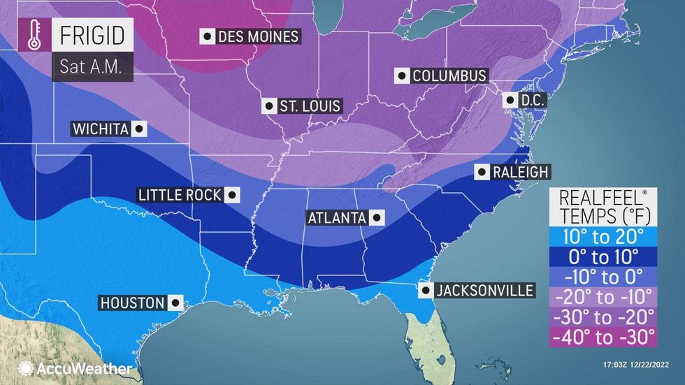
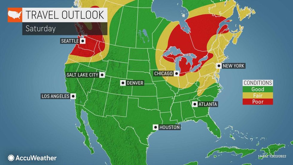
Saturday will be partly sunny, windy and brutally cold. The high will only be 23, but it'll feel well below zero in the morning and in the single digits in the afternoon.
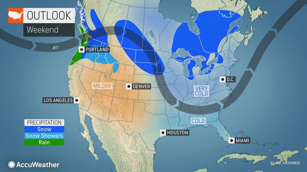
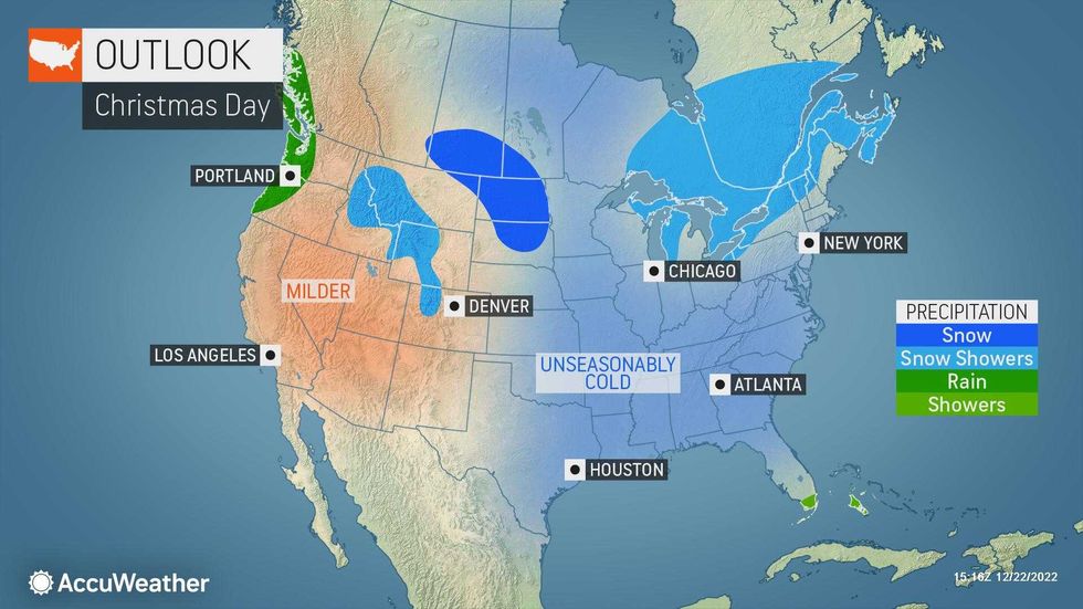
Christmas Day on Sunday will be cold but not as harsh as Saturday's wind subsides. It's forecast to be partly sunny with a high of 25.
Conditions start to improve next week. Temps will return to the 30s Monday and rise into the 50s by next weekend.
 AccuWeather
 AccuWeather
The Associated Press contributed to this report.