


NEW YORK (1010 WINS/WCBS 880) – Hurricane Lee won't hit the New York City area directly, but it may bring significant impacts to the shores of Long Island Friday into the weekend, including rough surf, rip currents, beach erosion and coastal flooding.
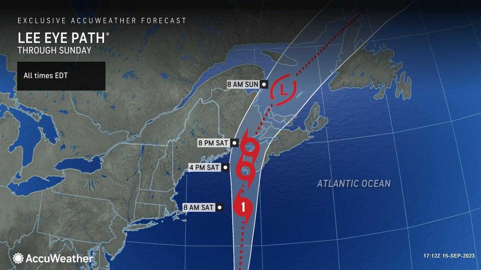
The hurricane—a Category 1 storm with maximum sustained winds of 85 mph—was spinning in the sea 400 miles southeast of Nantucket, Massachusetts, on Friday afternoon.
Coastal flood advisories were issued for Long Island, southwestern Connecticut and Westchester until Sunday morning. A coastal flood statement was issued for the five boroughs of New York City, also until Sunday morning.
 AccuWeather
 AccuWeather
The effects of Lee on Long Island should be most pronounced Friday night into Saturday. Then conditions should improve going into Sunday, according to AccuWeather.
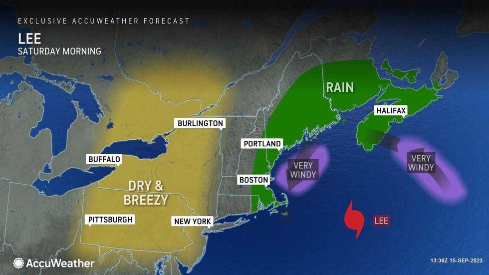
Showers may brush the island Friday night, while wind gusts could top 30 mph towards New York City and up to 40 mph on the forks of Suffolk County and in eastern Connecticut as the storm passes.
 AccuWeather
 AccuWeather
Rough surf has been building in recent days, as has the danger of rip currents—threats that will remain into the weekend. Beachgoers should be extra cautious if they head to the shores on the last weekend of summer.
Large, breaking waves of 7 to 11 feet—and building to 10 to 16 feet—are possible along the South Shore on Friday and Saturday before they subside through the weekend, according to the National Weather Service. The average high surf will be 6 to 12 feet.
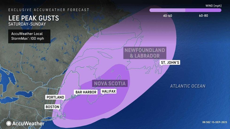
Meanwhile, Lee threatens to bring tropical-storm-force winds to a 400-mile swath of New England this weekend. A tropical storm warning was in place from Maine to Massachusetts.
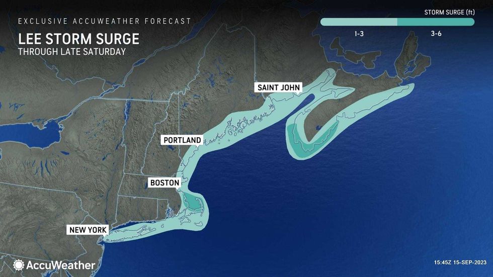
Forecasters warned that coastal areas stretching from Long Island to the U.S.–Canada border—including Boston Harbor, Cape Cod, Martha's Vineyard and Nantucket in Massachusetts—could see storm surge peaks of 1 to 3 feet at high tide.


