NEW YORK (1010 WINS) -- Heavy, flooding rains thrashed the Tri-State area Wednesday evening, causing damage in some areas and leading to a first-ever kind of weather emergency in New York City.
Mayor Bill de Blasio, New York Gov. Kathy Hochul and New Jersey Gov. Phil Murphy all declared states of emergency. De Blasio said the city was "enduring an historic weather event," adding about 5,300 New Yorkers had lost power as of around 11 p.m. In New Jersey, 80,000 customers have reportedly lost power.
Subway service was suspended, the MTA tweeted at 10:42 p.m.
A Flash Flood Watch is in effect for the entire New York City area as the remnants of Ida threaten the Tri-State with torrential rain, severe thunderstorms and the potential for isolated tornadoes into Thursday.
The National Weather Service says it issued a Flash Flood Emergency for the New York City Metro area -- even saying this is the first time it has ever had to issue one for the area.
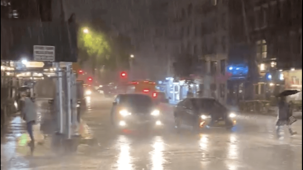
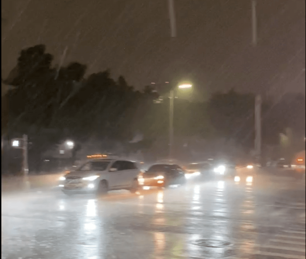 The remnants of Hurricane Ida slam the East Village on Sept. 1, 2021.
The National Weather Service said Wednesday night that multiple flood rescues were already underway in New Jersey, with more rain still to come.
New Jersey Gov. Phil Murphy declared a state of emergency in order to respond to the storm.
In Manhattan, over 3 inches of rain were recorded over a one-hour period.
Central Park, NY has just observed 3.10 inches of rain in one hour, from 8:51 pm to 9:51 pm.
— NWS New York NY (@NWSNewYorkNY) September 2, 2021
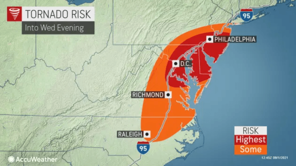
A tornado watch is also in effect across New York City, Long Island, southern Connecticut, northeastern New Jersey and Westchester County until 1 a.m. Thursday.
A Severe Thunderstorm Warning is currently in effect for New York City, Long Island and parts of New Jersey and Connecticut. The warning extends as far as 10:45 p.m. in parts of the area.
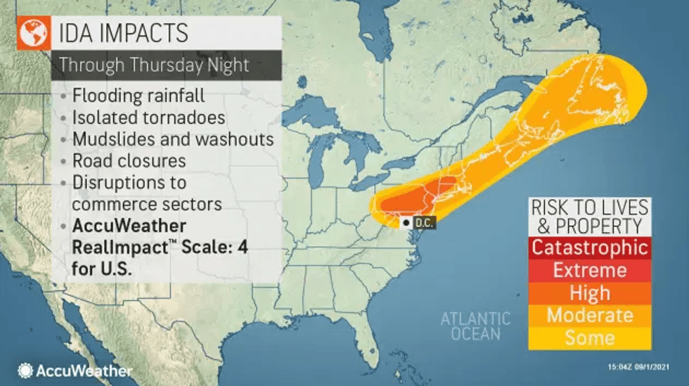
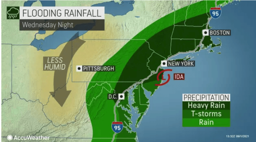
Ida, which slammed the Gulf Coast as a Category 4 storm earlier this week before weakening to a tropical depression, is bringing heavy rain to the northeast through Thursday.
 AccuWeather
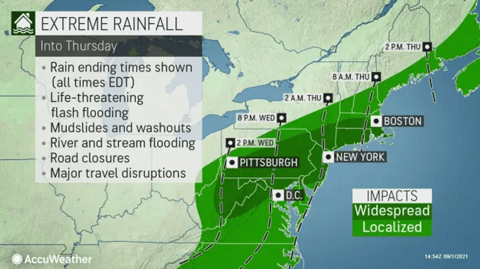
Ida is expected to bring 3 to 6 inches of rain to much of the region, with as much as 6 to 8 inches possible in North Jersey and the Hudson Valley suburbs, according to AccuWeather.
The National Weather Service said Wednesday night that multiple flood rescues were already underway in New Jersey, with more rain still to come.
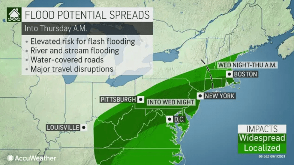
Emergency Management issued a travel advisory for all five boroughs from into Thursday morning because of the heavy rain and potential for flash flooding.
 AccuWeather
Gov. Kathy Hochul directed New York state agencies to prepare emergency response assets. She said authorities are in communication with local municipalities and partners, and that they're ready to respond as needed.
 AccuWeather
Downpours may turn torrential at times as the potential for strong thunderstorms increases.
The severe storms could produce damaging winds and have the potential to spin up quick, isolated tornadoes.
Stunning footage shows a tornado moving near the Burlington Bristol Bridge, located just over 20 miles from Philadelphia.
About 40 miles south of Burlington, footage from Mullica Hill, New Jersey showed significant damage to homes.
 AccuWeather
Flash Flood Warnings are in effect in New York Wednesday night across New York City, western Long Island, Westchester County and parts of southwestern Connecticut. In New Jersey, Flash Flood Warnings are posted Wednesday night for Burlington, Camden, Gloucster, Hunterdon, Warren and Salem counties.
The National Weather Service warned of "scattered to widespread" flash flooding and said "an isolated tornado cannot be ruled out, especially near the coast."
The rain will continue early Thursday morning before tapering off for clear skies by afternoon. The high will be 73.
Friday is mainly sunny and more pleasant with a high of 74. Labor Day Weekend should be mostly dry, although a shower cannot be ruled out on Sunday and Monday, when highs will be close to 80.
 AccuWeather