


NEW YORK (1010 WINS) – There was almost no snow in New York City last winter, much to the chagrin of snow lovers. But things may be looking up this season—snow is in the forecast heading into the first day of winter Saturday, though it will come with a blast of brutal cold.
NYC Emergency Management issued a winter weather alert from Friday to Saturday morning, warning of slippery conditions on roads, while the city Sanitation Department urged New Yorkers to stay off the roads during that time as it deploys hundreds of salt spreaders across the city.
The snow will also usher in the "coldest air mass in nearly two years" for the New York region, according to the National Weather Service. A Code Blue has been issued in NYC; outreach teams will work to get people into shelters.
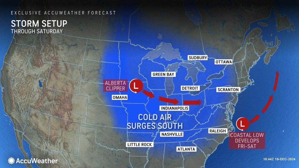
A mix of rain and snow began falling across the Tri-State in the afternoon, with steadier and heavier snow expected by evening as a coastal storm moves through.
Snow accumulations between the evening and midnight are set to be between a coating to 1 inch for most of the area, while higher amounts may be seen locally.
 AccuWeather
It's increasingly looking like the heaviest snow will fall from Connecticut down through Long Island.
Roads will become slippery during the evening commute and likely stay that way overnight into early Saturday, as holiday travel ramps up. The low will be 31 degrees.
 AccuWeather
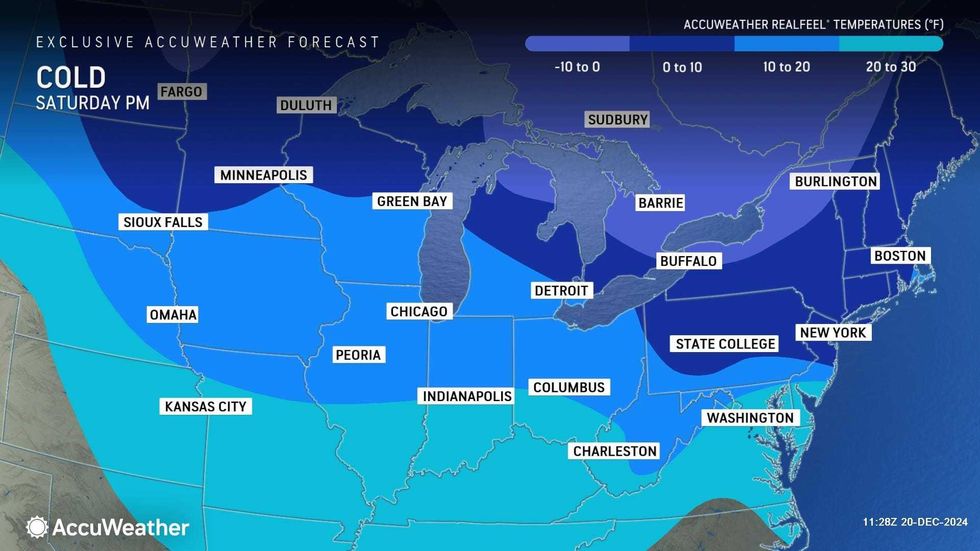
Saturday's high will only be 34 degrees, and wind gusts of 35 mph will send RealFeels plunging to the teens for the first day of winter. It will be dangerously cold, so people should limit their time outdoors.
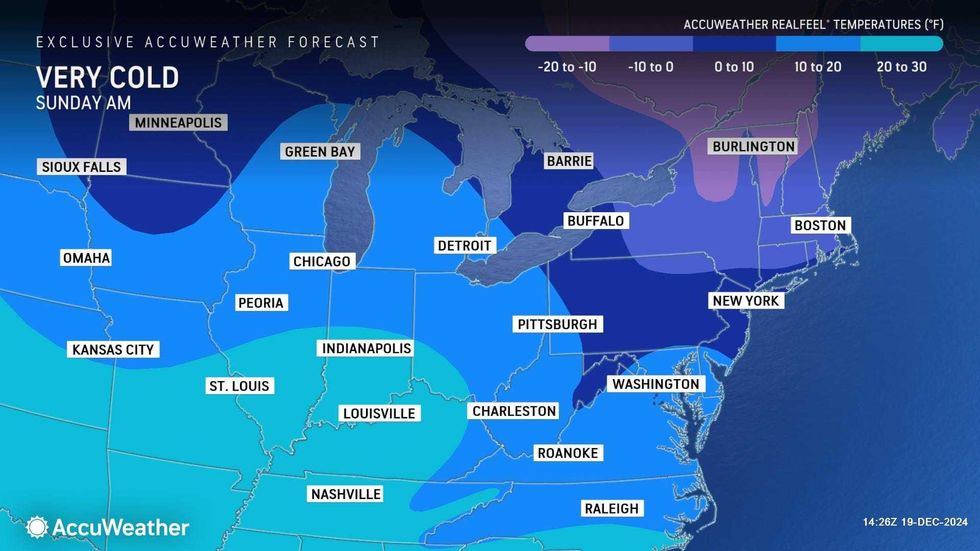
Sunday will be sunny but even colder, with a high of 27 and RealFeels again down in the teens.
 AccuWeather
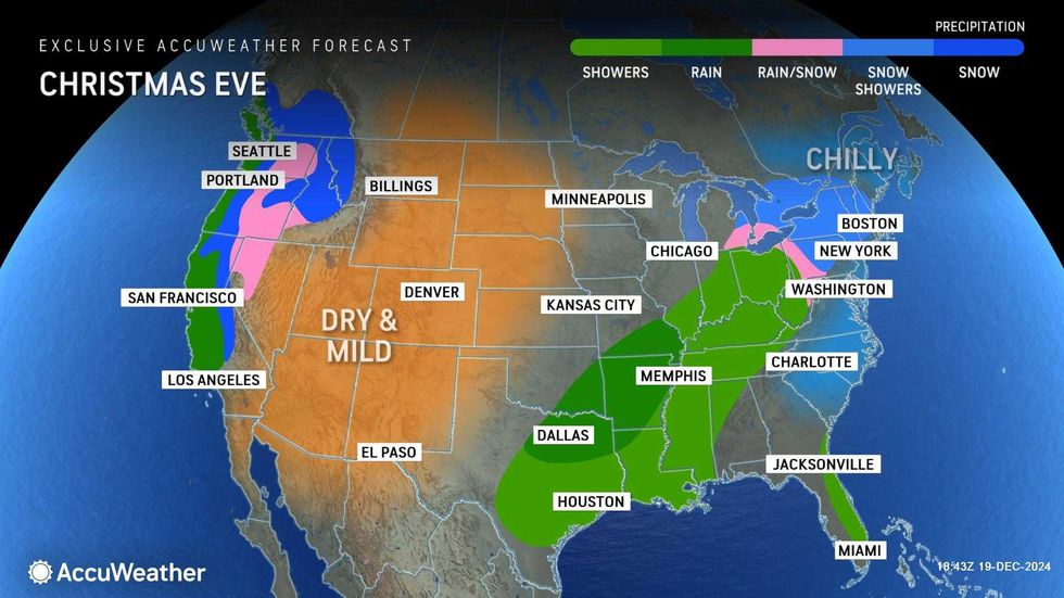
Monday will be dry and cold ahead of a wintry mix Tuesday. Highs will be in the 30s both days.
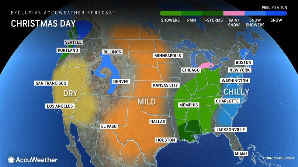
Looking ahead to Christmas and Hanukkah, Wednesday should be dry as temps top out near 40.
 AccuWeather
 AccuWeather


