


NEW YORK (BLOOMBERG) -- Extreme heat is testing power grids across much of the US on Wednesday as air quality drops from wildfire smoke drifting in from Canada.
The air-quality index in New York City deteriorated such that it’s “unhealthy for everyone, especially sensitive groups,” according to the Environmental Protection Agency’s airnow.gov.
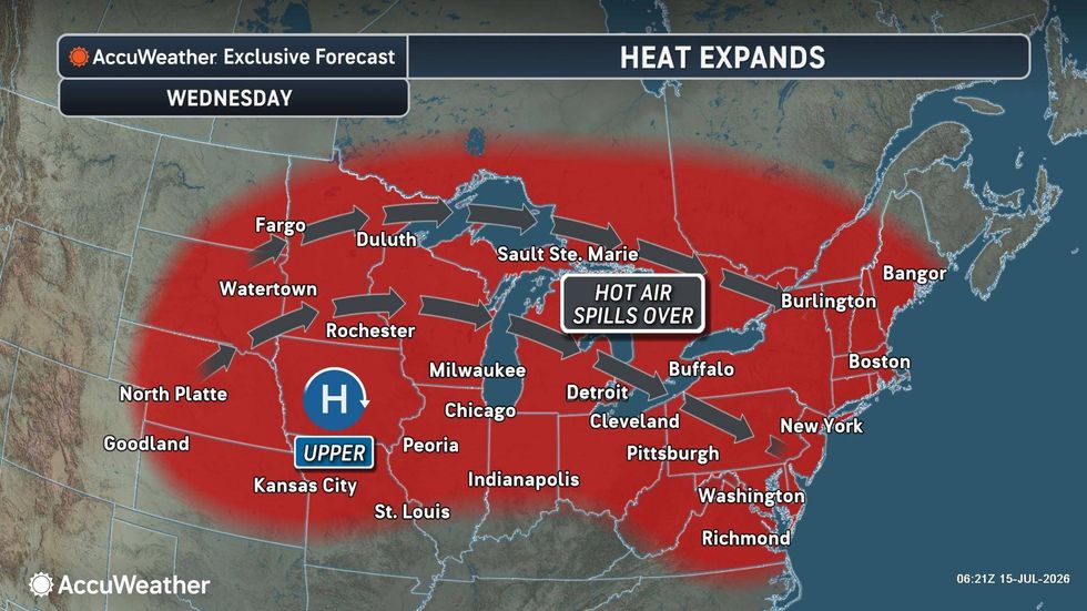
“Today is probably the hottest day for New York City,” said Bob Oravec, a senior branch forecaster at the US Weather Prediction Center. “The worst of the heat is today for New York City and today, tomorrow and Friday for DC.”
Washington is forecast to top 100F (38C). New York City’s heat index is expected to reach 102F.
 AccuWeather
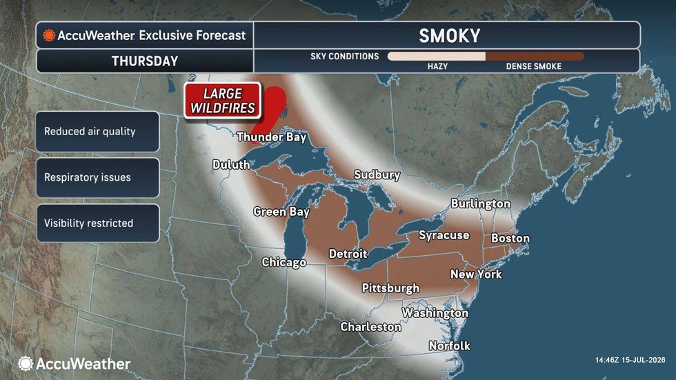
Wildfire smoke from hundreds of fires burning across Canada continues to blanket parts of the Great Lakes, Midwest and Northeast. Air quality alerts are in effect across portions of the Midwest and Northeast, and forecasters expect some of the smoke to spread toward Washington and Philadelphia. People with heart disease, asthma and other respiratory conditions are most at risk from deteriorating air quality.
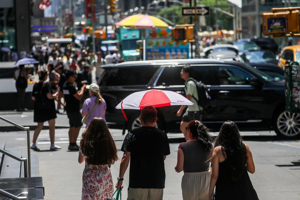 A pedestrian carries an umbrella to shield themself from the sun during high temperatures in New York.Michael Nagle/Bloomberg
“This will be a prolonged event, and we may see worse air quality tomorrow,” said Amanda Lefton, commissioner for the NYS Department of Environmental Conservation, adding that the smoke will come “in waves” throughout the day.
The state will distribute face masks throughout New York City. Lefton said New York is seeing increasing air quality issues because of longer fire seasons.
 AccuWeather
With electricity demand surging in the eastern US, the Energy Department is allowing generators on the country’s biggest grid, operated by PJM Interconnection, to bypass environmental permits and run at full capacity into next week. Meanwhile, New Jersey Transit warned riders that high temperatures could slow trains and cause delays.
Real-time prices on PJM’s western hub briefly spiked to $395 per megawatt-hour Wednesday afternoon. Spot power on the Dominion section of the grid serving Virginia’s Data Center Alley fetched as much as $500/mWh Tuesday evening.
The Mid-Continent Independent System Operator, which serves a large swath of the central US, issued a maximum generation warning due to forced generation outages and load that’s set to exceed forecasts through the Midwest. MISO plans to implement emergency pricing, which can drive up ex-post prices on the grid to secure additional capacity.
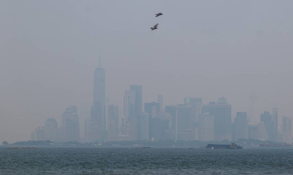 Haze from Canadian wildfires blankets the Manhattan skyline as seen from a Brooklyn pier on July 15, 2026Spencer Platt/Getty Images
Temperatures in Minneapolis are expected to peak at 96F Wednesday, according to the National Weather Service, while humidity will drive the heat index past 100F at O’Hare International Airport outside Chicago.
Large areas of Southern California are also under extreme heat warnings and advisories, the weather service said. Wednesday’s high may reach 95F in downtown Los Angeles.
The fire threat is rising across California and the West, where dry winds have raised an elevated, or level 1 of 3, threat, the US Storm Prediction Center said. Onshore winds across California will dry out and heat up as they roll downhill across the state’s coastal mountain ranges and Central Valley.
While several small blazes are burning across California, the largest is the Elephant Fire in Sierra County that has consumed 15,526 acres (6,283 hectares) and is 42% contained, the California Department of Forestry and Fire Protection said. The blaze is burning on federal land about 22.8 miles (37 kilometers) northwest of Reno, Nevada.
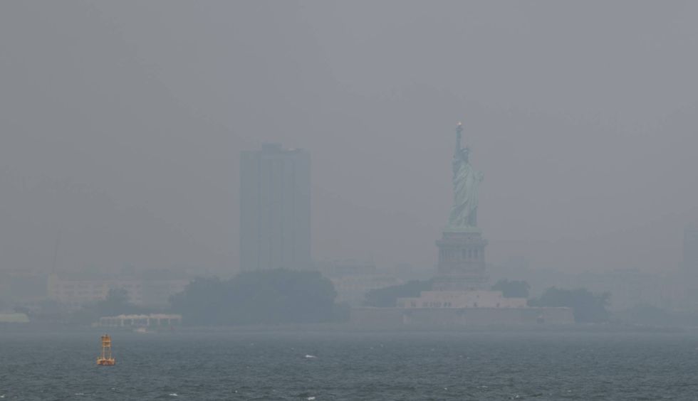 Haze from Canadian wildfires blankets the Statue of Liberty as seen from a Brooklyn pier on July 15, 2026.Spencer Platt/Getty Images
More stories like this are available on bloomberg.com.