


NEW YORK (1010 WINS/WCBS 880) – In what Gov. Kathy Hochul called a "classic Nor'easter," the Tri-State area was slammed with precipitation Saturday night and into Sunday morning. There was significant snowfall accumulations in much of the interior as slushy, wet snow fell and melted in New York City.
As of Sunday, it has been 693 days since Central Park got a measurable inch of snowfall, and the streak continues. Saturday night's storm brought only 0.2 inches to the park, according to the National Weather Service's snowfall reports.
Based on these same reports, accumulations on Long Island didn't exceed 0.5 inches.
The rest of the state was more impacted, with Westchester and Rockland Counties getting up to 4.0 inches of accumulation, Putnam County getting up to 6.5 inches and Orange County getting from 2.5 to 13.1 inches, the highest recorded total of which was in Port Jervis.
In New Jersey, snow totals range from 0.4 inches in Newark to up to 5.7 inches in parts of Bergen County. Connecticut follows a similar pattern, with low records of 0.3 inches and up to 6.0 inches of accumulation in parts of Fairfield County.
A new snowfall summary is expected to come out of the NWS by Sunday afternoon.
The NWS New York NY confirmed that the storm will exit to the northeast this morning, and in the process, "another round of rain may transition into snow (only briefly for the coast) as cooler air filters in with the exiting system."
The agency also noted earlier this morning that all Winter Storm Warnings have been canceled, and a Winter Weather Advisory is in place across the interior.
Hochul held a winter storm briefing at 9:36 a.m. on Sunday to discuss the impacts of the snowstorm and acknowledge the state's response.
This included a shout-out to the first of its kind State Weather Risk Communication Center at the University of Albany.
"This level of detail and accuracy has really improved our response time, we're seeing it already," Hocul said.
According to Hochul, the highest snowfall amounts in the state were in the Catskills and the eastern Hudson Valley with 14 inches. The Southern Tier and Central NY had 6-8 inches, and the Capitol Region had 4-5 inches, she said.
"Winter Storm Warning is still in effect until 7 p.m. today. That's the mid-Hudson, Southern Tier, Central New York and the North Country as well and the Capital Region," Hochul said.
Hochul also warned of coastal flooding along Long Island, southern Westchester, the Bronx and Northern Queens.
The NY Department of Sanitation spent the night spreading salt, and treated every street, according to the agency. It also reminded property owners to clear snow and slush off their sidewalks before it turns to ice in the cold of the night.
According to AccuWeather, Sunday afternoon is going to be cloudy and brisk with a high of 38. A bit of rain will come throughout the day and potentially change over to a small amount of snow or flurries.
Sunday night will clear partially and be breezy, with slick spots still possible. The low will be 32, AccuWeather said.
 AccuWeather
 AccuWeather
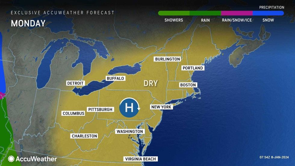
Monday will be mostly sunny and breezy with a high of 44 before another rain storm hits the area on Tuesday.
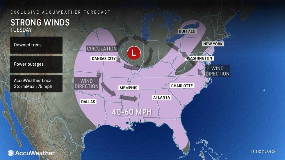
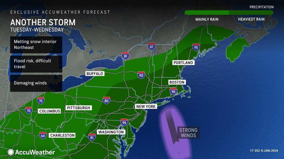
AccuWeather forecasts that Tuesday will be cloudy with rain, especially in the afternoon, with a high of 47. Rain will be heavy at night and bring flooding risks and gusty winds.
 AccuWeather
This second hit of precipitation will cause lingering flooding issues during Wednesday's commute, and there will be continuing showers. The day is expected to continue heating up with an uncharacteristic-for-January high of 56 before the temperature falls in the afternoon.
As of now, Thursday and Friday look dry, AccuWeather said.


