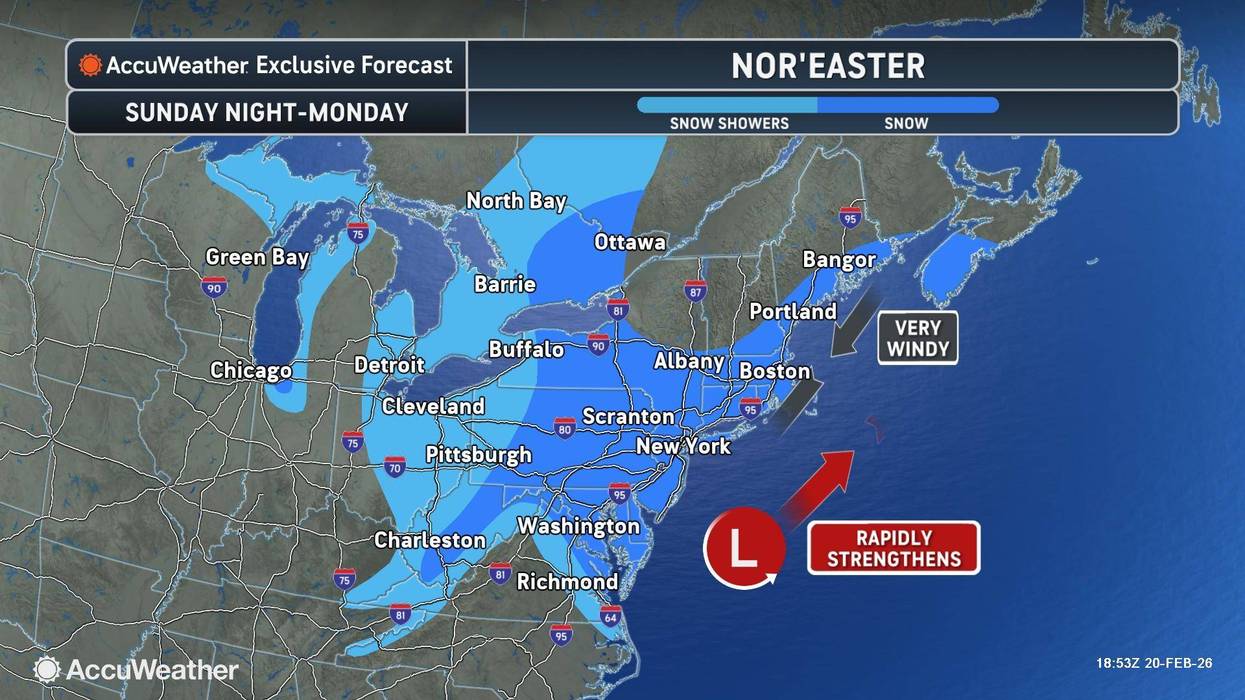
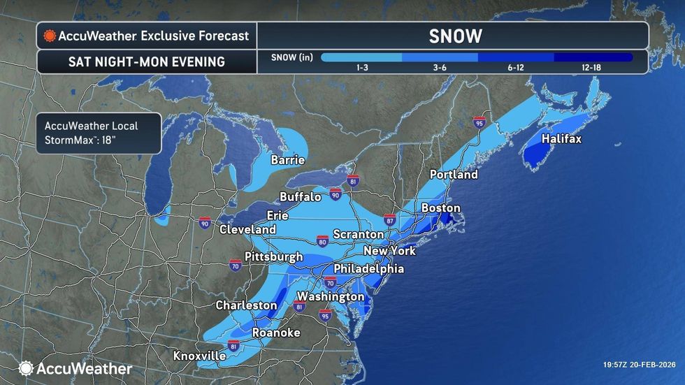
NEW YORK (1010 WINS) -- A developing coastal storm could bring 3-6 inches of snow to much of the Tri-State, and 6-12 inches of snow on Long Island, late Sunday into Monday.
The National Weather Service issued a Winter Storm Watch for the New York area from Sunday morning through Monday afternoon, as the nor'easter takes shape.
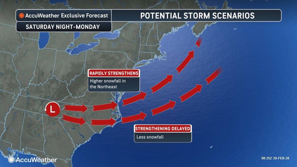
Exact snow amounts will depend on the track of the storm and how quickly it intensifies, according to AccuWeather.
 AccuWeather
In addition to the snow, wind gusts may reach 40 to 50 mph, which could cause blizzard conditions, especially on Long Island.
In an alert, the NWS wrote: "Travel could be very difficult. Areas of blowing snow could significantly reduce visibility. The hazardous conditions could impact the Monday morning and evening commutes. The combination of gusty winds and heavy wet snow could bring down tree branches."
 A worker tries to reach a can of soda from his food cart during a snowstorm on Jan. 25, 2026.Andres Kudacki/Getty Images
The weekend will start partly cloudy on Saturday with a high of 47 degrees.
Conditions will grow increasingly windy and colder on Sunday. Temps should stay just above freezing during the day, but as the snow picks up and the sun goes down on Sunday night, conditions are expected to deteriorate. The storm will then end as flurries on Monday morning.
 AccuWeather